GemVoyage Team • World
The Vorres Museum in Athens is a cultural gem that blends history, tradition, and modernity in a unique way. Established by the Greek art collector and philanthropist Ian Vorres in 1983, the museum offers a fascinating journey through 4,000 years of Greek heritage. It is not only a museum but also a cultural foundation dedicated to preserving and promoting Greek culture.
The museum is divided into two main sections: the contemporary art gallery and the folk art museum. The contemporary section houses over 6,000 works of modern Greek art, including paintings, sculptures, and installations by some of Greece’s most important artists. Meanwhile, the folk art collection showcases traditional artifacts, furniture, ceramics, and everyday objects that bring to life rural Greek culture from the 18th and 19th centuries.
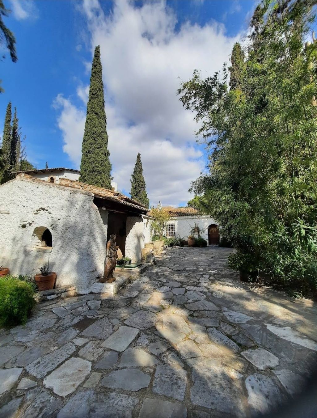
What makes the Vorres Museum particularly special is its location inside a beautifully restored 19th-century residence, surrounded by lush gardens filled with Mediterranean flora. The gardens themselves are works of art, featuring sculptures, pathways, and quiet corners that invite visitors to pause and reflect.
Little-known facts:
---
The Vorres Museum is located in Paiania, a suburb in the eastern region of Attica, Greece. Although it is slightly outside central Athens, it is easily accessible and offers visitors a welcome break from the busy city center.
---
---
The Vorres Museum in Athens is more than just an art museum—it is a cultural experience that bridges Greece’s rich past with its dynamic present. With its diverse collections, peaceful gardens, and dedication to cultural preservation, it is an ideal destination for art lovers, history enthusiasts, and anyone curious about Greek heritage. A visit here provides not only insight into the country’s artistic achievements but also a moment of peace away from the bustle of central Athens.
---
1. What type of art does the Vorres Museum showcase?
The museum features both modern Greek art and traditional folk art, offering a complete view of Greek culture.
2. Is the museum suitable for children?
Yes, the folk art section and gardens are particularly engaging for families with children.
3. How much time should I plan for a visit?
Most visitors spend about 2 hours exploring both the indoor exhibits and the gardens.
4. Is the museum wheelchair accessible?
Parts of the museum are accessible, but since it’s located in a historic building, some areas may have limitations. It’s best to check with the museum before your visit.
5. Are guided tours available?
Yes, the museum often provides guided tours, which enhance the experience by offering deeper insights into the collections.
6. Can I attend cultural events at the museum?
Yes, the museum regularly hosts concerts, lectures, and temporary exhibitions that are open to the public.
---
Discover more hidden gems you might love.
Barcelona
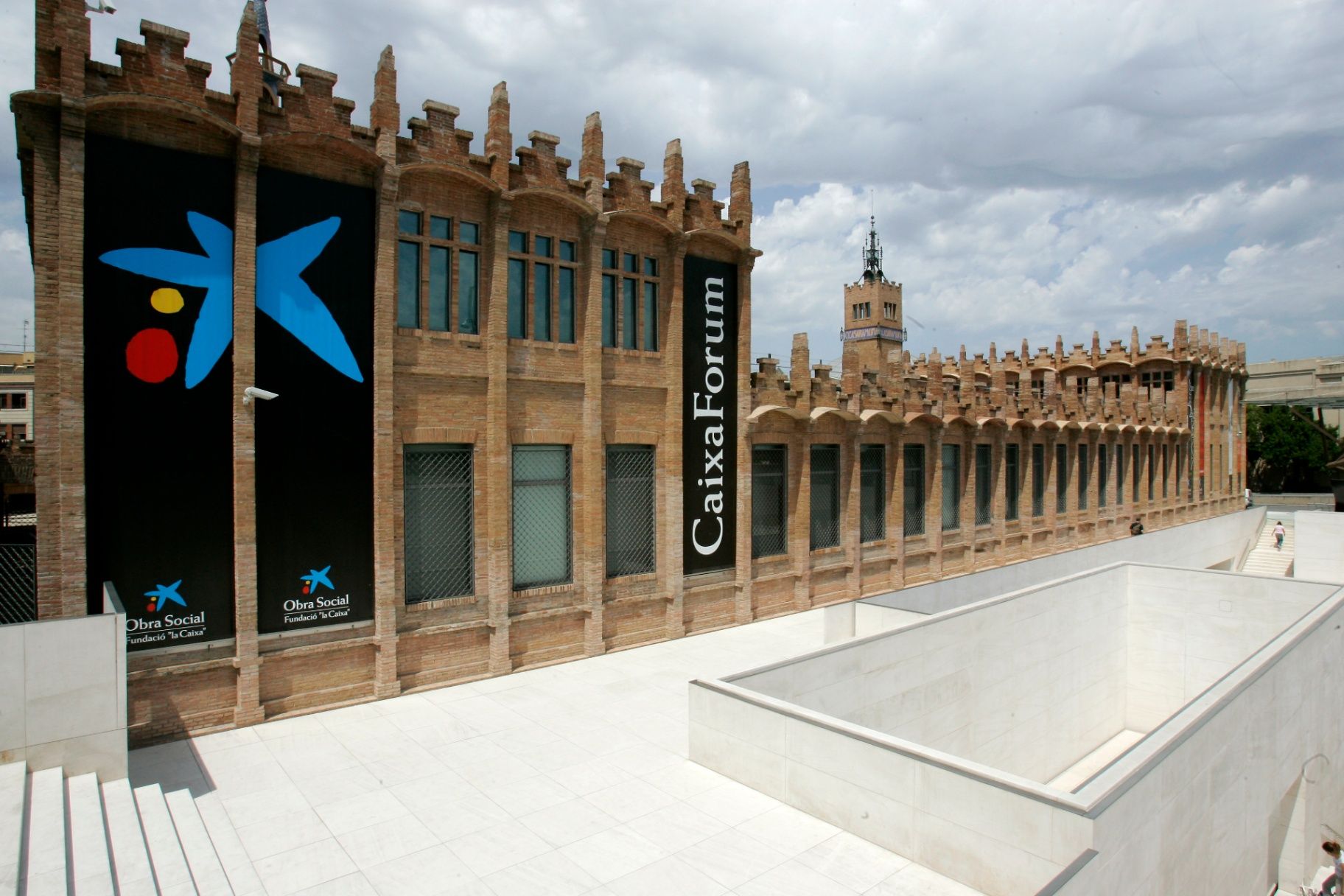
## Description **CaixaForum Barcelona** is one of the city’s most important cultural institutions, combining architecture, contemporary thought, and public education under one roof. It is housed in the former **Casaramona Textile Factory**, an early 20th-century industrial complex designed by the modernist architect Josep Puig i Cadafalch. Rather than demolishing the structure, it was carefully restored and repurposed, turning a once-abandoned factory into a vibrant center for exhibitions, debates, and artistic exploration. What makes CaixaForum Barcelona unique is its **programmatic diversity**. It is not a conventional museum with a permanent collection on display. Instead, it hosts a rotating schedule of high-quality temporary exhibitions covering art, photography, history, science, archaeology, music, and social issues. These exhibitions are often produced in collaboration with major international institutions, giving visitors access to works and ideas that rarely appear elsewhere in the city. Architecturally, the building itself is part of the experience. The red brick façades, sharp geometric volumes, and absence of ornamentation reflect a restrained form of Catalan modernism that contrasts with the more decorative style of Gaudí. A lesser-known fact is that the factory was originally built in 1911 but **never actually operated as an industrial plant**, as production ceased before it could fully open. Another interesting detail is the dramatic entrance plaza, redesigned by Japanese architect Arata Isozaki, which creates a striking dialogue between old and new through stone, steel, and light. Beyond exhibitions, CaixaForum functions as a **cultural forum in the literal sense**. It hosts lectures, film screenings, concerts, workshops, and family-oriented activities, making it appealing to a wide range of audiences. The institution emphasizes accessibility and education, aiming to make complex cultural topics understandable without oversimplifying them. ## Location **Country:** Spain **Region:** Catalonia **City:** Barcelona **District:** Sants-Montjuïc CaixaForum Barcelona is located at the foot of **Montjuïc Hill**, near Plaça d’Espanya, an area known for its concentration of museums, exhibition spaces, and monumental architecture. ### How to Get There * **By metro:** * Lines L1 (Red) or L3 (Green) to **Plaça d’Espanya** station. From there, it is a 5–7 minute walk. * **By bus:** * Several bus lines stop around Plaça d’Espanya and along Avinguda de Francesc Ferrer i Guàrdia. * **On foot:** * Easily reachable from Plaça d’Espanya and the surrounding exhibition grounds. * **By taxi:** * A convenient option if coming from other parts of the city; drop-off points are nearby. ## Tips * **Check the exhibition schedule in advance:** Exhibitions change regularly, and some are time-limited. * **Allow enough time:** One exhibition can easily take 90 minutes if explored thoroughly. * **Visit during weekdays:** Weekends tend to be busier, especially during popular exhibitions. * **Use the audio guides:** They provide context and depth without overwhelming the visitor. * **Combine with Montjuïc sights:** Pair your visit with nearby attractions such as museums or gardens. * **Look for free-entry times:** Certain days or time slots may offer reduced or free admission. ## Conclusion CaixaForum Barcelona is a cultural anchor that successfully bridges Barcelona’s industrial past with its intellectual present. Through its thoughtful exhibitions, adaptive architecture, and commitment to public engagement, it offers a meaningful alternative to traditional museums and rewards visitors seeking substance over spectacle. ## FAQ **1. Is CaixaForum Barcelona a museum?** It functions more as a cultural center with temporary exhibitions rather than a permanent museum collection. **2. How long does a visit usually take?** Most visitors spend between **1.5 and 3 hours**, depending on the exhibitions. **3. Is it suitable for children?** Yes, there are family-friendly exhibitions and interactive educational activities. **4. Are exhibitions available in multiple languages?** Yes, information panels and guides are usually available in Catalan, Spanish, and English. **5. Is the building accessible?** Yes, the center is fully accessible for visitors with reduced mobility. **6. Can you visit just for the architecture?** Yes, the building itself is worth seeing even without attending an exhibition. ## Links * [Official CaixaForum website](https://caixaforum.org/es/home)
GemVoyage Team • World

Cape Town
## Description Woodstock Street Art is one of the most vivid ways to experience Cape Town beyond the standard postcard view. Woodstock itself has long been associated with creative energy, urban change, and a strong independent character, and the neighborhood’s walls have become an ever-changing canvas for local and international artists. What makes it special is not just the color or scale of the murals, but the fact that the art is integrated into a living neighborhood rather than isolated in a formal gallery space. Every corner can feel like a discovery, and each block tells a different story about identity, politics, memory, and imagination. Unlike a single museum collection, street art in Woodstock changes constantly. Some murals are large and highly detailed, others are quick, expressive statements. That variety is part of the appeal. Visitors can see work that reflects social issues, community pride, satire, environmental themes, and the evolving face of Cape Town itself. Because the art lives on real buildings and infrastructure, the setting gives it an edge that is hard to replicate indoors. The texture of peeling walls, warehouse façades, and narrow streets adds meaning to the work and makes photographs feel more grounded and authentic. One little-known aspect of Woodstock’s street art scene is how strongly it reflects the neighborhood’s broader reinvention. The area has become one of Cape Town’s most recognizable creative districts, but many of the artworks also respond to the tensions that come with urban change, displacement, and heritage. Another detail that visitors sometimes miss is that the best experience often comes from moving slowly and looking above eye level as well as at street level. Murals are not limited to obvious walls; some of the most memorable pieces appear in alleys, on shutter doors, or on the sides of buildings that you might pass too quickly if you are not paying attention. The result is a destination that rewards curiosity. Woodstock Street Art is not polished in the traditional tourist sense, and that is exactly why it feels alive. It offers a way to understand Cape Town as a city of layers, where creativity and social commentary coexist with everyday street life. For travelers who like walking neighborhoods that feel both artistic and real, it is one of the city’s most compelling stops. ## Location Woodstock is a neighborhood in Cape Town, South Africa, situated close to the central city area and not far from the harbor and Table Mountain routes. Its location makes it easy to combine with other Cape Town sightseeing, especially if you are already exploring the city bowl or nearby cultural districts. Because the artwork is spread through streets and side roads rather than gathered in one single venue, the exact experience depends on the route you choose. The most practical way to explore is usually on foot with a map, a local guide, or a curated street art walk. Some travelers prefer joining a guided tour because guides can explain the meaning behind individual murals and help visitors navigate the area more confidently. Taxis and rideshares can drop you off at a convenient starting point, but the actual appreciation comes from walking slowly. If you are comfortable with urban exploration, pairing your visit with a café stop or market break in Woodstock can make the outing feel more complete. ## Tips Go in daylight. Street art is best appreciated when colors, textures, and details are visible, and daylight also makes navigation easier. A morning or early afternoon visit often gives you better light for photographs and a calmer pace for walking. If you are planning to take many pictures, bring a charged phone or camera because there will likely be more walls and details than you expect. Consider a guide if you want context. Some murals are visually striking on their own, but the stories behind them make the experience richer. A guide can also help you notice pieces that blend into the surroundings or point out artists and themes you might otherwise miss. If you prefer to explore independently, spend extra time reading plaques, following side streets, and looking for smaller works in doorways and corners. Dress practically. Comfortable shoes matter because you will likely walk more than you think. A light bag, water, and sun protection are wise choices, especially during warmer months. It is also sensible to stay aware of your surroundings and follow local advice about which streets are most convenient to explore. Combine the visit with food or coffee. Woodstock has a creative food scene, and stopping for a meal can make the district feel more approachable. Street art is at its best when it becomes part of a broader neighborhood experience rather than a quick photo stop. The more time you give Woodstock, the more the neighborhood’s layered personality becomes visible. ## Conclusion Woodstock Street Art offers a powerful introduction to Cape Town’s creative side. It is colorful, thought-provoking, and best enjoyed as a slow walk through a neighborhood that continues to reinvent itself. ## FAQ ### Is Woodstock Street Art safe to visit? Many visitors explore Woodstock during the day without problems, but like any urban neighborhood, it is smart to stay aware, travel in daylight, and follow local advice. A guided tour can be a good choice if you want extra reassurance. ### Do I need a guide? Not necessarily, but a guide adds value if you want context about the artists and the neighborhood’s history. Independent travelers can still enjoy the area by walking slowly and paying attention to smaller works. ### How long should I spend there? One to two hours can be enough for a quick walk, but more time is better if you want photography, coffee, and a relaxed pace. If you are using the visit to understand the neighborhood rather than just collect images, plan for longer. ### Are the murals always the same? No. That is one of the defining characteristics of street art. Works can be painted over, replaced, or altered, which means the area can look different from one visit to the next. ### Can I visit independently? Yes. Many people do. A map and basic awareness are usually enough for a self-guided visit, although some travelers prefer a structured tour for convenience and context. ## Links - [Wikipedia](https://en.wikipedia.org/wiki/Woodstock,_Cape_Town) - [Cape Town Tourism](https://www.capetown.travel/)
GemVoyage Team • World
Ontario
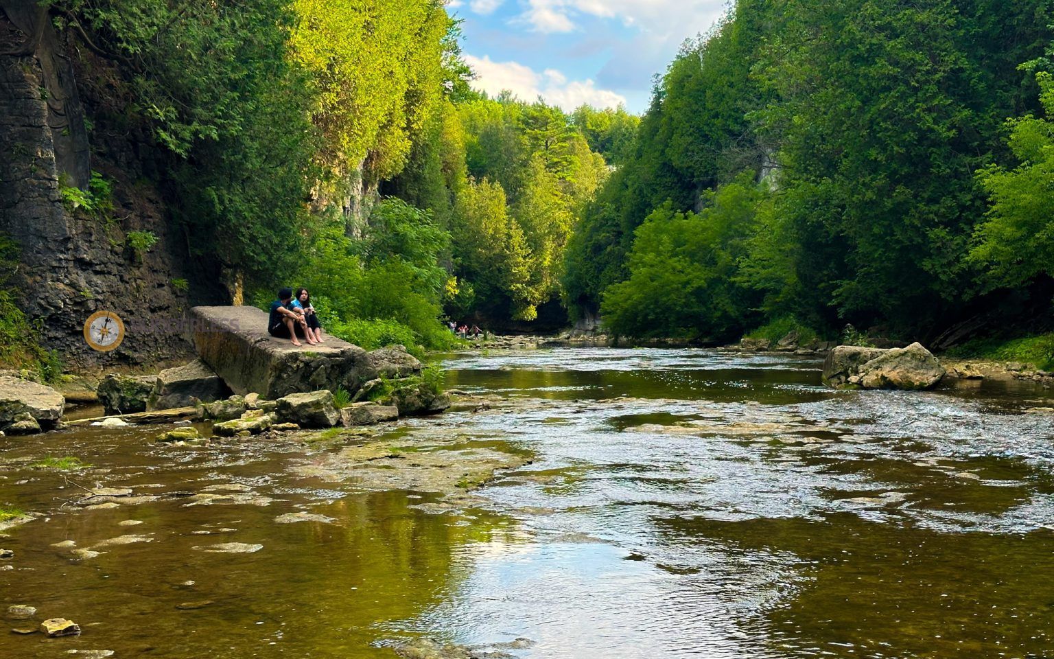
## Description Elora Gorge is one of Ontario’s most striking natural attractions, known for its steep limestone cliffs, fast-moving Grand River scenery, and a landscape that feels more dramatic than most visitors expect from southern Ontario. The gorge is part nature preserve, part outdoor recreation area, and part classic day-trip destination. People come for the views, the trails, the river access, and the feeling of standing in a place where water has carved a deep, narrow route through rock over a very long span of time. What makes Elora Gorge memorable is its contrast. The surrounding region is gently rural and easygoing, but the gorge itself is rugged and visually intense. When you stand on the edge and look down, the river appears surprisingly powerful as it moves through the canyon-like setting. The rock walls, tree cover, and water together create a scene that feels almost larger than life for a place that is relatively easy to access from nearby towns and cities. It is the kind of landscape that immediately rewards anyone who likes geology, photography, hiking, or simply being outdoors. One little-known fact about the area is how much its shape influences the mood of the visit. Even short walks feel more memorable because the viewpoint changes quickly from forest to cliff edge to river corridor. Another detail many visitors appreciate only after arriving is how seasonally different the gorge can feel. In spring, the river runs energetically and the foliage is fresh. In summer, the greens are dense and the area becomes a prime outdoor destination. In autumn, the cliffs and trees around the gorge can create a particularly vivid palette. Winter visits are quieter and more austere, but they can also be beautiful in a stark, sculptural way. Elora Gorge is also appealing because it can satisfy different travel styles. A casual visitor can enjoy the scenery and take a short walk, while a more active traveler can turn the visit into a longer outdoor outing. The gorge is one of those places where people often arrive with modest expectations and leave impressed by how photogenic and substantial it feels. ## Location Elora Gorge is in Ontario, Canada, near the village of Elora and within reach of the wider Waterloo Region and Wellington County area. The gorge is associated with the Grand River and is close enough to several southwestern Ontario cities to function as a realistic day trip. For many travelers, the easiest way to visit is by car, since that gives the most flexibility for parking, timing, and combining the gorge with nearby Elora village or other regional stops. If you are driving from Toronto, Kitchener-Waterloo, Guelph, or nearby communities, the route is straightforward enough for a day outing. Public transit is usually less convenient, so road travel is the most practical option for most visitors. Once you arrive, the experience is mostly about walking, looking, and choosing how active you want to be. If you are planning a fuller outdoor day, it makes sense to pair the gorge with village cafés, local shops, or other conservation-area activities in the surrounding region. ## Tips Wear footwear that can handle uneven paths and potentially muddy or damp ground. The gorge is beautiful, but it is not a place where fashionable footwear matters more than stability and comfort. If you want photos from scenic viewpoints, take your time and be cautious near edges and steep sections. The views are worth slowing down for, and safety should always come first. Check conditions before you go. Water levels, trail conditions, and seasonal access can change the experience significantly. A gorge that looks calm in one season can be much more energetic in another, and some areas may be better suited to certain weather conditions. If you are visiting with children, choose routes and viewpoints that match their energy and attention span. Bring water, snacks, and weather-appropriate layers. The gorge can feel cooler or windier than the nearby town, and you may spend more time outside than planned once you start enjoying the scenery. If you are interested in photography, morning and late afternoon are usually the best times for softer light. Consider making time for Elora village as well. The gorge is the headline attraction, but the surrounding area often makes the trip more satisfying. Many visitors find that pairing the natural site with a meal or wander in town creates the most balanced experience. ## Conclusion Elora Gorge is one of Ontario’s most rewarding scenic escapes, offering dramatic geology, outdoor recreation, and easy access from nearby communities. It is a strong choice for travelers who want nature without a complicated journey. ## FAQ ### Is Elora Gorge good for a quick visit? Yes. Even a short stop can be worthwhile if you want a scenic view and a brief walk. If you have more time, though, the gorge becomes much richer because you can explore the trails and surrounding area more fully. ### Is it suitable for families? It can be, provided you choose paths and viewpoints that fit your group’s comfort level. Families should pay close attention near steep edges and areas with uneven terrain. ### What is the best season to visit? There is no single best season, because each one has a different appeal. Spring and autumn are especially attractive for scenery, while summer is popular for outdoor activity and longer visits. ### Do I need to be an experienced hiker? No. There are options for casual visitors as well as more active hikers. You can tailor the trip to your own pace and interests. ### Can I see the gorge without a long hike? Yes. The attraction is accessible enough that you can enjoy views and the setting without committing to a major hike, although walking deeper into the area gives a fuller experience. ## Links - [Wikipedia](https://en.wikipedia.org/wiki/Elora_Gorge_Conservation_Area)
GemVoyage Team • World
New York
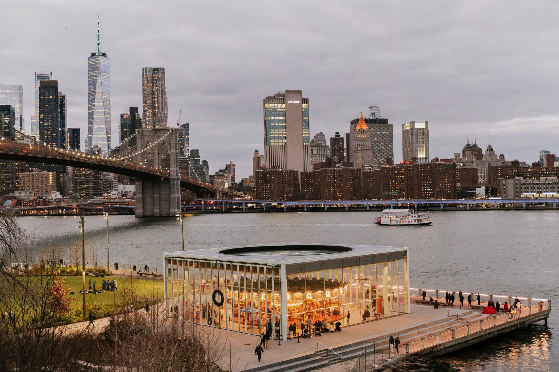
## Description DUMBO—short for Down Under the Manhattan Bridge Overpass—is one of Brooklyn's most iconic neighborhoods because it combines industrial architecture, riverfront views, art-driven energy, and world-recognized photo spots. The district's cobblestone streets, former warehouses converted into galleries and boutiques, and dramatic sightlines toward the Manhattan skyline make it an attractive stop for photographers, architecture fans, and anyone who enjoys a well-defined urban character. DUMBO's transformation from a gritty industrial waterfront to a creative residential and commercial neighborhood has been central to Brooklyn's broader redevelopment. The area is layered: landmark bridges and piers, converted loft buildings, independent cafes, and public spaces like Brooklyn Bridge Park all coexist in a compact grid. Many visitors first see the classic viewpoint framed by the Manhattan Bridge and then discover quieter corners—galleries, waterfront piers, and local bakeries—that reward a slower approach. The neighborhood also plays well to varied audiences: families come for waterfront park space and playgrounds; food-focused visitors enjoy casual dining and artisanal shops; and history-minded travelers appreciate the story of urban change reflected in restored industrial buildings. These multiple attractions make DUMBO a flexible itinerary option in New York City. ## Location DUMBO sits between the Manhattan and Brooklyn Bridges along the East River in Brooklyn, New York. It is easily reachable by subway, ferry, bike, or on foot from nearby Manhattan. The neighborhood's compactness makes it ideal for walking: you can combine a DUMBO visit with a Brooklyn Bridge walk, a longer riverside stroll, or time in Brooklyn Bridge Park. Practical tips: take the F or A/C trains to nearby stops and walk, or use the NYC Ferry service for a scenic arrival. The area can be crowded at peak times, so plan early-morning or late-afternoon visits for better light and fewer people. ## Tips - Visit in early morning for photographs with softer light and fewer people; sunset also offers dramatic hues over the bridges. - Walk beyond the main plaza to discover side streets, local shops, and cafes where residents spend their time. - Combine DUMBO with Brooklyn Bridge Park for playgrounds, green space, and long riverfront promenades. - Wear comfortable shoes—cobblestones and uneven pavement are common. - Check local galleries and pop-up schedules if you are interested in contemporary art scenes. - If you plan to dine at a popular spot, consider making reservations or visiting outside typical meal windows. ## Conclusion DUMBO is a compact but richly textured neighborhood that rewards visitors who pause and explore more than the classic photo spot. Its combination of design-forward architecture, river views, and pedestrian-friendly spaces makes it a standout part of any Brooklyn or NYC itinerary. ## FAQ ### Why is DUMBO so popular? DUMBO offers dramatic urban vistas, preserved industrial architecture, and easy access to waterfront parks, making it visually compelling and visitor-friendly. ### Is DUMBO good for a short visit? Yes. The neighborhood's core sights can be seen in an hour or two, but allowing more time uncovers quieter streets and local businesses. ### What is the best time for photos? Early morning or late afternoon are ideal. Midday light can be harsh and the streets busier. ### Can I walk there from Manhattan? Absolutely. Walking across the Brooklyn Bridge into DUMBO is a memorable route and places you directly into the neighborhood. ### Is DUMBO family-friendly? Yes—parks and open spaces make it suitable for families, though crowds can be a consideration on weekends. ## Links - [Official neighborhood website](https://dumbo.is/)
GemVoyage Team • World
Lisbon
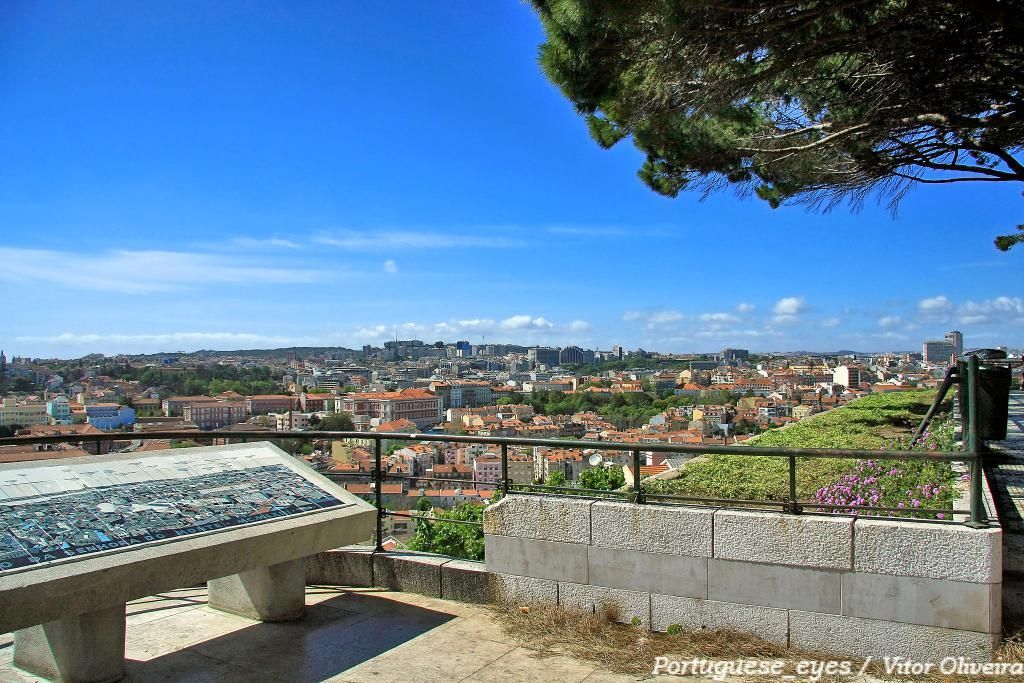
## Description Miradouro da Senhora do Monte is one of Lisbon’s most beloved viewpoints, offering a tranquil perch with unrestricted vistas across the city’s red rooftops, the Tagus River and landmarks like São Jorge Castle and the historic downtown. Tucked in the Graça neighborhood, the miradouro (viewpoint) is less crowded than some of Lisbon’s better-known terraces, making it a favorite among locals seeking a peaceful panorama and photographers hunting for unobstructed compositions. The small chapel of Senhora do Monte adds a devotional nuance to the setting, while benches and shaded nooks invite lingering. The viewpoint’s orientation gives particularly broad views to the east and south of the city, and because it is elevated, light at sunrise and sunset can be spectacular. Little-known facts: Miradouro da Senhora do Monte sits at one of the city’s highest natural points and was historically used to monitor the Tagus approaches; its quieter reputation owes partly to steeper approaches that keep the most casual visitors away. ## Location Miradouro da Senhora do Monte is located in the Graça parish of Lisbon, in the Lisbon District, Portugal. The viewpoint occupies a hilltop position above the Alfama and Graça neighborhoods and is within walking distance of São Vicente hill and several historic lanes. Getting there: The easiest ways are a short uphill walk through Graça from the tram 28 route or a ride to the Largo da Graça and a brief ascent. Tram 28 passes through Alfama and Graça and is a scenic option; buses also serve nearby stops. If using a taxi or rideshare, ask to be dropped at Largo da Senhora do Monte or the small square near the chapel. Wear comfortable shoes for the short climb. ## Tips - Timing: Sunrise and sunset are prime times for soft, warm light; sunrise is quieter and ideal for photographers. Weekday mornings are the least busy. - Safety & comfort: The area is generally safe and frequented by locals; standard precautions suffice. Bring water in warmer months and a light jacket in evenings. - Accessibility: The viewpoint involves steep streets and steps; it’s less accessible for visitors with limited mobility. - Neighborhood exploration: Combine the visit with a walk through Graça and Alfama’s lanes, sample local cafés and pastelarias nearby. - Respectful behavior: The chapel is a place of worship; observe quiet respect if services occur. ## Conclusion Miradouro da Senhora do Monte is an essential Lisbon experience for those seeking scenic calm and panoramic perspectives without the crowds of more famous terraces. Its high vantage point, local atmosphere and exceptional light conditions make it ideal for reflective moments, photography, and absorbing Lisbon’s layered skyline. ## FAQ Q: Is the miradouro crowded? A: It’s quieter than many Lisbon viewpoints but can be busy at sunset on weekends. Q: Are there cafés nearby? A: Yes, Graça and Alfama have several small cafés and bakeries within a short walk. Q: Does public transport reach it? A: Yes — Tram 28 and several buses serve the Graça area; from stops expect a short uphill walk. Q: Is there a fee to visit? A: No. The viewpoint and surrounding terraces are free and open to the public. ## Links [Detailed Guide](https://lisbonlisboaportugal.com/Alfama-Lisbon/miradouro-da-senhora-do-monte-lisbon.html)
GemVoyage Team • World
Lisbon
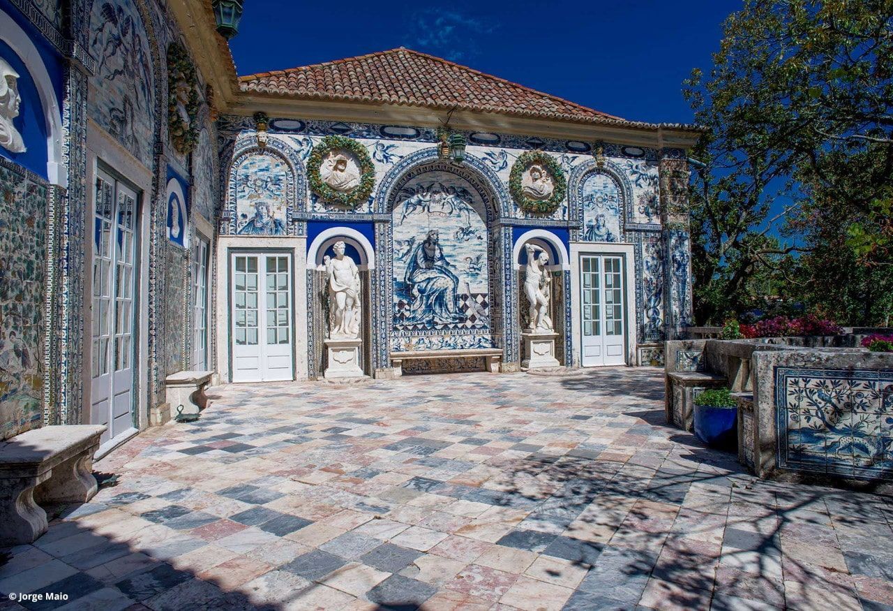
## Description Palácio dos Marqueses de Fronteira is an elegant, family-owned 17th-century estate on the edge of Lisbon that delights visitors with its exceptional azulejo tile panels, intimate museum rooms, and meticulously designed gardens. The palace feels less like a public museum and more like entering a well-preserved private residence that has been lived in and cared for by the same lineage of nobility for centuries. Interiors display an array of period furniture, heirloom portraits, and decorative arts that create a layered sense of domestic aristocratic life. The palace’s defining artistic draw is its azulejo program: large narrative tile panels that record hunting scenes, mythological episodes, allegories, and courtly imagery, executed in the refined blue-and-white and polychrome palettes typical of the 17th and 18th centuries. These tiles cover interior and exterior walls, forming pictorial narratives that reward close looking. Complementing the tiles are frescoes, gilded frames and sculptural elements that reflect Baroque and Rococo tastes adapted to Portuguese sensibilities. The gardens are a major reason to visit. Laid out with geometric hedges, elegant statuary and reflecting pools, they weave Moorish and Renaissance influences into a distinctly Portuguese landscape grammar. Garden rooms framed by clipped yews and boxwood create intimate vistas, while larger terraces open to sweeping views of the surrounding neighborhood. Seasonal plantings and careful maintenance mean the palace is beautiful year-round, although spring and early summer are especially lush. Conservation and stewardship at the palace are noteworthy: the family’s ongoing custodianship has supported careful tile restoration projects and the preservation of original material culture. Many of the conservation interventions have been carried out by local artisans using traditional techniques, preserving not just objects but craft knowledge. Photographic and accessibility note: photographers should plan for a mix of wide-angle shots of garden terraces and close-ups of tile details; early morning light reduces harsh shadows on glazed surfaces. Visitors requiring mobility assistance should contact palace staff ahead of time to arrange the smoothest route through garden paths and to confirm which rooms are accessible. ## Location The palace is located in the Benfica neighborhood of Lisbon, a short drive northwest of central districts like Rossio and Baixa. From the historic center, it typically takes 15–25 minutes by car depending on traffic. Public transit options involve buses and sometimes a combination of tram and bus; travelers should allow extra time for connections and walking to the palace grounds. Getting there: taxis and rideshares are convenient and typically the fastest way for visitors without a car. If using public transport, check current bus routes and schedules and allow for a short walk from the nearest stop to the palace entrance. ## Tips - Book tickets in advance when possible; guided tours are often limited and sell out during peak season. - Wear comfortable shoes: garden paths include gravel and uneven surfaces. - Respect interior rules: certain rooms may be closed or restricted for conservation reasons; photography inside may be limited. - Bring a camera and consider different lenses: a wide-angle captures garden vistas while a close lens helps study tile details. - Time your visit: visit in the morning light for softer photographs and more tranquil garden conditions. - Combine visits: pair the palace with nearby cultural sites such as the National Coach Museum or a walk in Monsanto Forest Park for a varied day. ## Conclusion Palácio dos Marqueses de Fronteira is a quietly grand escape from Lisbon’s busiest tourist routes. It rewards the patient visitor — those who enjoy architectural decoration, tile art and carefully tended gardens — with an intimate glimpse of aristocratic Portuguese life. The palace’s careful preservation and the family’s ongoing care make it a dignified and deeply rewarding stop on a cultural itinerary. ## FAQ Q: Are guided tours available? A: Yes. Guided tours are offered and provide detailed historical context about the palace, its tiles and the family’s history. Check the palace’s official website or local tourism resources for times and booking procedures. Q: Is the palace wheelchair accessible? A: Accessibility is limited in some historic rooms and garden areas due to steps and uneven terrain. Contact the palace in advance to discuss specific access requirements and to learn which sections are accessible. Q: Can I photograph inside the palace and gardens? A: Photography is usually permitted in the gardens; some interior rooms may restrict photography to protect delicate materials. Always follow posted signs and staff instructions. Q: How long should I allow for a visit? A: Plan for 1–2 hours to see the main rooms and stroll the gardens at a relaxed pace. If you are a tile or garden enthusiast, you may wish to allow more time. Q: Are there any special events or seasonal highlights? A: The palace occasionally hosts concerts, temporary exhibitions, or guided thematic tours. Spring and early summer offer peak garden blooms and are popular times to visit. ## Links - [Wikipedia: Palácio dos Marqueses de Fronteira](https://en.wikipedia.org/wiki/Palace_of_the_Marquises_of_Fronteira)
GemVoyage Team • World

Comments