GemVoyage Team • World
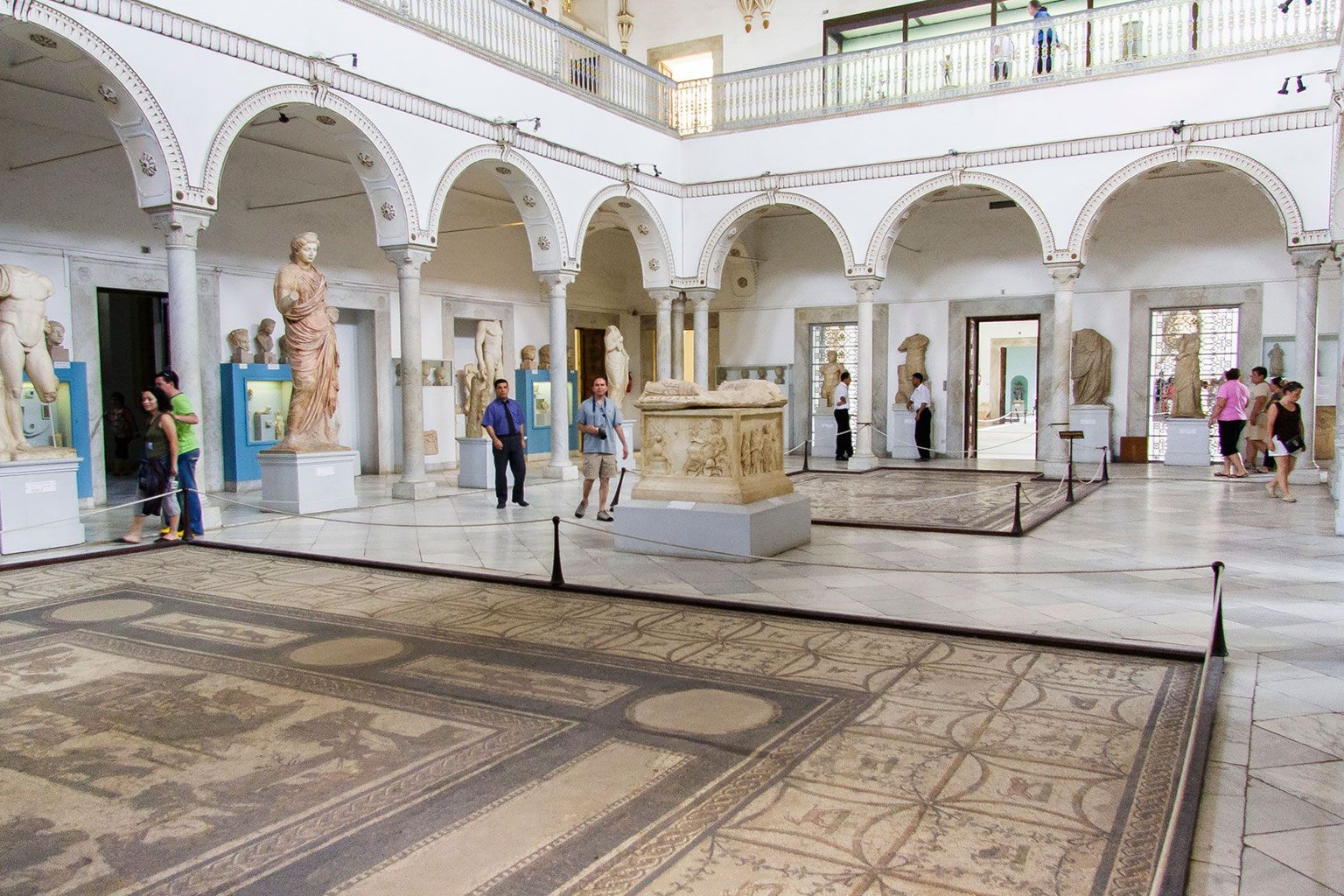
What makes the Bardo especially memorable is the quality of the collection and the setting in which it is displayed. The museum occupies a former palace complex, and that architectural backdrop gives the exhibits a sense of elegance and continuity with the past. Walking through the galleries feels like moving through a living archive. The mosaics are often the first thing people mention, and for good reason: they are vivid, large, and remarkably well preserved. But there is also a quieter pleasure in discovering smaller objects, inscriptions, and artifacts that reveal daily life, trade, belief, and artistic taste across centuries.
One little-known fact is that the museum’s collection is not only important for Tunisia, but for the broader Mediterranean world. Many of the objects speak to the country’s position as a crossroads of empires, shipping routes, and cultural exchange. Another is that the palace setting helps create a more immersive experience than a plain modern gallery might. The rooms, courtyards, and architectural details remind you that the museum itself is part of Tunisia’s heritage story.
For travelers, the Bardo works well because it gives context to the rest of a Tunis itinerary. If you have already seen medinas, ruins, or coastal sites, the museum ties many of those threads together. It is not just about looking at beautiful objects. It is about seeing how Tunisia’s geography and history produced a remarkably rich material culture.
The most practical way to get there is by taxi or local transport from central Tunis. Because the museum is a major institution, drivers will usually know it well. If you are already exploring Tunis, it is straightforward to combine the museum with a medina visit or another city-center stop. The museum is also a sensible first stop if you want historical context before branching out to other parts of Tunisia.
Plan enough time for a proper visit. The collection is substantial, and rushing would mean missing some of the strongest mosaics and broader historical displays. This is best approached as a serious museum outing rather than a quick photo stop.
Check opening information before you go, especially if your trip is part of a tight itinerary. Museums sometimes have schedule changes, and it is better to confirm in advance.
If you are interested in ancient history, a guide or a bit of background reading will help you get more out of the collection. The objects are impressive on their own, but the context makes them much richer.
Allow time to walk slowly through the galleries. The Bardo is not only about seeing famous pieces; it is also about noticing the range and depth of Tunisia’s past.
How much time should I spend there? At least two hours is a good baseline, and more is better if you want to see the museum thoroughly.
Is it easy to get to from central Tunis? Yes. It is in Le Bardo and can be reached conveniently by taxi or local transport.
Is the museum only about Roman history? No. It covers a much wider range of Tunisia’s history and culture.
Is it suitable for first-time visitors to Tunis? Absolutely. It is one of the most useful places to visit early in a trip.
Discover more hidden gems you might love.
Hong Kong
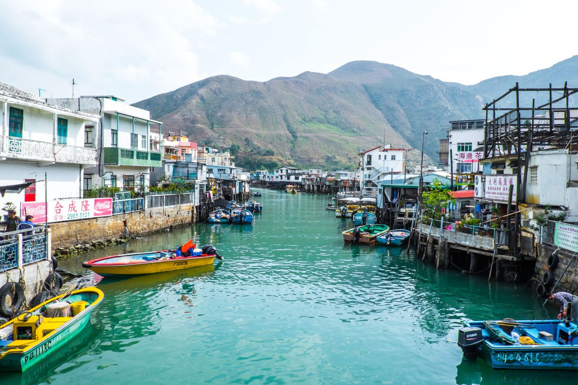
## Description Tai O Fishing Village is one of the most atmospheric places in Hong Kong because it preserves a way of life that feels very different from the city’s skyscraper identity. Located on the western side of Lantau Island, Tai O is known for its stilt houses, narrow waterways, fishing heritage, and the sense that time moves more slowly here than in Hong Kong's urban core. For travelers looking for a place that combines cultural history, coastal scenery, and a strong local character, Tai O delivers all three in a single visit. The village is especially distinctive because it has kept much of its fishing-community layout, even as Hong Kong developed around it. The stilt houses, built above tidal waters and connected by wooden walkways, create a visual landscape that is unique in the region. Boat traffic still matters here, seafood is still central to the local economy, and the village still feels shaped by the rhythms of sea and tide. In the early morning, Tai O can feel hushed and contemplative. Later in the day, it becomes more animated as day visitors arrive, shops open, and boats move in and out of the channels. A little-known fact is that Tai O has long been associated with salt production and trade, not just fishing. Another detail many visitors miss is the old village fortifications and temple structures that reflect how communities once protected themselves from pirates, storms, and the uncertainties of coastal life. The area is therefore not simply picturesque; it is historically layered and reveals a deeper story about how people adapted to Hong Kong's shoreline before modern development changed the coastline. The food here is another major reason to visit. Dried seafood, shrimp paste, sweet treats, and simple local dishes are part of Tai O’s identity, and they help visitors understand how the village economy worked for generations. Even if you only spend half a day here, Tai O can feel like a complete change of pace from the rest of Hong Kong, offering a mixture of water, heritage, and community that is increasingly rare. ## Location Tai O Fishing Village is on the western side of Lantau Island in the Hong Kong Special Administrative Region of China. It sits in the Islands District, far from the dense business cores of Hong Kong Island and Kowloon, which is part of what preserves its quieter character. Because it is not on a major rail line, getting there takes a little planning, but that is also what helps keep the area special. The usual route is to travel by MTR to Tung Chung and then continue by bus toward Tai O. This combination is the most practical for most visitors and gives you a smooth connection from the city’s main transport network. Ferries and cable car routes may also be part of a longer day trip if you are combining Tai O with other parts of Lantau Island. If you prefer a more relaxed pace, many travelers visit as part of a full-day itinerary that includes Ngong Ping and the Big Buddha before continuing to Tai O in the afternoon. Once you arrive, much of the village is best explored on foot, though local boat rides are a memorable way to see the stilt houses from the water. Because the village is compact, it is easy to cover the main areas without rushing, but you should allow extra time for food stops, photographs, and slow wandering. ## Tips Visit early in the day or late in the afternoon if you want softer light and fewer crowds. Midday can be busy, especially on weekends and public holidays, and the village is at its best when you can move slowly and take in the details. Take a boat ride if your schedule allows. Seeing Tai O from the water gives you a better sense of how the stilt houses, waterways, and fishing infrastructure fit together. It also helps explain why the village developed the way it did. If you only walk the streets, you still get a strong impression, but the boat perspective adds depth. Try local snacks and dried seafood, but do so with curiosity rather than haste. Many travelers rush through Tai O, take a few photos, and leave without understanding the food culture that has shaped the village for years. Sampling something local makes the visit more meaningful. Wear comfortable shoes and bring sun protection. Tai O is relatively easy to walk, but the experience is more enjoyable when you are prepared for heat, humidity, and a fair amount of time outdoors. If the weather looks unstable, check conditions before you go, since coastal villages are more sensitive to storms and heavy rain. ## Conclusion Tai O Fishing Village offers a rare glimpse of Hong Kong's coastal past, with stilt houses, local food, and a slower rhythm that gives the village a memorable sense of place. ## FAQ ### Why is Tai O famous? Tai O is famous for its stilt houses, fishing heritage, scenic waterways, and its reputation as one of the last traditional fishing villages in Hong Kong. ### How long should I spend in Tai O? Most visitors spend half a day to a full day, depending on whether they plan to add boat rides, food stops, or nearby Lantau attractions. ### Is Tai O easy to reach from central Hong Kong? It takes some planning, but it is straightforward by taking the MTR to Tung Chung and then continuing by bus. ### What should I eat in Tai O? Try local seafood snacks, dried seafood products, and village specialties from small shops and street-side vendors. ## Links - [Discover Hong Kong](https://www.discoverhongkong.com/) - [Wikipedia article](https://en.wikipedia.org/wiki/Tai_O)
GemVoyage Team • World
Los Angeles
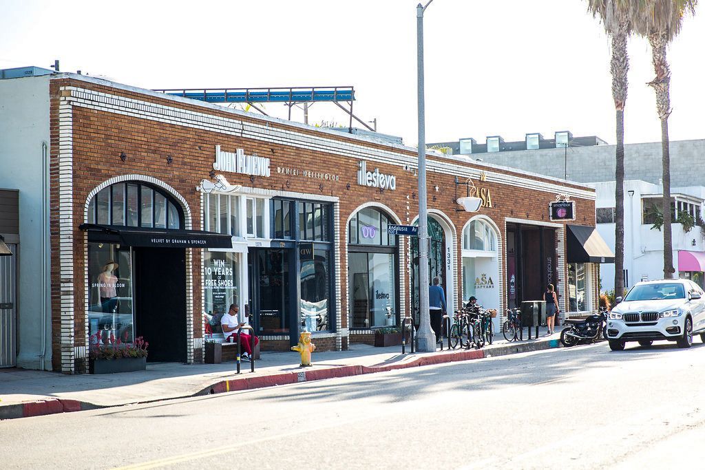
## Description Abbot Kinney Boulevard in Venice, Los Angeles, is a short but influential thoroughfare celebrated for its creative retail scene, independent restaurants, and a distinctive local aesthetic that has become synonymous with modern, small-scale urban cool. Stretching for just a few blocks, Abbot Kinney packs an outsized cultural punch: curated boutiques, artisanal homewares, specialty coffee shops, and innovative dining concepts sit shoulder-to-shoulder with galleries and pop-up markets. The boulevard’s identity is rooted in a "local-first" ethos. Many shops are owner-operated and feature limited-run or locally produced goods, which gives the area an artisanal sensibility that contrasts with more commercial shopping districts. Over the years Abbot Kinney has become a preferred destination for designers, food entrepreneurs and creative-makers who favor a human-scale retail environment where craftsmanship and storytelling matter. Events like "First Fridays" and seasonal street fairs amplify the boulevard’s community mood, with extended shop hours, live music and curated pop-ups that draw both locals and visitors. For food lovers, the avenue is a laboratory of contemporary culinary trends: casual but refined bakeries, modern vegan eateries, and chef-driven bistros can all be found within a short walk. Side streets and upper-floor venues often hide some of the area’s best-kept secrets — intimate bars, tiny galleries, and rooftop patios — rewarding those who slow down and explore. Abbot Kinney also serves as a hub connecting Venice’s broader cultural assets: the nearby beach, historic canals, street art corridors and the bustling Venice Boardwalk are all within easy reach, making the boulevard an ideal stop on a full-day itinerary. Buying categories and sustainability: shoppers can expect to find distinct clusters along the boulevard — homewares and design shops, independent fashion boutiques, specialty food producers, and lifestyle stores focused on wellness. Many retailers emphasize sustainable sourcing and limited production runs; if ethical purchasing matters to you, look for small labels and ask about materials and production methods. ## Location Abbot Kinney Boulevard runs through the Venice neighborhood of Los Angeles, approximately between Ocean Avenue near the beach and Lincoln Boulevard inland. Its central location makes it accessible from Santa Monica, Marina del Rey and other nearby neighborhoods. Getting there: driving is often the fastest option but parking can be limited; consider using parking apps, arrive early, or use nearby paid lots. Multiple bus routes serve Venice, and rideshares or bike rentals are popular alternatives. From Santa Monica or the Marina, cycling along dedicated paths is a pleasant way to arrive and enjoy the waterfront scenery. ## Tips - Visit on weekday mornings for quieter browsing and the best chance to chat with shop owners. - Explore side streets: many of Abbot Kinney’s best cafes and galleries are tucked away from the main strip. - Check store hours: many boutiques open mid-morning and close earlier than big-box retailers, so plan accordingly. - Reserve tables for popular restaurants during weekends and evenings, especially for dinner. - Bring a reusable bag and embrace the local eco-friendly ethos; some shops minimize packaging. - Wear comfortable shoes: although the area is walkable, you’ll want to wander both main and side streets. - Bring a camera and leave space for small, meaningful purchases rather than impulse-heavy shopping. ## Conclusion Abbot Kinney Boulevard distills Venice’s eclectic, creative spirit into a compact, walkable experience. Whether you’re shopping for thoughtful design pieces, sampling new culinary concepts, or simply watching the neighborhood pulse, the boulevard delivers a layered portrait of community-driven urban life. ## FAQ Q: Is Abbot Kinney family-friendly? A: Yes. The area is walkable and casual during the day, with family-friendly cafes and shops. Evening hours can be livelier and more adult-focused, so plan accordingly. Q: How do I find parking near Abbot Kinney? A: Parking is limited on-street; look for paid lots, use parking apps, or consider rideshares and public transit to avoid circling for spaces. Q: When is First Fridays and what is it? A: First Fridays is a monthly event (check local listings for exact dates) where shops extend hours, pop-ups appear and live music is common. It’s a popular time to experience the boulevard’s community energy. Q: Are the shops expensive? A: The mix includes accessible boutiques and higher-end designer stores. Many shops sell locally made, limited-run items that reflect artisanal production which can influence prices. Q: Are dogs welcome? A: Many cafes and stores are dog-friendly, but policies vary; always check individual shop rules before bringing a pet inside. ## Links - [Abbot Kinney Blvd Official Site](https://www.abbotkinneyblvd.com)
GemVoyage Team • World

Dubysa
## Description Lyduvėnai Bridge is an arresting piece of nineteenth- and twentieth-century engineering that spans the deep, wooded Dubysa River valley near Lyduvėnai. Its soaring iron arches and lattice work combine functional railway engineering with a sculptural presence that is particularly striking when framed by the steep gorge below. Photographers, history enthusiasts and hikers are drawn to the site for the dramatic perspectives it creates—an industrial monument suspended over a wild, verdant canyon. Over time the bridge has required restorations and careful maintenance, and those interventions are part of its layered history. Local preservation efforts have sought to keep the bridge operational while respecting its historical materials and structure. The engineered spans and riveted ironwork tell a story about rail transport, regional development and the craft of steel construction. Beyond its technical merits, Lyduvėnai Bridge sits within a landscape of trails, viewpoints and small rural roads that allow visitors to explore the canyon from multiple angles. Birdsong and river sounds contrast with the bridge’s metallic lines, and seasonal changes—spring greens, autumn foliage—transform the setting dramatically, offering different moods for photographic study. ## Location Lyduvėnai Bridge is located near the village of Lyduvėnai in Raseiniai district municipality, Kaunas County, central-western Lithuania. It spans the Dubysa River in a steep, forested valley that is characteristic of the region’s mixed agricultural and wooded landscape. Access is most convenient by car: follow regional roads from Raseiniai and nearby towns. Public transport to the immediate vicinity is limited, so visitors relying on buses or trains should plan for a taxi or private transfer for the final leg. The rural setting rewards a slower pace—park at designated pullouts or village car parks and follow marked trails toward viewpoints. ## Tips - Photograph at golden hour—early morning or late afternoon—when light sculpts the ironwork and the valley takes on warm tones. - Never walk on active tracks; use official viewpoints and trails to keep a safe distance while still getting dramatic compositions. - Bring sturdy shoes and insect repellant for nearby trails; the area can be steep and overgrown in parts. - Combine the visit with local villages, riverside hikes and birdwatching; pack water and snacks as amenities are sparse. - Check local guidance on accessibility—some viewpoints require steep walks, while others are more level and family-friendly. ## Conclusion Lyduvėnai Bridge is an exemplar of how engineering and landscape can produce a site of compelling beauty. The bridge rewards visitors who slow down to observe structural detail, changing light and the interplay of human craft with natural settings. Whether you come for history, photography or a quiet day outdoors, the bridge and its surrounding valley offer memorable vistas and a distinct slice of regional heritage. ## FAQ Q: Can visitors walk across the bridge? A: No. For safety and legal reasons, do not walk on active railway tracks. Use the designated viewpoints and trails which provide safe vantage points. Q: Is the bridge accessible by car? A: Yes, but roads are rural and sometimes narrow—drive carefully and park only in designated areas or official pullouts. Q: Are there guided tours or information panels on site? A: Information is limited on-site; local heritage groups sometimes publish guides or online materials—check regional tourism resources for up-to-date information. Q: What wildlife might I see in the Dubysa valley? A: The valley supports woodland birds, small mammals and a range of plant life; spring and autumn are best for birdwatching and seasonal flora. Q: Is it possible to photograph the bridge from below? A: Some viewpoints near the riverside allow lower-angle shots, but access may be steep and require caution; respect private property and posted restrictions. ## Links - [Lyduvėnai Bridge](https://militaryheritagetourism.info/en/military/sites/view/800)
GemVoyage Team • World

Tokyo
## Description Shimokitazawa is one of Tokyo's most beloved neighborhoods for travelers who want a creative, youthful, and slightly offbeat urban experience. Known for its indie shops, vintage fashion, small music venues, cafes, bars, and relaxed street culture, the area feels like a counterpoint to the polished intensity of central Tokyo. It is dense enough to feel exciting but compact enough to explore without stress, which makes it ideal for wandering. The neighborhood's appeal lies in its mix of everyday life and subculture. You can spend an afternoon browsing record stores, secondhand clothing shops, zines, and design goods, then stop for coffee or a casual meal in a tiny restaurant tucked into a side street. The area has long been associated with theater, music, and youth culture, so even when it is busy it retains an unmistakable creative identity. Many visitors describe it as a place where Tokyo becomes more approachable and personal. One little-known fact is that Shimokitazawa's reputation as a vintage hub grew gradually over decades, rather than through a single development plan, which gives its retail landscape an organic feel. Another is that the neighborhood has been shaped by rail infrastructure and urban redevelopment, yet it still preserves a strong sense of small-scale community in its alleys and side streets. That balance between change and continuity is central to its character. The streets themselves are part of the experience. Unlike hyper-structured shopping districts, Shimokitazawa encourages detours. A turn into a narrow lane may reveal a tiny jazz bar, an art space, or a cafe with a deliberately handmade interior. This makes the neighborhood especially rewarding for repeat visits, because the pleasure comes from discovering layers rather than checking off landmarks. Food is another reason to stay longer than expected. Shimokitazawa has everything from casual ramen and curry to dessert shops and specialty coffee. The density of places to eat means you can shape the day around browsing, resting, and browsing again. In the evening the district softens into a social district, with bars and live venues drawing a crowd that is varied but usually relaxed. For travelers who want a neighborhood that captures a more intimate and creative side of Tokyo, Shimokitazawa is an excellent choice. It is stylish without feeling exclusive and lively without feeling overwhelming. That combination is rare, and it is what keeps the area high on many repeat visitors' lists. ## Location Shimokitazawa is a neighborhood in Setagaya, Tokyo, Japan, located in the western part of the inner city. It is known for the station area and the streets that radiate from it. The easiest way to get there is by train, especially via the Odakyu Line or Keio Inokashira Line. Once you arrive, the district is best explored on foot. Because the neighborhood is compact, you can comfortably combine shopping, food, and nightlife in one visit. ## Tips Go without a rigid plan. The neighborhood is best enjoyed through spontaneous exploration. Visit both daytime and evening if you can. Daytime is better for shopping, while evening brings a more social atmosphere. Bring cash or a card that works widely in Japan, since smaller shops may have different payment preferences. If you are interested in vintage fashion, be prepared to spend time. Good finds often take patience. Look for smaller side streets rather than staying only near the station exits. Use Shimokitazawa as a half-day or full-day stop, depending on how much you want to browse and eat. ## Conclusion Shimokitazawa offers one of Tokyo's most distinctive neighborhood experiences, blending indie culture, vintage shopping, and relaxed urban energy in a compact and walkable district. ## FAQ ### What is Shimokitazawa famous for? It is famous for vintage clothing, independent cafes, small live music venues, theater, and a creative neighborhood atmosphere. ### Is Shimokitazawa worth visiting for first-time travelers to Tokyo? Yes, especially if you want a more local and youthful district beyond the major sightseeing areas. ### How much time do I need there? At least half a day, though many visitors stay longer because of the shopping and food options. ### Is Shimokitazawa good for nightlife? Yes, but it is a more relaxed nightlife scene than the biggest entertainment districts in Tokyo. ## Links - [Shimokitazawa](https://en.wikipedia.org/wiki/Shimokitazawa) - [Tokyo tourism](https://www.gotokyo.org/en/)
GemVoyage Team • World
Seattle
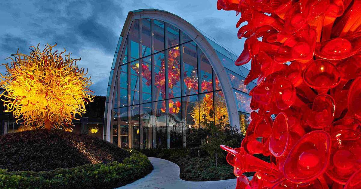
## Description Chihuly Garden and Glass is a dazzling celebration of color, form, and imagination, showcasing the work of world-renowned glass artist Dale Chihuly. Located in the heart of Seattle, this long-term exhibition invites visitors into a vibrant world where glass transcends its traditional boundaries and becomes a medium of storytelling, emotion, and architectural wonder. The exhibition is divided into three main areas: the Glasshouse, the Garden, and the Interior Galleries. The Glasshouse is the centerpiece—a 100-foot-long structure with a soaring ceiling that houses one of Chihuly’s largest suspended installations, a fiery cascade of red, orange, and yellow glass blossoms. The Garden blends natural landscaping with glass sculptures that twist and bloom among the plants, creating a surreal fusion of organic and manmade beauty. Inside the galleries, visitors can explore over four decades of Chihuly’s work, including the Persian Ceiling, Ikebana and Float Boats, and the Sea Life Room. A little-known fact: the site of Chihuly Garden and Glass was once home to the Fun Forest amusement park, a beloved local attraction that closed in 2010. Another interesting detail is that the facility was designed with sustainability in mind and has earned LEED Silver certification for its environmentally conscious construction. ## Location Chihuly Garden and Glass is located in the **United States**, in the **state of Washington**, within the **city of Seattle**. It sits at **305 Harrison Street**, directly adjacent to the iconic Space Needle in the Seattle Center. ### How to Get There - **By Light Rail**: Take the Link Light Rail to Westlake Station, then transfer to the Seattle Center Monorail, which drops you off steps from the entrance. - **By Bus**: Multiple King County Metro routes serve the Seattle Center area. - **By Car**: Paid parking is available in nearby garages, including the Mercer Street Garage and 5th Avenue North Garage. - **By Foot or Bike**: The Seattle Center is pedestrian- and bike-friendly, with easy access from downtown and surrounding neighborhoods. Its central location makes it an ideal stop on any Seattle itinerary, especially when paired with nearby attractions like the Museum of Pop Culture and the Space Needle. ## Tips - **Visit During Daylight and After Dark**: The glass sculptures take on a different character depending on the light. Daytime highlights the vivid colors, while nighttime illuminations create a magical ambiance. - **Buy Combo Tickets**: Consider purchasing a ticket that includes admission to both Chihuly Garden and Glass and the Space Needle for a discounted rate. - **Take Advantage of Gallery Talks**: Short, informative talks are offered throughout the day and are included with admission. - **Check for Special Events**: Seasonal exhibitions, live glassblowing demonstrations, and the annual Refract Festival add extra value to your visit. - **Use the Audio Tour**: Available via smartphone, the audio guide offers deeper insights into Chihuly’s inspirations and techniques. - **Visit The Bar**: Explore Dale Chihuly’s personal collections while enjoying a drink in a uniquely curated setting. ## Conclusion Chihuly Garden and Glass is a mesmerizing fusion of art and nature, offering a one-of-a-kind experience in the heart of Seattle. With its stunning installations, immersive galleries, and tranquil garden, it’s a must-see destination for art lovers, photographers, and curious travelers alike. ## FAQ **1. What are the opening hours of Chihuly Garden and Glass?** The museum is typically open daily from 9:30 AM to 9:30 PM, though hours may vary seasonally or for private events. **2. What is the cost of admission?** General admission ranges from $35 to $42.50. Discounts are available for seniors and youth. Children under 4 enter free. **3. Is photography allowed?** Yes, photography is encouraged, though tripods and flash are not permitted. **4. Is the museum wheelchair accessible?** Yes, the entire facility is ADA-compliant and offers accessible entrances and restrooms. **5. Can I visit without a reservation?** Walk-ins are welcome, but purchasing tickets in advance is recommended, especially during peak seasons. **6. Are there guided tours available?** While there are no formal guided tours, gallery talks and audio guides provide rich context throughout the exhibition. ## Links - [Chihuly Garden and Glass Official Website](https://www.chihulygardenandglass.com/)
GemVoyage Team • World
Montevideo
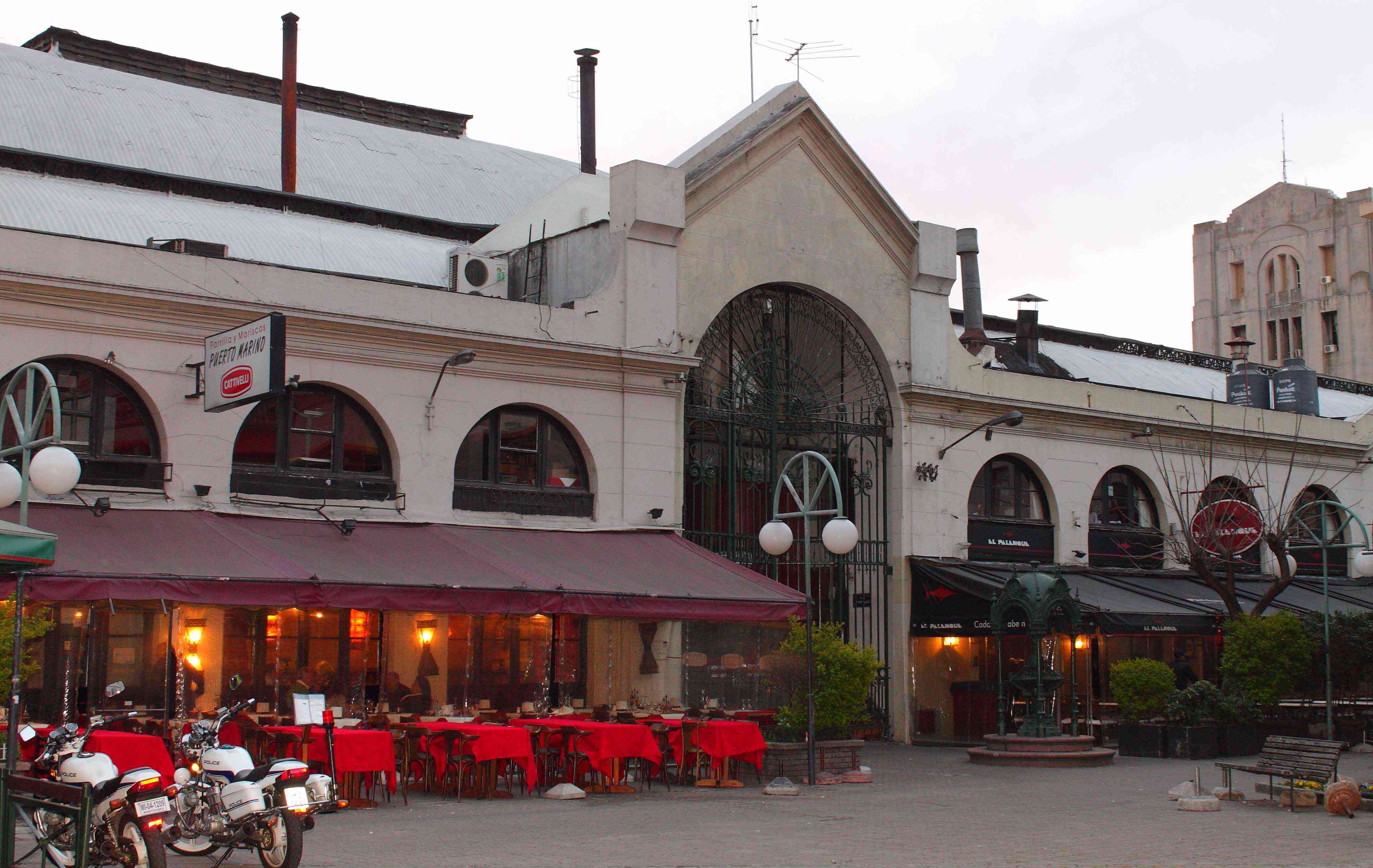
## Description Mercado del Puerto is one of the most iconic landmarks in Montevideo, Uruguay. More than just a market, it’s a cultural and gastronomic hub that captures the essence of Uruguayan traditions. Built in 1868, the building itself is a masterpiece of 19th-century iron architecture imported from Liverpool, England. The structure’s grand iron beams and vaulted ceilings give it an old-world charm that stands in contrast to the modern city outside. What truly makes Mercado del Puerto unique is its vibrant mix of sights, sounds, and flavors. Visitors are immediately drawn to the tantalizing aroma of grilled meats from the famous **parrillas** (traditional Uruguayan steakhouses). This is the perfect place to try Uruguay’s national dish: **asado** (barbecue). Beyond food, the market is filled with local artisans, lively street performers, and the friendly chatter of locals and tourists alike, making it a warm and welcoming environment. A little-known fact about Mercado del Puerto is that it was originally intended to be a train station, but when plans changed, it was transformed into a market instead. Another interesting detail is that the market becomes especially lively on weekends, when musicians and tango dancers bring the whole square to life, turning it into an open-air cultural festival. ## Location Mercado del Puerto is located in **Montevideo**, the capital city of **Uruguay**, situated along the country’s southern coast in the **Montevideo Department**. Specifically, it lies in the **Ciudad Vieja** (Old City), the historic heart of Montevideo, just steps away from the city’s main port and the Rambla waterfront promenade. Getting there is easy: * **By foot:** If you’re staying in the Old City or near the Rambla, it’s a pleasant walk. * **By bus:** Numerous city buses stop near the Old City and the port. * **By taxi or rideshare:** For convenience, especially if you’re staying farther away, a short taxi ride will get you there quickly. If you’re arriving by cruise ship, Mercado del Puerto is conveniently located within walking distance of the port terminal, making it a must-visit stop for cruise passengers. ## Tips To make the most of your visit to Mercado del Puerto, consider the following tips: 1. **Visit at lunchtime** – The market is at its most vibrant between 12:00 and 3:00 PM. This is the perfect time to enjoy freshly grilled asado paired with local wines. 2. **Try local specialties** – In addition to barbecue, don’t miss traditional dishes like *chivito* (a steak sandwich), *morcilla dulce* (sweet blood sausage with raisins and nuts), and *medio y medio* (a half-wine, half-sparkling drink). 3. **Bring cash** – While some restaurants accept cards, many smaller stalls and shops prefer cash in Uruguayan pesos. 4. **Go on weekends** – Live music, tango, and folk performances make weekends especially lively. 5. **Explore nearby attractions** – Since Mercado del Puerto is in Ciudad Vieja, take time to stroll the cobblestone streets, admire colonial architecture, and visit museums like the Museo Torres García. 6. **Watch your belongings** – Like in many busy tourist areas, keep an eye on your bags and valuables. ## Conclusion Mercado del Puerto is more than just a market—it’s the beating heart of Montevideo’s culture, food, and history. From savoring the best Uruguayan barbecue to soaking in the lively atmosphere of the Old City, a visit here offers an authentic and unforgettable experience. Whether you’re a foodie, a history buff, or simply curious, this landmark is a must-see on any trip to Uruguay. ## FAQ **1. What is Mercado del Puerto known for?** Mercado del Puerto is famous for its traditional Uruguayan barbecue (*asado*) and its vibrant cultural atmosphere with music, dance, and artisan shops. **2. Is Mercado del Puerto open every day?** Yes, it is generally open daily, but the best time to visit is around midday when the parrillas are busiest and the atmosphere is most lively. **3. How much time should I spend at Mercado del Puerto?** Most visitors spend 1–2 hours enjoying a meal and exploring the market, but if you also visit nearby attractions in Ciudad Vieja, plan for half a day. **4. Is Mercado del Puerto family-friendly?** Absolutely! Families are welcome, and children often enjoy the lively music and performances while parents savor the food. **5. Can vegetarians find food at Mercado del Puerto?** While it’s a meat-lover’s paradise, many restaurants offer vegetarian sides, salads, and grilled vegetables, though options may be limited compared to meat dishes. ## Links * [Official Tourism Website of Uruguay](https://turismo.gub.uy)
GemVoyage Team • World

Comments