GemVoyage Team • World
The Torre Velasca is one of Milan’s most recognizable—and most controversial—architectural landmarks. Rising sharply above the historic city center, this distinctive skyscraper challenges the visual harmony of Milan with a form that defies both traditional elegance and modernist simplicity. Completed in 1958, Torre Velasca represents a bold experiment in post-war Italian architecture, blending medieval visual references with modern structural engineering.
Designed by the prestigious BBPR architectural collective (Banfi, Belgiojoso, Peressutti, and Rogers), the tower was conceived during a period when Italy was rebuilding not only its cities, but its cultural identity after World War II. Rather than copying American glass skyscrapers, BBPR attempted to create a uniquely Italian vertical building, rooted in Milan’s historical skyline of towers, fortifications, and cathedrals.
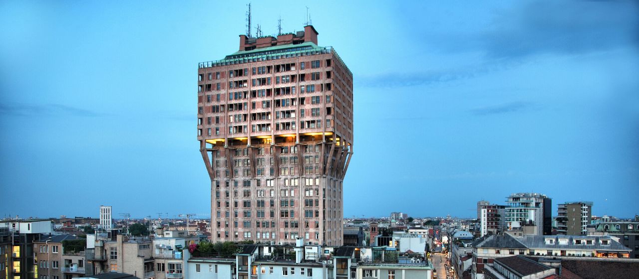
The most striking feature of Torre Velasca is its mushroom-shaped profile. The lower portion is slim and vertical, while the upper floors expand outward dramatically, creating the impression of a fortress suspended in midair. This unusual silhouette deliberately echoes the medieval defensive towers that once protected Italian cities. The exterior façade, with its exposed concrete ribs and reddish-brown cladding, reinforces the impression of strength and permanence rather than lightness or transparency.
Functionally, the tower was built as a mixed-use structure, combining offices in the lower levels and residential apartments in the expanded upper portion. This dual function was innovative for its time and contributed to the tower’s distinctive form—wider upper floors were better suited for domestic layouts with larger windows and more light.
Artistically, Torre Velasca sits in a unique position between Brutalism, Rationalism, and Neo-Medievalism. Some critics consider it awkward or aggressive, arguing that it clashes with Milan’s Renaissance and Gothic heritage. Others see it as a courageous refusal to submit to anonymous international modernism. Over time, what was once widely criticized has become a symbol of intellectual resistance in architecture, representing Milan’s willingness to experiment rather than imitate.
A little-known fact is that one of the architects, Gian Luigi Banfi, died in a Nazi concentration camp during World War II, and the tower stands partly as a symbolic continuation of the group’s interrupted pre-war ambitions. Another lesser-known detail is that construction techniques used in Torre Velasca directly influenced later Italian concrete tower projects in the 1960s and 1970s, making it a reference point for generations of architects.
Today, Torre Velasca remains fully functional and continues to divide opinion. To some, it is Milan’s “ugliest skyscraper.” To others, it is one of its most intellectually daring. What is beyond dispute is that the tower is an unavoidable visual statement, standing as a reminder that urban identity can be built not only on beauty, but also on creative risk.
Torre Velasca is located in the historic center of Milan, just a short walk from several of the city’s most important landmarks.
City: Milan
Region: Lombardy (Lombardia)
Country: Italy
District: Centro Storico
* Line M3 (Yellow Line) to Missori Station, then walk 5 minutes.
* Line M1 (Red Line) to Duomo Station, then walk about 10 minutes.
Its central location allows visitors to integrate Torre Velasca into almost any walking itinerary of historic Milan.
The Torre Velasca is not designed to impress everyone—and that is precisely its strength. As a bold post-war experiment, it challenges conventional ideas of beauty, heritage, and modernity within one of Europe’s most historically refined cities. Whether admired or criticized, the tower remains a defining symbol of Milan’s architectural independence and intellectual courage, proving that controversy can be as enduring as elegance.
1. Why is Torre Velasca so controversial?
Because its fortress-like modern design sharply contrasts with Milan’s classical skyline, dividing public opinion.
2. Can visitors go inside Torre Velasca?
No. It is mainly a private residential and office building and is not generally open to tourists.
3. Who designed Torre Velasca?
It was designed by the BBPR architectural group, one of Italy’s most influential post-war design collectives.
4. What architectural style does it represent?
It blends Brutalism, Rationalism, and Neo-Medieval influences, making it difficult to classify under a single style.
5. How tall is Torre Velasca?
It stands approximately 106 meters (348 feet) tall.
6. Is Torre Velasca considered a protected building?
Yes. It is now recognized as an important monument of 20th-century Italian architecture.
Discover more hidden gems you might love.
Berlin
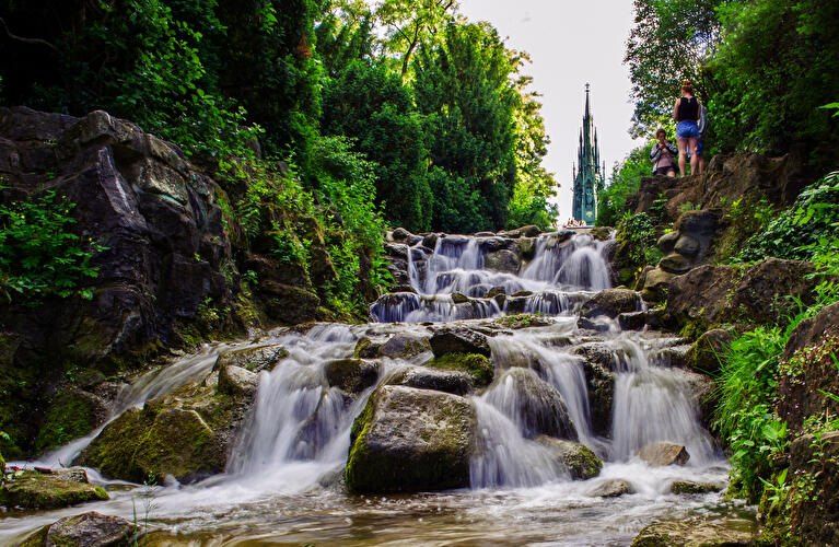
## Description **Viktoriapark** is one of Berlin’s most distinctive urban green spaces, combining **natural elevation, engineered waterfalls, panoramic city views, and national symbolism** within a compact yet dramatic landscape. Unlike Berlin’s vast flat parks such as Tiergarten or Tempelhofer Feld, Viktoriapark stands out because it rises sharply above the surrounding streets, offering one of the **best natural viewpoints in the entire city**. The park is centered around **Kreuzberg Hill**, a 66-meter-high elevation that gives the surrounding district its name. At the summit stands the imposing **National Monument for the Wars of Liberation** (Nationaldenkmal für die Befreiungskriege), a Gothic-style cast-iron monument designed by **Karl Friedrich Schinkel** and completed in 1821. The monument commemorates Prussia’s victory over Napoleon and represents one of the earliest major patriotic memorials in Germany. Its dark, spired form creates a dramatic silhouette against the sky and serves as a visual anchor for the entire park. One of Viktoriapark’s most beloved features is its **artificial waterfall system**, which cascades down the eastern slope of the hill toward Kreuzbergstraße. Built in the late 19th century, the waterfall was designed to mimic alpine mountain streams, bringing the sound, movement, and cooling atmosphere of flowing water into the dense urban fabric. During warm months, these waterfalls become the emotional heart of the park—children play at the base, couples sit on the stone steps, and photographers wait for light to catch the moving water. What makes Viktoriapark particularly compelling is the way it merges **romantic landscape design with political history**. The hill was reshaped during the 19th century to fit the ideals of romantic nationalism, where nature, sacrifice, and monumentality were meant to reinforce each other. The result is a park that feels both organic and highly symbolic at the same time. A little-known fact is that Kreuzberg Hill was once part of a **vine-growing region**, and small-scale wine production existed here in earlier centuries. Even today, a modern vineyard operates on the slope near the monument, producing limited local wine each year. Another lesser-known detail is that the waterfall only runs during the warmer months, meaning many winter visitors never realize that this dramatic feature exists at all. Beyond its historical symbolism, Viktoriapark plays a vital role in everyday neighborhood life. It is a **local refuge** for residents of Kreuzberg, attracting joggers, families, musicians, dog walkers, and sunset watchers. Unlike some of Berlin’s more monumental parks, Viktoriapark maintains a **distinctly neighborhood-driven character**, blending tourism and local daily rhythm without feeling staged. Emotionally, the park shifts moods throughout the day. Mornings are quiet and misty along the lower paths. Afternoons bring activity and movement. Evenings transform the summit into a gathering point for people watching the sun sink behind Berlin’s rooftops. From the top, visitors can often see landmarks such as the **TV Tower (Fernsehturm)** and distant church spires, reinforcing the sense of standing above the city without ever leaving it. ## Location **Viktoriapark** is located in the **Kreuzberg district of central Berlin**, close to the border with Schöneberg. **City:** Berlin **Region:** Berlin (city-state) **Country:** Germany **District:** Kreuzberg (Friedrichshain-Kreuzberg borough) ### How to Get There: * **By U-Bahn:** * **Line U6** to **Platz der Luftbrücke**, then walk about 10 minutes. * **Line U7** to **Mehringdamm**, then walk about 12–15 minutes. * **By bus:** Several bus lines stop along Mehringdamm and Kreuzbergstraße. * **By bicycle:** Well connected by bike lanes and ideal as part of a Kreuzberg cycling route. * **By taxi or ride-hailing apps:** Direct access from anywhere in central Berlin. * **On foot:** Easily reachable from Bergmannkiez and Tempelhofer Damm areas. The park’s elevated position makes it visible from many surrounding streets, acting as a **natural landmark within Kreuzberg**. ## Tips * **Visit near sunset:** The panoramic view from the monument is one of the best free sunset spots in Berlin. * **Check if the waterfall is running:** It is typically active only from spring to autumn. * **Wear comfortable shoes:** The paths include steep inclines and irregular stone steps. * **Bring a light jacket:** Wind at the top can be significantly stronger than street level. * **Combine with Bergmannkiez:** The surrounding neighborhood is full of cafés, bakeries, and local restaurants. * **Avoid peak hours for quiet time:** Late afternoons on weekends can be crowded. * **Respect the monument:** It is a protected historical site, not a climbing structure. * **Photography tip:** Early morning light illuminates the eastern slope and waterfall beautifully. ## Conclusion **Viktoriapark** is a rare Berlin green space where **natural elevation, romantic landscape design, national history, and everyday local life intersect**. From its cascading waterfalls and shaded paths to the solemn monument crowns its summit, the park offers both emotional contrast and visual depth. It is not grand in size, but in **experience, symbolism, and atmosphere**, it ranks among the most memorable outdoor spaces in the city. ## FAQ **1. What is Viktoriapark famous for?** It is best known for its **hilltop national monument, artificial waterfalls, and panoramic city views**. **2. Is Viktoriapark suitable for children?** Yes. Families visit frequently, especially near the lower waterfall areas, though supervision is required due to rocky terrain. **3. Is there an entrance fee?** No. Viktoriapark is **free and open to the public**. **4. Does the waterfall run all year?** No. It usually operates **only during the warmer months**. **5. Can you see major landmarks from Viktoriapark?** Yes. On clear days, you can spot parts of the **Berlin skyline including the TV Tower**. **6. How long should a visit take?** Most visits last **45 minutes to 1.5 hours**, depending on walking pace and time spent at viewpoints. ## Links * [Official Berlin Parks Page](https://www.berlin.de/tourismus/parks-und-gaerten/3560783-1740419-viktoriapark.html)
GemVoyage Team • World
Paro
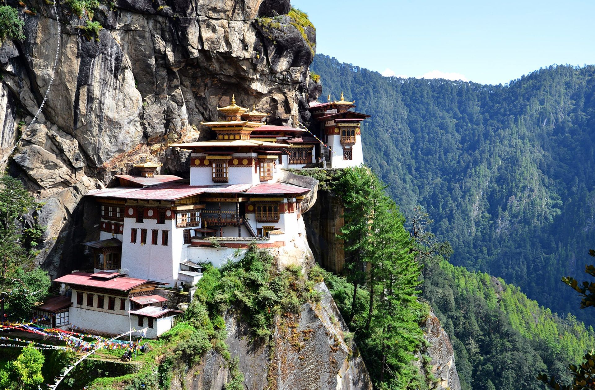
## Description The Tiger’s Nest, or Paro Taktsang, is a cliffside Buddhist monastery in Bhutan dramatically perched on a vertical rock face above the Paro Valley. Dating to the 17th century (with earlier sacred associations to Guru Rinpoche), the complex comprises several temples and hermitages connected by steep steps and narrow paths. The visual impact — whitewashed buildings and golden roofs clinging to granite — is among the most evocative images of Himalayan spiritual architecture. The site is both a pilgrimage destination and a focal point of Bhutanese national identity. Legend holds that Guru Rinpoche (Padmasambhava) arrived on the back of a tigress and meditated in the grottoes that now form part of the monastery complex. The blend of sacred history, dramatic landscape, and living monastic life gives Paro Taktsang deep spiritual resonance for Bhutanese and international visitors alike. SEO-friendly phrases you may use for planning include "Tiger's Nest hike," "Paro Taktsang visit tips," and "Bhutan monastery etiquette." Visitor experience: The descent into the valley and the ascent along forested trails provide a contemplative approach lined with prayer flags, small chortens, and viewpoints. While the most iconic view is from the main lookout before descending to the monastery, many visitors linger to observe ritual offerings, circumambulation of shrines, and the quiet rhythm of monastic routines. Respectful curiosity—asking guides about appropriate behavior and dress—enhances the visit for both guests and residents. ## Location Paro Taktsang sits within Paro valley in western Bhutan, about a 45–60 minute drive from Paro town and its international airport. Access requires a moderate hike of 2–3 hours round-trip depending on pace and stops. How to get there: Most travelers arrange transport through a licensed guide or hotel. Bhutan's regulated tourism policies require foreign visitors to book through licensed operators who manage permits, accommodation, and local guide services. For practical planning, search queries like "book Tiger's Nest guide" or "Paro Taktsang hiking permits" will direct you to authorized providers. Trail notes: The trail rises steadily with sections of stone steps and steeper pitches; resting at teahouses and lookout points is common. Horse rentals are occasionally offered for portions of the route, but check animal welfare practices and trail suitability before choosing this option. ## Tips - **Dress respectfully:** Wear modest clothing for temple visits; remove shoes inside shrines as required and avoid revealing or inappropriate attire. - **Prepare for a strenuous hike:** Bring sturdy footwear, adequate water, sun protection, and allow time for rest stops; altitude and steps make the climb moderately challenging. - **Hire an experienced guide:** Guides explain religious practices, translation of local rituals, and can signal areas off-limits to visitors, creating a more meaningful visit. - **Follow monastery rules:** Photography restrictions inside temples, silence in prayer halls, and specific rituals require compliance; ask before photographing monks or ceremonies. - **Consider timing:** Early morning or late afternoon visits reduce crowding and provide superior photography light, but check seasonal opening hours and local festivals. ## Conclusion Paro Taktsang is both a pilgrimage site and a Himalayan emblem: its precarious position and spiritual resonance make it an unforgettable visit that blends exertion with contemplative reward. When planning, confirm that your tour operator or hotel handles permits and local guidelines; these practical steps help protect the monastery’s sanctity and the visitor’s experience. ## FAQ - **Q: Can foreigners visit Tiger’s Nest independently?** A: Bhutan requires most foreign visitors to travel with licensed operators or registered guides. Booking through authorized tour operators ensures that permits, accommodations, and guide services are in place. - **Q: How long does the hike take?** A: Typical round-trip times range from 3 to 5 hours depending on fitness, stops, and whether you use any horse transport for parts of the ascent. - **Q: Are there age or mobility restrictions?** A: The trail includes steep steps and uneven surfaces and may not be suitable for those with severe mobility limitations. Discuss options with your guide; horse rentals for short segments may be available but evaluate safety and welfare considerations. - **Q: What permits or fees are required?** A: Entry to Bhutan is managed via licensed operators; fees and permit processes vary with season and travel packages. Confirm all costs with your provider in advance. - **Q: Is photography allowed inside the monastery?** A: Many interior temple spaces restrict photography to preserve sacred objects and respect practitioners. Always ask guides or monks before photographing interior or ritual scenes. ## Links - [Paro Taktsang — Wikipedia](https://en.wikipedia.org/wiki/Paro_Taktsang)
GemVoyage Team • World
Ontario
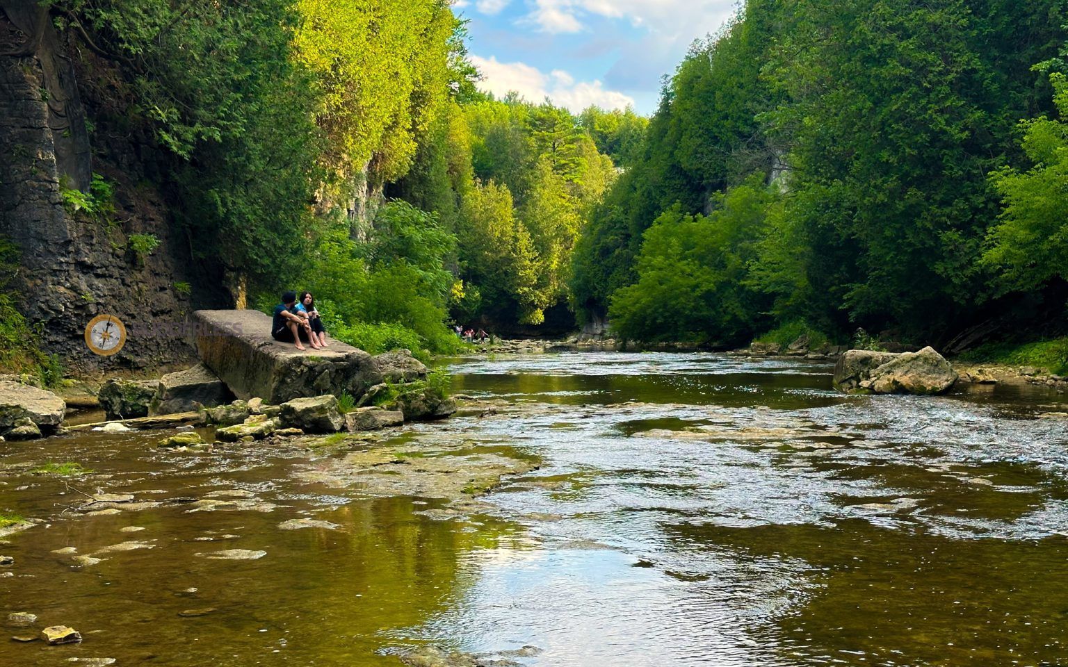
## Description Elora Gorge is one of Ontario’s most striking natural attractions, known for its steep limestone cliffs, fast-moving Grand River scenery, and a landscape that feels more dramatic than most visitors expect from southern Ontario. The gorge is part nature preserve, part outdoor recreation area, and part classic day-trip destination. People come for the views, the trails, the river access, and the feeling of standing in a place where water has carved a deep, narrow route through rock over a very long span of time. What makes Elora Gorge memorable is its contrast. The surrounding region is gently rural and easygoing, but the gorge itself is rugged and visually intense. When you stand on the edge and look down, the river appears surprisingly powerful as it moves through the canyon-like setting. The rock walls, tree cover, and water together create a scene that feels almost larger than life for a place that is relatively easy to access from nearby towns and cities. It is the kind of landscape that immediately rewards anyone who likes geology, photography, hiking, or simply being outdoors. One little-known fact about the area is how much its shape influences the mood of the visit. Even short walks feel more memorable because the viewpoint changes quickly from forest to cliff edge to river corridor. Another detail many visitors appreciate only after arriving is how seasonally different the gorge can feel. In spring, the river runs energetically and the foliage is fresh. In summer, the greens are dense and the area becomes a prime outdoor destination. In autumn, the cliffs and trees around the gorge can create a particularly vivid palette. Winter visits are quieter and more austere, but they can also be beautiful in a stark, sculptural way. Elora Gorge is also appealing because it can satisfy different travel styles. A casual visitor can enjoy the scenery and take a short walk, while a more active traveler can turn the visit into a longer outdoor outing. The gorge is one of those places where people often arrive with modest expectations and leave impressed by how photogenic and substantial it feels. ## Location Elora Gorge is in Ontario, Canada, near the village of Elora and within reach of the wider Waterloo Region and Wellington County area. The gorge is associated with the Grand River and is close enough to several southwestern Ontario cities to function as a realistic day trip. For many travelers, the easiest way to visit is by car, since that gives the most flexibility for parking, timing, and combining the gorge with nearby Elora village or other regional stops. If you are driving from Toronto, Kitchener-Waterloo, Guelph, or nearby communities, the route is straightforward enough for a day outing. Public transit is usually less convenient, so road travel is the most practical option for most visitors. Once you arrive, the experience is mostly about walking, looking, and choosing how active you want to be. If you are planning a fuller outdoor day, it makes sense to pair the gorge with village cafés, local shops, or other conservation-area activities in the surrounding region. ## Tips Wear footwear that can handle uneven paths and potentially muddy or damp ground. The gorge is beautiful, but it is not a place where fashionable footwear matters more than stability and comfort. If you want photos from scenic viewpoints, take your time and be cautious near edges and steep sections. The views are worth slowing down for, and safety should always come first. Check conditions before you go. Water levels, trail conditions, and seasonal access can change the experience significantly. A gorge that looks calm in one season can be much more energetic in another, and some areas may be better suited to certain weather conditions. If you are visiting with children, choose routes and viewpoints that match their energy and attention span. Bring water, snacks, and weather-appropriate layers. The gorge can feel cooler or windier than the nearby town, and you may spend more time outside than planned once you start enjoying the scenery. If you are interested in photography, morning and late afternoon are usually the best times for softer light. Consider making time for Elora village as well. The gorge is the headline attraction, but the surrounding area often makes the trip more satisfying. Many visitors find that pairing the natural site with a meal or wander in town creates the most balanced experience. ## Conclusion Elora Gorge is one of Ontario’s most rewarding scenic escapes, offering dramatic geology, outdoor recreation, and easy access from nearby communities. It is a strong choice for travelers who want nature without a complicated journey. ## FAQ ### Is Elora Gorge good for a quick visit? Yes. Even a short stop can be worthwhile if you want a scenic view and a brief walk. If you have more time, though, the gorge becomes much richer because you can explore the trails and surrounding area more fully. ### Is it suitable for families? It can be, provided you choose paths and viewpoints that fit your group’s comfort level. Families should pay close attention near steep edges and areas with uneven terrain. ### What is the best season to visit? There is no single best season, because each one has a different appeal. Spring and autumn are especially attractive for scenery, while summer is popular for outdoor activity and longer visits. ### Do I need to be an experienced hiker? No. There are options for casual visitors as well as more active hikers. You can tailor the trip to your own pace and interests. ### Can I see the gorge without a long hike? Yes. The attraction is accessible enough that you can enjoy views and the setting without committing to a major hike, although walking deeper into the area gives a fuller experience. ## Links - [Wikipedia](https://en.wikipedia.org/wiki/Elora_Gorge_Conservation_Area)
GemVoyage Team • World
Paris
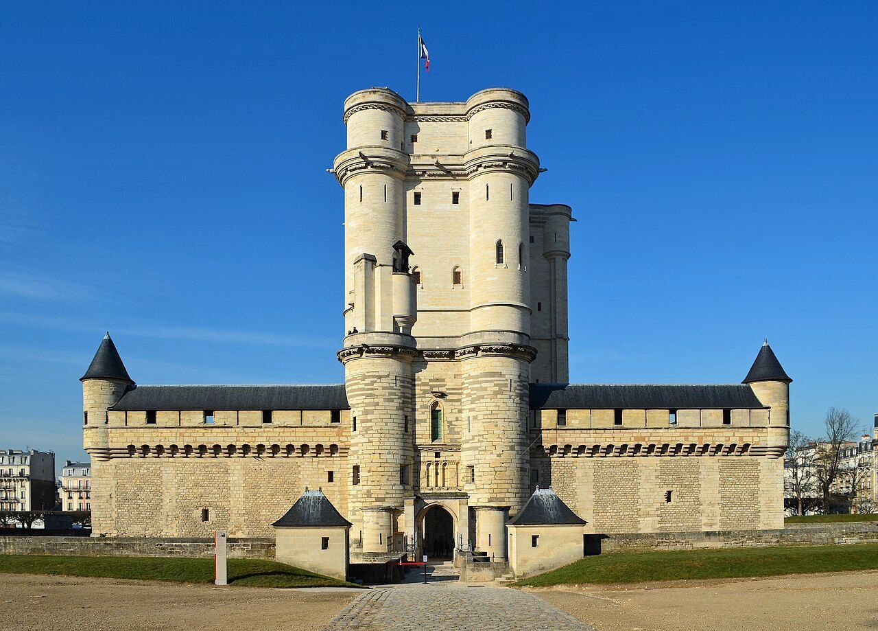
## Description The **Château de Vincennes** is one of France’s most historically significant royal fortresses and a remarkable example of **medieval military architecture** in the heart of modern Paris. Located just east of the city, this vast castle stands as a symbol of the **power, prestige, and evolution of the French monarchy** from the Middle Ages through the Renaissance. Originally built as a **hunting lodge for King Louis VII in the 12th century**, the site was transformed into a formidable **royal fortress** by **King Philip VI** and **King Charles V** during the 14th century. The result was one of Europe’s largest and most impressive medieval castles, complete with towering walls, fortified gates, and a majestic **52-meter (170-foot) keep** — the tallest medieval fortified tower in Europe. The keep, surrounded by a deep moat, served as both a **royal residence** and a **symbol of authority**. Inside, visitors can explore beautifully preserved **royal apartments**, **chapels**, and **ceremonial halls** that once housed some of France’s most powerful monarchs, including **Charles V**, **Henry IV**, and **Louis XIV**. Before Versailles rose to prominence, Vincennes was the main royal residence of the French crown. What makes the Château de Vincennes truly unique is its **dual character** — both royal and defensive. The complex includes a massive **curtain wall with nine towers**, a **drawbridge**, and a **gothic-style chapel** modeled after Sainte-Chapelle in central Paris. Over the centuries, it also served as a **royal prison**, holding famous figures such as **the Marquis de Sade**, **Denis Diderot**, and **Mirabeau**. A lesser-known fact is that the **castle was occupied by Napoleon Bonaparte’s troops**, later used as a **military arsenal**, and even served as a **command center during World War II**. Despite its turbulent past, the site remains remarkably well-preserved and offers a fascinating journey through 800 years of French history. Today, the Château de Vincennes stands as a peaceful yet awe-inspiring monument — less crowded than central Paris landmarks, making it an ideal destination for history enthusiasts seeking authenticity and atmosphere. ## Location The **Château de Vincennes** is located in the **suburb of Vincennes**, directly east of **central Paris**, within the **Val-de-Marne (Île-de-France)** region. It sits adjacent to the **Bois de Vincennes**, Paris’s largest public park. To get there: * **By metro:** Take **Line 1** to **Château de Vincennes Station**, which is just outside the main entrance. * **By RER:** The **RER A** also stops at **Vincennes Station**, about a **5-minute walk** from the castle. * **By bus:** Several Paris bus lines serve the area, including **46, 112, and 114**. * **By car:** Easily accessible via the **Périphérique** (Porte de Vincennes exit), with nearby paid parking available. * **By bike or on foot:** The surrounding **Bois de Vincennes** area offers scenic paths leading directly to the château. ## Tips * **Take the guided tour:** It offers rich historical context about the kings, prisoners, and architects who shaped the site. * **Visit the Sainte-Chapelle de Vincennes:** A stunning Gothic chapel that rivals its Parisian namesake in beauty and craftsmanship. * **Climb the keep:** The panoramic view from the top reveals both the castle’s vast grounds and the Paris skyline. * **Go early or late in the day:** To enjoy a quieter experience and capture the best light for photos. * **Combine with nearby attractions:** After your visit, explore the **Bois de Vincennes**, **Parc Floral de Paris**, or the **zoo** — all within walking distance. * **Family-friendly:** Wide courtyards and open spaces make it a great outing for families and children. * **Check for exhibitions:** The castle regularly hosts **temporary exhibitions, medieval fairs, and reenactments**. ## Conclusion The **Château de Vincennes** is a living testament to the grandeur and endurance of French royal history. With its soaring towers, Gothic chapel, and centuries of royal intrigue, it offers visitors a journey from the medieval era to modern France — all within reach of central Paris. Far less crowded than the city’s major monuments, it’s a place where you can truly feel the **power, elegance, and mystery** of France’s royal past. Whether you’re fascinated by architecture, military history, or French monarchy, the Château de Vincennes promises an experience both majestic and intimate. ## FAQ **1. When was the Château de Vincennes built?** Construction began in the **14th century** under **Philip VI** and **Charles V**, though the site dates back to a 12th-century royal hunting lodge. **2. What is the château known for?** It is renowned as **France’s largest medieval royal fortress**, featuring Europe’s tallest keep and a beautifully preserved Gothic chapel. **3. How can I get there from central Paris?** Take **Metro Line 1** directly to **Château de Vincennes Station** — it’s the last stop on the line and just a few minutes’ walk from the castle. **4. Are guided tours available?** Yes, guided tours in French and English are offered daily and provide detailed insights into the château’s rich history. **5. How long should I plan for a visit?** Allow about **2–3 hours** to explore the keep, chapel, and grounds at a comfortable pace. **6. Is it suitable for children?** Yes — children often enjoy exploring the towers and open courtyards, and there are family-friendly tours available. **7. When is the best time to visit?** Spring and early autumn offer pleasant weather and fewer crowds, though the château is open year-round. ## Links * [Wikipedia page](https://en.wikipedia.org/wiki/Ch%C3%A2teau_de_Vincennes)
GemVoyage Team • World
.jpg)
Scotland
## Description The Fairy Pools on the Isle of Skye in Scotland are a series of crystal-clear, aqua-blue pools and cascading waterfalls that tumble down from the foothills of the Black Cuillin mountains. These natural pools, fed by the Allt Coire a’ Mhadaidh stream, are renowned for their ethereal beauty and have become one of Skye’s most iconic and photographed attractions. Whether you're a hiker, wild swimmer, or simply a lover of dramatic landscapes, the Fairy Pools offer a magical experience that feels straight out of folklore. The walk to the pools is relatively short—about 2.4 kilometers round trip—and follows a well-maintained gravel path that winds through heather-covered moorland. Along the way, visitors encounter a series of waterfalls and pools, each more striking than the last. The water is so clear that you can see the rocky bottoms and reflections of the surrounding hills, making it a favorite spot for photographers and nature enthusiasts. A little-known fact: the area around the Fairy Pools was the site of the last and bloodiest clan battle in Scottish history—the Battle of Coire na Creiche in 1601 between the MacLeods of Dunvegan and the MacDonalds of Sleat. Legend has it that the stream ran red with blood, a stark contrast to its current tranquil appearance. Another quirky detail is that despite their name, there’s no historical association with fairies—the name “Fairy Pools” only began appearing in guidebooks in the 20th century. ## Location The Fairy Pools are located in **Scotland**, on the **Isle of Skye**, near the village of **Carbost** in the **Highland region**. They sit at the base of the Black Cuillin mountains in **Glen Brittle**, on the western side of the island. ### How to Get There - **By Car**: From Portree, the island’s main town, it’s about a 30-minute drive (20.5 miles) via the B8009 and Glenbrittle road. The route includes single-track roads with passing places. - **By Bus**: Public transport is limited. Buses run to Carbost, but you’ll need to arrange a taxi or walk from there. - **By Tour**: Several guided tours from Portree or Inverness include the Fairy Pools as part of a day trip. - **By Foot**: The walk to the pools begins at the Fairy Pools car park, located near Glenbrittle. From the car park, it’s a 20-minute walk to the first waterfall. ## Tips - **Visit Early or Late**: The site gets crowded during peak hours, especially in summer. Early morning or late afternoon offers better light and fewer visitors. - **Wear Waterproof Footwear**: The path can be muddy and uneven, especially after rain. - **Bring Layers**: Weather on Skye is unpredictable. Pack a waterproof jacket and warm clothing. - **Wild Swimming**: Brave souls can swim in the pools, but the water is icy year-round. A wetsuit is recommended. - **Respect Nature**: Follow the Scottish Outdoor Access Code—take your litter with you and stick to marked paths. - **Parking**: There is a charge for parking at the Fairy Pools car park, which helps maintain the site. ## Conclusion The Fairy Pools on the Isle of Skye are a breathtaking blend of natural beauty and Highland mystique. With their vivid waters, dramatic mountain backdrop, and rich history, they offer a memorable experience for anyone exploring Scotland’s rugged landscapes. ## FAQ **1. Is there an entrance fee to visit the Fairy Pools?** No, the pools are free to visit, but there is a charge for parking. **2. How long is the walk to the Fairy Pools?** The round-trip walk is approximately 2.4 kilometers and takes 40 minutes to 1.5 hours depending on pace and stops. **3. Can I swim in the Fairy Pools?** Yes, wild swimming is allowed, but the water is extremely cold. A wetsuit is recommended. **4. Are the Fairy Pools suitable for children?** Yes, but children should be supervised due to uneven terrain and cold water. **5. Is the site wheelchair accessible?** No, the terrain is rugged and includes steep inclines, making it unsuitable for wheelchairs. **6. What is the best time of year to visit?** Spring and autumn offer mild weather and fewer crowds. Summer is busiest, while winter can be icy and less accessible. ## Links - [Fairy Pools Walk – Isle of Skye Guide](https://www.isleofskye.com/skye-guide/top-ten-skye-walks/fairy-pools) - [Fairy Pools – VisitScotland Overview](https://www.visitscotland.com/info/see-do/fairy-pools-p1770011) - [Fairy Pools – Wikipedia Entry](https://en.wikipedia.org/wiki/Fairy_Pools) Description The Fairy Pools on the Isle of Skye in Scotland are a series of crystal-clear, aqua-blue pools and cascading waterfalls that tumble down from the foothills of the Black Cuillin mountains. These natural pools, fed by the Allt Coire a’ Mhadaidh stream, are renowned for their ethereal beauty and have become one of Skye’s most iconic and photographed attractions. Whether you're a hiker, wild swimmer, or simply a lover of dramatic landscapes, the Fairy Pools offer a magical experience that feels straight out of folklore. The walk to the pools is relatively short—about 2.4 kilometers round trip—and follows a well-maintained gravel path that winds through heather-covered moorland. Along the way, visitors encounter a series of waterfalls and pools, each more striking than the last. The water is so clear that you can see the rocky bottoms and reflections of the surrounding hills, making it a favorite spot for photographers and nature enthusiasts. A little-known fact: the area around the Fairy Pools was the site of the last and bloodiest clan battle in Scottish history—the Battle of Coire na Creiche in 1601 between the MacLeods of Dunvegan and the MacDonalds of Sleat. Legend has it that the stream ran red with blood, a stark contrast to its current tranquil appearance. Another quirky detail is that despite their name, there’s no historical association with fairies—the name “Fairy Pools” only began appearing in guidebooks in the 20th century. Location The Fairy Pools are located in Scotland, on the Isle of Skye, near the village of Carbost in the Highland region. They sit at the base of the Black Cuillin mountains in Glen Brittle, on the western side of the island. How to Get There By Car: From Portree, the island’s main town, it’s about a 30-minute drive (20.5 miles) via the B8009 and Glenbrittle road. The route includes single-track roads with passing places. By Bus: Public transport is limited. Buses run to Carbost, but you’ll need to arrange a taxi or walk from there. By Tour: Several guided tours from Portree or Inverness include the Fairy Pools as part of a day trip. By Foot: The walk to the pools begins at the Fairy Pools car park, located near Glenbrittle. From the car park, it’s a 20-minute walk to the first waterfall. Tips Visit Early or Late: The site gets crowded during peak hours, especially in summer. Early morning or late afternoon offers better light and fewer visitors. Wear Waterproof Footwear: The path can be muddy and uneven, especially after rain. Bring Layers: Weather on Skye is unpredictable. Pack a waterproof jacket and warm clothing. Wild Swimming: Brave souls can swim in the pools, but the water is icy year-round. A wetsuit is recommended. Respect Nature: Follow the Scottish Outdoor Access Code—take your litter with you and stick to marked paths. Parking: There is a charge for parking at the Fairy Pools car park, which helps maintain the site. Conclusion The Fairy Pools on the Isle of Skye are a breathtaking blend of natural beauty and Highland mystique. With their vivid waters, dramatic mountain backdrop, and rich history, they offer a memorable experience for anyone exploring Scotland’s rugged landscapes. FAQ 1. Is there an entrance fee to visit the Fairy Pools? No, the pools are free to visit, but there is a charge for parking. 2. How long is the walk to the Fairy Pools? The round-trip walk is approximately 2.4 kilometers and takes 40 minutes to 1.5 hours depending on pace and stops. 3. Can I swim in the Fairy Pools? Yes, wild swimming is allowed, but the water is extremely cold. A wetsuit is recommended. 4. Are the Fairy Pools suitable for children? Yes, but children should be supervised due to uneven terrain and cold water. 5. Is the site wheelchair accessible? No, the terrain is rugged and includes steep inclines, making it unsuitable for wheelchairs. 6. What is the best time of year to visit? Spring and autumn offer mild weather and fewer crowds. Summer is busiest, while winter can be icy and less accessible. Links Fairy Pools Walk – Isle of Skye Guide Fairy Pools – VisitScotland Overview Fairy Pools – Wikipedia Entry 715 words37 lines4484 characters4520 bytes
GemVoyage Team • World
Stockholm
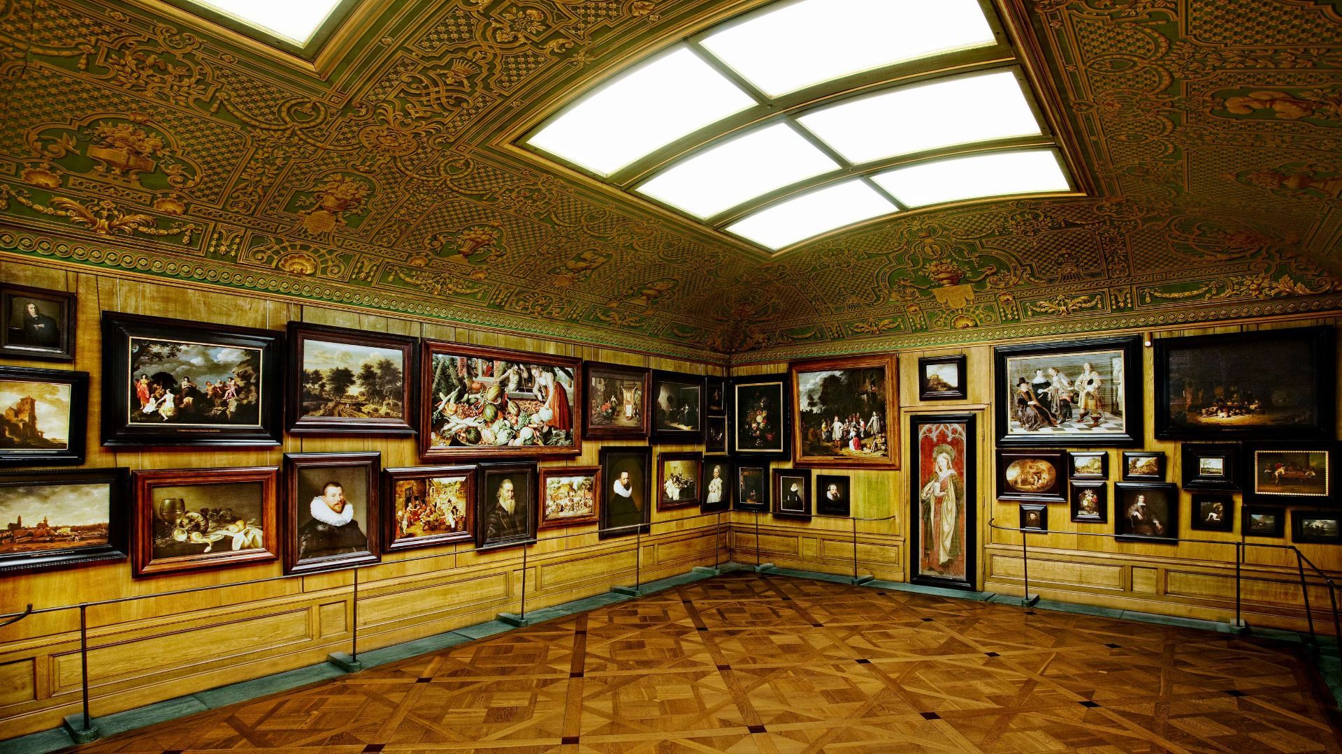
## Description The Hallwyl Museum in Stockholm offers one of the city’s most distinctive historic-house experiences. Housed in the former residence of Count and Countess von Hallwyl, the museum preserves an extraordinary late-nineteenth-century interior filled with art, furniture, decorative objects, and the feeling of a private home that has been carefully maintained rather than transformed into a generic museum. Visiting it is like stepping into a remarkably complete snapshot of upper-class domestic life in Stockholm at the turn of the century. The museum is especially appealing because it balances grandeur and intimacy. Some rooms are richly decorated and formal, while others feel like lived-in domestic spaces, making the whole building feel coherent rather than staged. One little-known fact is that the Hallwyl collection was assembled with unusual care and documentation, giving historians and visitors a detailed view of the household’s contents and routines. Another interesting detail is that the house itself reflects both status and modernity, showing how wealthy Stockholm families adopted new technologies and comforts while still displaying traditional elegance. What makes the museum memorable is the combination of its architecture, interiors, and sense of personal history. Unlike larger national museums, Hallwyl’s charm comes from concentration. Every room, object, and corridor contributes to a specific atmosphere. The visit is ideal for travelers who enjoy historic interiors, design history, or the way private homes can reveal broader social changes. It also fits well into Stockholm’s cultural landscape because it offers a different experience from the city’s more famous royal or maritime attractions. Instead of scale, it offers detail; instead of spectacle, it offers texture. ## Location The Hallwyl Museum is in central Stockholm, Sweden, near the city’s commercial and cultural core. Its location makes it easy to reach from many parts of the city and convenient to combine with shopping streets, other museums, or a broader downtown walk. The simplest way to get there is by public transport or on foot from central Stockholm. Because the city is well connected, visitors staying in the center can usually reach the museum quickly without needing a car. If you are planning a full day in central Stockholm, the museum works well as a quieter stop between busier attractions. ## Tips Take your time in the rooms; the best part of the museum is noticing the details. If you enjoy decorative arts, interiors, or social history, this museum will be especially rewarding. Check the current opening information in advance, since historic-house museums sometimes have schedule variations. Pair the visit with nearby Stockholm attractions to make the most of the central location. ## Conclusion The Hallwyl Museum is a refined and atmospheric historic house that gives visitors a rare, detailed glimpse into Stockholm’s aristocratic past. ## FAQ ### What kind of museum is Hallwyl? It is a historic house museum preserved from a wealthy Stockholm family’s residence. ### Is it good for first-time visitors to Stockholm? Yes, especially if you want a cultural site that is elegant and manageable in size. ### How long should I plan for the visit? Around one to two hours is usually enough. ### Is the museum family-friendly? Yes, though it is especially enjoyable for visitors interested in history and interiors. ### Why is it special compared with other museums? Because it preserves a remarkably complete domestic environment rather than only displaying isolated objects. ## Links - [Official website](https://hallwylskamuseet.se/en/) - [Hallwyl Museum on Wikipedia](https://en.wikipedia.org/wiki/Hallwyl_Museum)
GemVoyage Team • World

Comments