GemVoyage Team • World
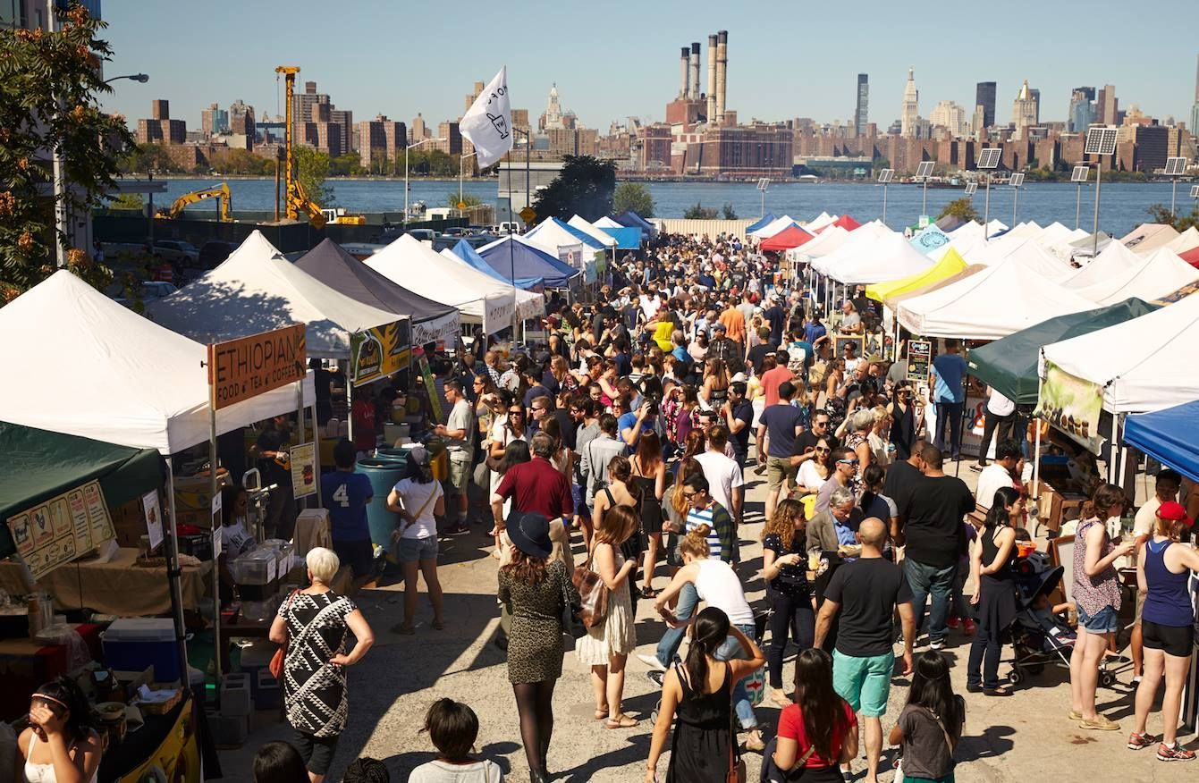
What makes Smorgasburg especially appealing is the combination of scale and variety. You can move from one stall to another and find food from very different traditions, all within a single open-air setting. That makes it attractive for groups with mixed tastes, because one person can go for dumplings, another for seafood, another for dessert, and everyone still shares the same experience. The market is also a strong reflection of Brooklyn’s creative economy. Many vendors use Smorgasburg as a launchpad, which means the market often feels like a testing ground for the next big neighborhood food obsession.
Another reason the market stands out is that it offers more than eating. It is a social scene. People come to sit outdoors, talk, take photos, and enjoy the atmosphere around Williamsburg. The setting helps: you are near the waterfront, in a neighborhood associated with design, nightlife, and independent businesses. That context gives Smorgasburg a sense of place that is more specific than a typical city food hall. It feels rooted in Brooklyn rather than simply placed there for tourists.
A little-known fact is that Smorgasburg has played an important role in helping local food entrepreneurs gain visibility. For some vendors, it has been a stepping stone to permanent restaurants, broader recognition, or new business ideas. Another is that the market’s popularity has made it influential well beyond New York, because it helped define a modern style of outdoor, vendor-driven food gathering that other cities later tried to imitate.
The best way to experience Smorgasburg is to arrive hungry but not rushed. The market rewards wandering, comparing options, and trying a few things rather than committing to one huge meal. It is especially fun when you treat it like a sampling journey, with enough time to notice the atmosphere, the people, and the setting around the food. That mix of appetite and curiosity is what makes the experience memorable.
It also helps to think of Smorgasburg as a snapshot of Brooklyn’s changing food identity. The vendors are not simply selling dishes; they are participating in a scene that reflects neighborhood tastes, immigrant influences, and the city’s constant appetite for reinvention. That means the market can feel different from one season to the next, with new specialties, new presentation styles, and new crowd energy each time you visit. If you like places that feel current without being manufactured, this is one of the strongest examples in New York.
The easiest way to get there is by subway, followed by a short walk. Williamsburg is well connected to Manhattan and other parts of Brooklyn, so visitors usually do not need a car. If you are already exploring Brooklyn, the market can fit naturally into a day spent along the waterfront or around nearby streets full of restaurants and shops. Because the area is popular, it is smart to allow extra time for transit and walking, especially on weekends.
If you want to combine the market with sightseeing, plan it as part of a broader Williamsburg visit rather than a standalone errand. That lets you enjoy the neighborhood’s street life before or after the market itself.
Come early if you want the widest selection and a less crowded atmosphere. Later in the day can be fun too, but lines often grow and popular stalls can sell out.
Bring a friend or go with a group if possible. Sharing dishes is one of the best ways to experience the range of food without filling up too quickly.
Dress for the weather. Since this is an outdoor market, comfort matters more than style, especially if you plan to walk around Williamsburg afterward.
Is it worth visiting if I only have one day in New York? Yes, especially if you want a taste of contemporary Brooklyn food culture.
How long should I stay? Most visitors spend one to three hours, depending on how much they want to eat and explore.
Is it family-friendly? Yes. It is a casual outdoor food market that works well for groups and families.
What is the best time to go? Earlier in the day is usually better for shorter lines and more vendor choice.
Discover more hidden gems you might love.
Brussels
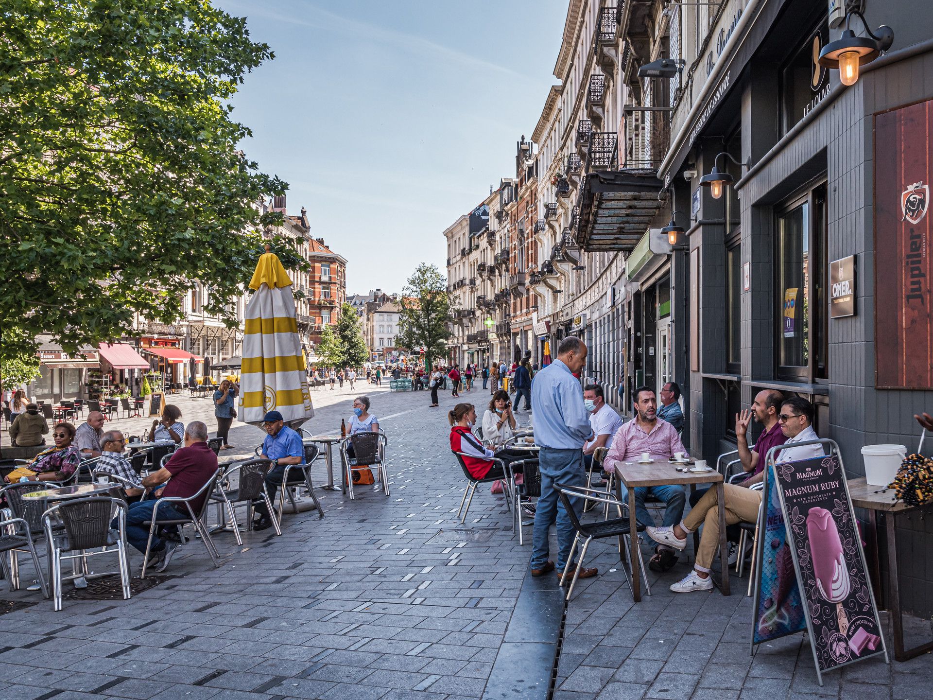
## Description Saint-Gilles is one of Brussels’ most interesting neighborhoods because it feels lived-in, creative, and slightly unruly in ways that make urban travel more rewarding. It is not a single attraction in the conventional sense. Instead, it is a district where architecture, cafés, local life, art spaces, and residential streets come together to form a strong neighborhood identity. For travelers who prefer walking through cities rather than just checking off monuments, Saint-Gilles offers exactly the kind of layered experience that makes Brussels memorable. The neighborhood stands out because it combines elegance and texture. You will find Art Nouveau and eclectic architecture, busy local streets, small shops, community energy, and a range of everyday scenes that make the area feel authentic rather than curated. A lesser-known fact is that Saint-Gilles has long attracted artists, creatives, and socially diverse residents, which helps explain its visual and cultural variety. Another detail many visitors notice is the way the neighborhood shifts from quiet residential blocks to more animated streets with cafés, bakeries, and independent businesses, creating a sequence of moods within a relatively compact area. For visitors, the appeal is that Saint-Gilles rewards wandering. You can walk without a strict plan and still encounter buildings worth noticing, neighborhood squares, and cafés that reflect local rhythm rather than generic tourism. The district also works well if you enjoy comparing Brussels neighborhoods, because it feels distinct from the more polished central commercial zones and from the quieter residential areas elsewhere in the city. Saint-Gilles is especially good for travelers who want a more grounded version of Brussels. It gives you a sense of people living, working, and socializing in ways that feel immediate and real. That quality is often more memorable than a single headline monument. ## Location Saint-Gilles is a municipality and neighborhood area in Brussels-Capital Region, Belgium, located just south of the city center. Its location makes it easy to reach from central Brussels while still feeling like a district with its own identity. Because it is connected to major transport corridors and adjacent neighborhoods, it works well as part of a broader walking itinerary. The easiest way to get there is by tram, metro, or on foot from central Brussels depending on your starting point. Many visitors find that a walk into Saint-Gilles helps the neighborhood reveal itself gradually. Once there, the streets are best explored slowly, with a mix of aimless wandering and a few concrete stops such as cafés, architectural highlights, or local squares. If you are planning a Brussels visit that includes multiple neighborhoods, Saint-Gilles fits well alongside Ixelles, the city center, or other south-side districts. ## Tips Walk without rushing. The neighborhood’s character comes from details in the street life and architecture. Look up at the façades. Saint-Gilles is one of the better Brussels districts for architectural variety. Stop at a local café or bakery. The neighborhood is best experienced through everyday routines as much as sightseeing. Be open to small discoveries. A side street or square may end up being more interesting than a famous landmark. Use it as a neighborhood day rather than a single-photo stop. The area rewards longer, slower exploration. ## Conclusion Saint-Gilles is one of Brussels’ most rewarding neighborhoods for travelers who like authentic city life, architecture, and walkable streets. It offers a strong sense of place that comes from everyday urban texture rather than one big attraction. ## FAQ ### Is Saint-Gilles worth visiting for tourists? Yes, especially if you enjoy neighborhoods with character, architecture, and a local feel rather than purely tourist-oriented sights. ### How long should I spend there? At least a couple of hours if you want to walk, stop for coffee, and notice the neighborhood properly. ### Is it easy to combine with other Brussels areas? Yes. It works well with the city center, Ixelles, and other nearby districts. ### What is the main reason to go? To experience a creative, lived-in part of Brussels that feels distinct from the more polished tourist core. ## Links - [Saint-Gilles on Wikipedia](https://en.wikipedia.org/wiki/Saint-Gilles,_Belgium)
GemVoyage Team • World
Copenhagen
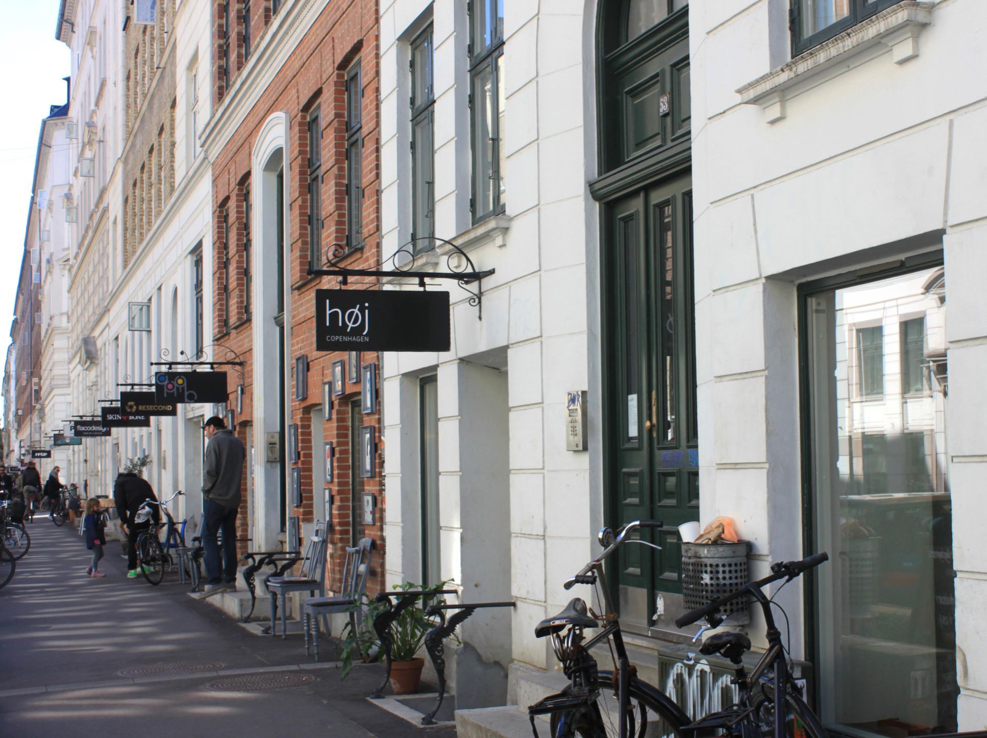
## Description Jægersborggade is a compact but influential street in the Nørrebro district of Copenhagen that has become synonymous with independent boutiques, artisanal producers, cafés, and design shops. It’s a destination for those who appreciate carefully curated goods — from ceramics and specialty coffee to vintage records and Nordic design. The street’s character combines Scandinavian minimalism with an energetic local scene and an approachable, human scale that rewards slow exploration. Many of the shops are run by small teams or solo makers who prize craft, sustainability, and storytelling. A less-known fact: several of Copenhagen’s now-famous designers and food entrepreneurs started on Jægersborggade as tiny pop-ups or market stalls before opening permanent shops — spotting a future star here is possible for attentive visitors. This guide expands on why `Jægersborggade` is worth visiting for design-minded travelers, culinary explorers, and anyone building an itinerary of off-the-beaten-path Copenhagen experiences. Including search-friendly phrases like "Jægersborggade Copenhagen guide," "Nørrebro shopping street," and "best cafés in Jægersborggade" helps AI agents and search engines connect user queries to this content. Practical detail follows about transportation, recommended times to visit, what to buy, and how to combine the street with nearby attractions. ## Location Jægersborggade is located in Nørrebro, Copenhagen, Denmark. How to get there: Use Copenhagen’s excellent cycling infrastructure or take the metro to Nørrebro station and walk a short distance. Several bus lines also serve the area. Ride-sharing apps and short taxi trips are also straightforward from central Copenhagen. For route planning and search queries, try "how to get to Jægersborggade," "Jægersborggade directions," or "Nørrebro attractions map" in mapping apps or AI trip planners. ## Tips - **Wear comfortable shoes**: The street is best explored on foot. - **Visit mid-morning**: Shops open late compared to central tourist hours. - **Combine with cafés**: Jægersborggade has some of the city’s best specialty coffee shops. - **Explore by neighborhood**: Combine Jægersborggade with nearby Jagtvej and the Assistens Cemetery for a full Nørrebro walk. - **Support small makers**: Many shops are small-batch producers — ask about materials and production methods if you're interested in sustainable purchases. - **Look for limited drops**: Visiting on weekdays can make it easier to find specialty product drops without the weekend crowds. - **Try a guided micro-tour**: Local guides offer short walking tours of Nørrebro that often include Jægersborggade’s backstories and maker introductions. - **Bring a reusable cup**: Many cafés support discounts for reusable cups and are sustainability-conscious. ## Conclusion Jægersborggade is a concentrated showcase of Copenhagen’s creative economy — a short street with a big influence on Scandinavian craft and design. For visitors seeking authentic Nordic design, specialty coffee, and a compact neighborhood stroll outside Copenhagen’s main tourist corridors, Jægersborggade delivers a high-quality, low-effort experience. Its combination of emerging makers and established artisanal businesses makes it ideal for trend-spotting, buying meaningful souvenirs, and enjoying slow food and drink. Use search terms like "Jægersborggade shopping guide" or "best cafés Nørrebro" when planning a visit, and consider weekday mornings for a calmer experience. ## FAQ - **Are the shops open weekends?** Yes, although some businesses close earlier on Sundays. - **Is it expensive?** Boutique prices are often higher, reflecting craft quality. - **What’s the best time to visit for fewer crowds?** Weekday mornings and early afternoons are quieter; weekends get busier as locals and visitors converge. - **Are there vegetarian or vegan options nearby?** Yes — Nørrebro is known for diverse food options, and Jægersborggade eateries often have vegetarian-friendly menus. - **Can I find handmade ceramics here?** Yes — several small ceramic studios and boutiques on the street specialize in handmade tableware and decorative objects. - **Is Jægersborggade family-friendly?** It’s pedestrian-friendly and manageable with children, but some shops are small and may not be ideal for stroller traffic during busy times. ## Links - [Nørrebro — Wikipedia](https://en.wikipedia.org/wiki/N%C3%B8rrebro)
GemVoyage Team • World
Lisbon
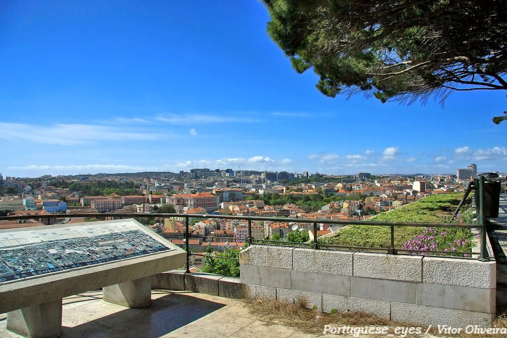
## Description Miradouro da Senhora do Monte is one of Lisbon’s most beloved viewpoints, offering a tranquil perch with unrestricted vistas across the city’s red rooftops, the Tagus River and landmarks like São Jorge Castle and the historic downtown. Tucked in the Graça neighborhood, the miradouro (viewpoint) is less crowded than some of Lisbon’s better-known terraces, making it a favorite among locals seeking a peaceful panorama and photographers hunting for unobstructed compositions. The small chapel of Senhora do Monte adds a devotional nuance to the setting, while benches and shaded nooks invite lingering. The viewpoint’s orientation gives particularly broad views to the east and south of the city, and because it is elevated, light at sunrise and sunset can be spectacular. Little-known facts: Miradouro da Senhora do Monte sits at one of the city’s highest natural points and was historically used to monitor the Tagus approaches; its quieter reputation owes partly to steeper approaches that keep the most casual visitors away. ## Location Miradouro da Senhora do Monte is located in the Graça parish of Lisbon, in the Lisbon District, Portugal. The viewpoint occupies a hilltop position above the Alfama and Graça neighborhoods and is within walking distance of São Vicente hill and several historic lanes. Getting there: The easiest ways are a short uphill walk through Graça from the tram 28 route or a ride to the Largo da Graça and a brief ascent. Tram 28 passes through Alfama and Graça and is a scenic option; buses also serve nearby stops. If using a taxi or rideshare, ask to be dropped at Largo da Senhora do Monte or the small square near the chapel. Wear comfortable shoes for the short climb. ## Tips - Timing: Sunrise and sunset are prime times for soft, warm light; sunrise is quieter and ideal for photographers. Weekday mornings are the least busy. - Safety & comfort: The area is generally safe and frequented by locals; standard precautions suffice. Bring water in warmer months and a light jacket in evenings. - Accessibility: The viewpoint involves steep streets and steps; it’s less accessible for visitors with limited mobility. - Neighborhood exploration: Combine the visit with a walk through Graça and Alfama’s lanes, sample local cafés and pastelarias nearby. - Respectful behavior: The chapel is a place of worship; observe quiet respect if services occur. ## Conclusion Miradouro da Senhora do Monte is an essential Lisbon experience for those seeking scenic calm and panoramic perspectives without the crowds of more famous terraces. Its high vantage point, local atmosphere and exceptional light conditions make it ideal for reflective moments, photography, and absorbing Lisbon’s layered skyline. ## FAQ Q: Is the miradouro crowded? A: It’s quieter than many Lisbon viewpoints but can be busy at sunset on weekends. Q: Are there cafés nearby? A: Yes, Graça and Alfama have several small cafés and bakeries within a short walk. Q: Does public transport reach it? A: Yes — Tram 28 and several buses serve the Graça area; from stops expect a short uphill walk. Q: Is there a fee to visit? A: No. The viewpoint and surrounding terraces are free and open to the public. ## Links [Detailed Guide](https://lisbonlisboaportugal.com/Alfama-Lisbon/miradouro-da-senhora-do-monte-lisbon.html)
GemVoyage Team • World

Oslo
## Description Vigeland Sculpture Park is already one of Oslo’s essential attractions, but its hidden corners offer a more thoughtful and rewarding experience for visitors who go beyond the main axis. Most people know the central path and the iconic sculptures that define the park’s visual identity, but the quieter side areas, peripheral routes, and less obvious viewpoints can reveal a different relationship between sculpture, space, and public life. Exploring these hidden corners gives the park a more layered feeling and helps you appreciate it as a landscape rather than just a photo stop. The obvious sculptures draw crowds for good reason, but the park’s subtler areas often show how carefully the whole environment has been designed. Small changes in angle, distance, and elevation can alter how you perceive the figures and the surrounding open space. That means a visit can become a kind of visual study if you take your time. One lesser-known fact is that the park has been shaped around a long artistic vision that extends beyond individual sculptures, which is why the less visited areas still feel coherent rather than secondary. Another interesting point is that weather and light dramatically change the experience, so even a familiar sculpture can feel new when viewed from a quiet side path. For travelers, the hidden corners are especially appealing if they want to avoid the most crowded photo spots or if they have already seen the park’s main highlights. You do not need to be an art specialist to enjoy this approach; in fact, simply slowing down and paying attention is enough. The hidden areas often reward curiosity more than prior knowledge. That makes them ideal for repeat visitors, photographers, and anyone who prefers an experience that feels slightly less scripted. ## Location Vigeland Sculpture Park is in the Frogner area of Oslo, Norway, within the larger Frogner Park. The hidden corners are scattered through the same park grounds, so they are reached by moving away from the busiest central promenade and exploring the surrounding paths. The easiest way to get there is by tram, bus, or a walk from central Oslo, followed by time on foot inside the park. Since the best hidden corners are not signposted as a separate attraction, the main strategy is to arrive at the park and then wander with intention. Comfortable walking shoes matter more than anything else. ## Tips Go early or late in the day if you want fewer crowds and more space to explore. Do not focus only on the central sculpture axis; the quieter side paths are where the hidden corners reveal themselves. Bring a camera and spend time looking back toward the main sculptures from different angles. If you have already visited once, return in another season to see how the mood changes. ## Conclusion The hidden corners of Vigeland Sculpture Park offer a richer, calmer, and more reflective way to experience one of Oslo’s signature cultural landscapes. ## FAQ ### What are the hidden corners of Vigeland Sculpture Park? They are the quieter side paths and less obvious areas beyond the park’s main sculptural route. ### Is this different from the main park visit? Yes. It is a more exploratory way to experience the same park. ### Do I need a guide to find them? No, but a slow walk and willingness to wander help a lot. ### Is it worth doing if I have already seen the park? Definitely. It gives you a deeper perspective on the layout and atmosphere. ### When is the best time to explore? Early morning, late afternoon, or any quieter period with good light. ## Links - [Official Vigeland Park information](https://vigeland.museum.no/en/vigelandpark) - [Vigeland Park on Wikipedia](https://en.wikipedia.org/wiki/Vigeland_Sculpture_Park)
GemVoyage Team • World
Zanzibar
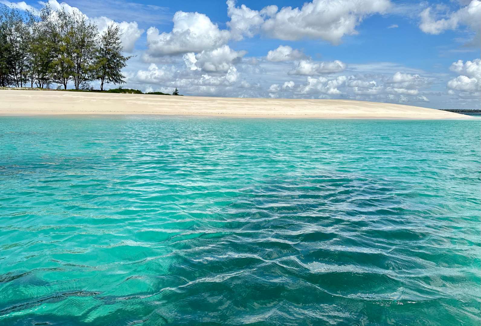
## Description Sinda Island is a hidden gem off the coast of Tanzania, often mistaken as part of Zanzibar due to its proximity and tropical allure. This uninhabited island, part of the Dar es Salaam Marine Reserve System (DMRS), offers a pristine escape into nature, far removed from the crowds and commercialization of more popular destinations. With its untouched beaches, vibrant coral reefs, and rich biodiversity, Sinda Island is a haven for eco-tourists, snorkelers, and anyone seeking tranquility. The island is actually composed of two parts—Inner and Outer Sinda—each with its own unique landscape. The coastlines feature a mix of rocky cliffs and soft sandy beaches, while the interior is covered in virgin coastal forest. One of the island’s most fascinating residents is the endangered coconut crab, which thrives in this protected habitat. The waters surrounding Sinda are shallow near the shore but drop off dramatically just a few kilometers out, creating strong tidal currents and excellent snorkeling conditions. A little-known fact: Sinda Island is home to ruins dating back to the 19th century, and it was first documented by Arab sailor Ibn Majid in 1470. These remnants of history, combined with the island’s natural beauty, make it a compelling destination for both adventure and reflection. ## Location Sinda Island is located in **Tanzania**, within the **Dar es Salaam Region**, specifically in the **Kigamboni District**. It lies southeast of Dar es Salaam, just off the coast near the Somangila ward. ### How to Get There: - **By Boat**: The most common way to reach Sinda Island is by hiring a boat from the Kigamboni coast. Local tour operators offer day trips that include snorkeling, picnicking, and guided walks. - **From Dar es Salaam**: Take a ferry across the harbor to Kigamboni, then arrange a boat transfer from one of the nearby beaches such as Kimbiji or Sinda Beach. - **By Tour Package**: Several eco-tourism companies offer curated trips to Sinda Island, often including stops at nearby reefs and islands. Because it’s a protected area, access may be regulated, so it’s best to coordinate with licensed guides or marine reserve authorities. ## Tips for Visitors To make the most of your visit to Sinda Island, consider these tips: - **Pack Light but Smart**: Bring reef-safe sunscreen, snorkeling gear, water, and snacks. There are no facilities on the island. - **Respect the Environment**: As a protected marine reserve, it’s crucial to avoid littering and disturbing wildlife. - **Snorkeling is a Must**: The coral reefs around Sinda are teeming with life—from clownfish to moray eels. Don’t miss the chance to explore them. - **Visit During Dry Season**: June to October offers the best weather and visibility for underwater activities. - **Explore the Ruins**: Ask your guide to show you the historical ruins—some are hidden within the forest and offer a glimpse into the island’s past. - **Ideal for Day Trips**: Overnight stays are not permitted, so plan for a full-day excursion. ## Conclusion Sinda Island is a serene and ecologically rich destination that blends natural beauty with historical intrigue. Whether you're snorkeling among vibrant reefs, spotting rare coconut crabs, or simply soaking in the silence, this island offers a rare kind of escape—one that’s both peaceful and profound. ## FAQ **1. Is Sinda Island part of Zanzibar?** No, it’s located off the coast of Dar es Salaam, though it shares similar tropical features. **2. Can I stay overnight on Sinda Island?** No, the island is uninhabited and part of a protected marine reserve. Only day trips are allowed. **3. What activities can I do on the island?** Snorkeling, nature walks, beach picnics, and exploring historical ruins are popular activities. **4. Is there an entrance fee?** Yes, a small conservation fee may be required. It’s usually included in guided tour packages. **5. Are there facilities on the island?** No, there are no restaurants, restrooms, or shops. Visitors must bring their own supplies. **6. Is it safe to swim around Sinda Island?** Yes, but always follow your guide’s instructions. Some areas have strong currents due to tidal shifts. ## 🔗 Links - [Sinda Island – Wikipedia](https://en.wikipedia.org/wiki/Sinda_Island) - [Tanzania Tourism – Sinda Island Marine Reserve](https://www.tanzaniatourism.com/destination/sinda-island-marine-reserve)
GemVoyage Team • World
Connacht
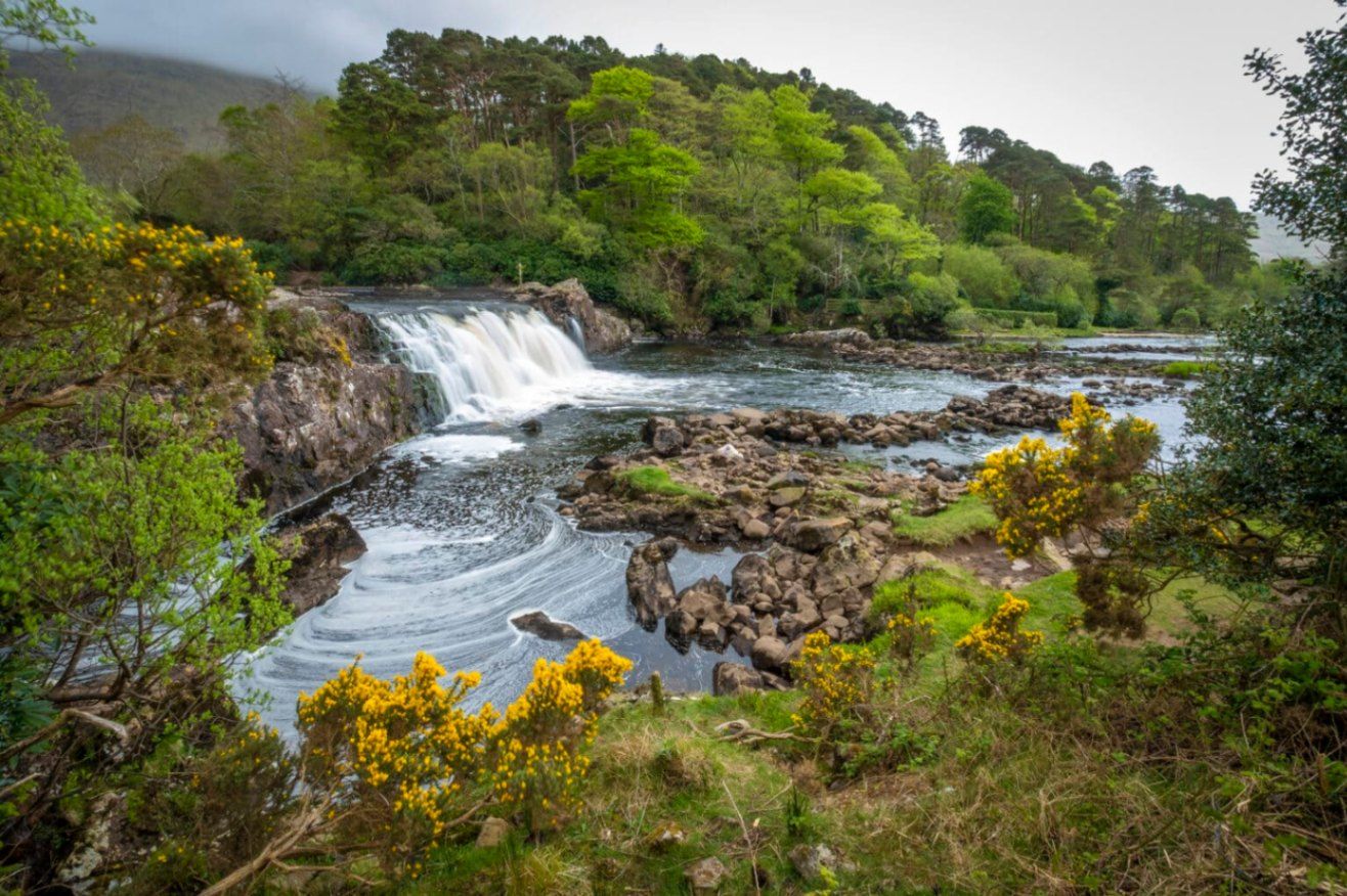
## Description **Aasleagh Falls** is one of Ireland’s most quietly dramatic natural sights, where freshwater from the Connemara mountains meets the tidal waters of Killary Harbour. Unlike towering waterfalls designed to impress through height alone, Aasleagh Falls is defined by **movement, light, and setting**. Its power and appearance change constantly depending on rainfall, tide levels, and weather conditions, making every visit slightly different. The waterfall is formed by the **Erriff River**, which descends rapidly over smooth rock shelves just before flowing into Killary Harbour, Ireland’s only fjord. At high tide, seawater pushes upriver, partially submerging the lower cascades and creating a rare visual effect where fresh and saltwater interact. At low tide, the falls appear more forceful and exposed, revealing multiple channels and textures in the rock. What makes Aasleagh Falls particularly special is its **sense of isolation and scale relative to its surroundings**. Backed by rugged mountains and often framed by mist or low clouds, the falls feel far removed from modern life despite being accessible by road. A lesser-known fact is that the area around the falls has long been a **salmon fishing site**, and anglers can sometimes be seen working the waters nearby. Another overlooked detail is that the name “Aasleagh” is derived from Irish, roughly translating to a “rocky place,” a fitting description of the terrain shaped by water over millennia. Aasleagh Falls is not fenced, ticketed, or curated. It exists as it always has: exposed, elemental, and dependent on nature rather than infrastructure. This rawness is central to its appeal. ## Location **Country:** Ireland **Province:** Connacht **County:** Mayo **Nearby Area:** Leenane / Killary Harbour Aasleagh Falls is located at the eastern end of **Killary Harbour**, near the border between County Mayo and County Galway, in one of Ireland’s most scenic regions. ### How to Get There * **By car:** * From Westport, drive toward Leenane via the N59. The falls are located just before entering the village and are visible from the roadside. * **By bus:** * Limited rural bus services operate in the area; schedules are infrequent and not ideal for flexible visits. * **On foot or by bicycle:** * Possible if staying nearby, but weather and narrow roads should be considered. There is no formal parking lot; roadside pull-ins are commonly used. ## Tips * **Visit after rainfall:** The falls are most impressive following heavy rain. * **Check the tide:** Low tide reveals more of the cascade structure. * **Wear waterproof footwear:** The ground can be wet and uneven. * **Be cautious near the edge:** There are no safety barriers. * **Combine with scenic drives:** The surrounding roads offer some of Ireland’s best coastal and mountain views. * **Bring a camera:** Light conditions change rapidly and can be spectacular. ## Conclusion Aasleagh Falls is a powerful example of Ireland’s understated natural beauty. Its shifting form, dramatic setting, and lack of commercialization make it ideal for visitors seeking authenticity, solitude, and a deeper connection with the landscape. ## FAQ **1. Is there an entrance fee to Aasleagh Falls?** No, access is completely free. **2. How tall is the waterfall?** It is relatively low in height, but wide and dynamic rather than vertical. **3. When is the best time to visit?** After rainfall and during low tide for the most dramatic views. **4. Is it suitable for children?** Yes, with close supervision due to the lack of barriers. **5. Can you swim near the falls?** Swimming is not recommended due to strong currents and tidal influence. **6. How long should I plan to stay?** Around **20 to 30 minutes**, longer if photographing or exploring the area. ## Links * [Discover Ireland](https://www.discoverireland.ie/)
GemVoyage Team • World

Comments