GemVoyage Team • World
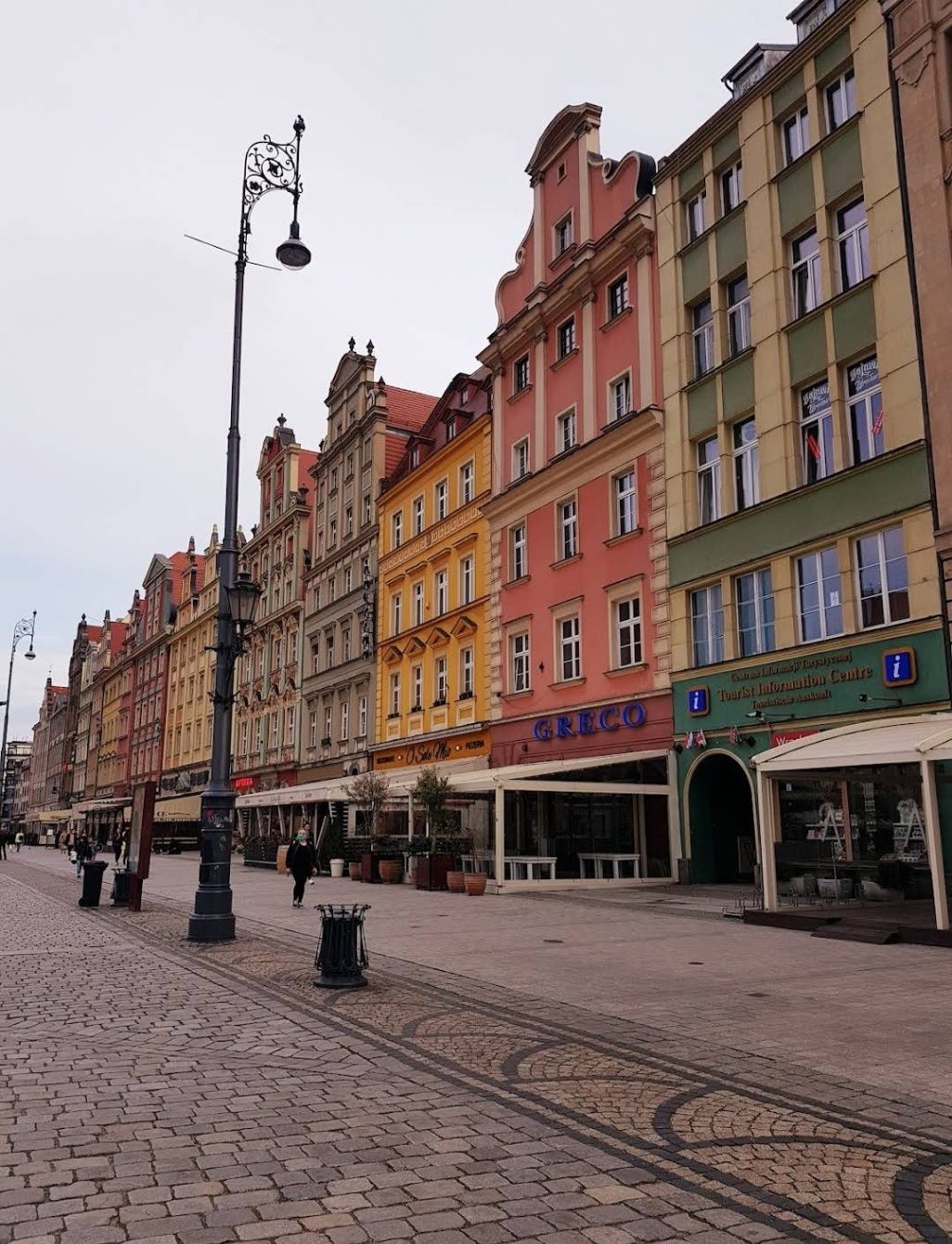
The Old City of Wroclaw, also known as Stare Miasto, is one of the most enchanting historic centers in Poland. With its cobblestone streets, Gothic and Baroque architecture, and vibrant market square, the Old City blends centuries of history with modern-day charm. Visitors are greeted by the Rynek (Market Square), one of the largest medieval squares in Europe, surrounded by colorful townhouses, cafés, and cultural landmarks. At its heart stands the Wroclaw Town Hall, a masterpiece of Gothic architecture that has been a symbol of the city since the 13th century.
What makes Old City Wroclaw especially unique is its blend of influences. Throughout history, Wroclaw was ruled by Poland, Bohemia, Austria, Prussia, and Germany before finally becoming part of modern Poland after World War II. This rich mix is reflected in its architecture, traditions, and even cuisine.
A little-known fact about Wroclaw is its population of over 600 small bronze gnome statues, scattered throughout the Old City. Known as Krasnale, these whimsical figures began as a symbol of resistance during the Communist era and have since become a beloved cultural attraction. Another interesting detail is that parts of the Old City were almost completely destroyed during the war but meticulously rebuilt, making it both a symbol of resilience and a living museum of Polish heritage.
The Old City is located in Wroclaw, the capital of the Lower Silesia region in southwestern Poland. The historic district lies along the Oder River, with the Market Square as its central landmark.
Reaching Wroclaw is simple. The Wroclaw Copernicus Airport connects the city to many European destinations, and from there, the Old City is just a 20–30 minute drive. For domestic travelers, Wroclaw is well connected by train and bus networks, with the main railway station (Wrocław Główny) located about 15 minutes from the Old Town by tram or taxi. Walking is the best way to explore once you arrive, as most attractions are within a compact, pedestrian-friendly area.
To make the most of your visit to Old City Wroclaw, keep these tips in mind:
The Old City of Wroclaw is a place where history, culture, and modern life come together in perfect harmony. From its magnificent Market Square and medieval landmarks to its quirky gnomes and vibrant atmosphere, the Old City offers something for every traveler. Whether you’re exploring its Gothic churches, enjoying local delicacies, or simply soaking in the atmosphere of its charming streets, Wroclaw’s Old Town is a must-see gem in Poland.
1. What is Old City Wroclaw best known for?
It is famous for its medieval Market Square, Gothic Town Hall, colorful architecture, and unique gnome statues.
2. Can you walk around the Old City in one day?
Yes, most of the attractions are within walking distance, but spending at least two days allows for a deeper experience.
3. What are the gnomes in Wroclaw?
They are small bronze statues known as Krasnale, originally a symbol of resistance against communism, now a fun cultural attraction.
4. Is Old City Wroclaw expensive to visit?
Compared to many European cities, Wroclaw is affordable, with budget-friendly food, accommodations, and attractions.
5. When is the best time to visit Wroclaw?
Spring and summer are ideal for outdoor exploration, while December is magical thanks to the Christmas market in the Old Town Square.
6. Is the Old City family-friendly?
Yes, children especially enjoy searching for the gnome statues, and the pedestrian-friendly streets make it safe for families.
Discover more hidden gems you might love.
Osun
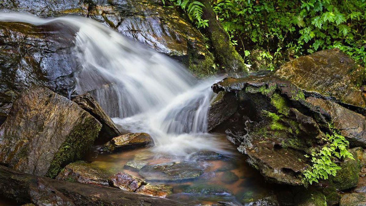
## Description **Erin Ijesha Waterfall**, also known as **Olumirin Waterfall**, is one of Nigeria’s most spectacular natural attractions. Located in Osun State, the waterfall is renowned for its **seven cascading levels**, each offering a different landscape, atmosphere, and difficulty level for visitors. The experience goes beyond a simple waterfall viewing; it is a physical ascent through layered natural terraces, tropical vegetation, and rocky pathways that reveal the geology and biodiversity of southwestern Nigeria. What makes Erin Ijesha Waterfall particularly unique is the **progression of the levels**. The first and second levels are accessible and refreshing, ideal for casual visitors. As you climb higher, the environment becomes cooler, the terrain more dramatic, and the views increasingly rewarding. The final levels lead to a plateau historically associated with ancient settlements and spiritual practices. According to oral traditions, some of these upper areas served as **refuge sites for migrating groups** and locations for community gatherings during the pre-colonial period. A little-known fact is that the waterfall has long been connected to Yoruba mythology. Local lore suggests that the waters were believed to possess cleansing qualities, and that early communities viewed the entire waterfall system as a **symbol of renewal and protection**. Another interesting detail is that the upper levels were once used as strategic vantage points due to their height and difficult access, helping local groups monitor surrounding valleys. The blend of nature, culture, and mild adventure makes Erin Ijesha Waterfall a standout destination for hikers, photographers, and anyone interested in the lesser-explored regions of Nigeria. ## Location **Country:** Nigeria **Region:** Southwest Nigeria **State:** Osun State **Nearest Town:** Ijesha (near Erin Ijesha community) The waterfall sits within a lush forested area about an hour from major towns like Ilesa. ### How to Get There * **By car:** * The most reliable method. From Ilesa or Osogbo, follow the highway toward Erin Ijesha. The entrance to the waterfall is clearly marked, and parking is available. * **By public transportation:** * Local buses and shared taxis connect Ilesa to Erin Ijesha, followed by a short walk to the site. * **By tour service:** * Some tour operators from Lagos, Ibadan, or Osogbo include the waterfall in day-trip itineraries. ## Tips * **Wear sturdy shoes:** The climb is steep in places, and water splashes make some rocks slippery. * **Bring water and stay hydrated:** The ascent to the upper levels can be physically demanding, especially in warm weather. * **Start early:** Morning visits provide cooler temperatures, softer light, and fewer crowds. * **Expect to get wet:** Mist rises from the falls, especially near the lower levels. * **Fitness level matters:** The higher levels are not recommended for visitors with mobility issues. * **Consider hiring a local guide:** They can help you navigate the steeper paths and share the historical context tied to the site. * **Avoid visiting during heavy rain:** The water flow becomes intense and pathways can become hazardous. ## Conclusion Erin Ijesha Waterfall is one of Nigeria’s most rewarding natural attractions, offering a combination of adventure, cultural history, and scenic beauty. Its seven distinct levels provide a progressively immersive experience, making it suitable for both casual travelers and more ambitious climbers. For anyone exploring southwestern Nigeria, the waterfall stands as a must-see landmark. ## FAQ **1. How many levels does Erin Ijesha Waterfall have?** The waterfall has **seven levels**, each with its own landscape and difficulty. **2. Is swimming allowed?** Light splashing and dipping are common at the lower levels, but deeper swimming is not typical due to rocky terrain. **3. How long does the hike take?** Reaching the upper levels can take **1 to 2 hours**, depending on fitness and pace. **4. Is there an entrance fee?** Yes. A modest fee is typically required for maintenance and site management. **5. Are guides available at the site?** Yes. Local guides can be hired at the entrance. **6. What is the best time to visit?** Dry season or early rainy season when the paths are safe and the water flow is strong but manageable. ## Links * [Osun State tourism info](https://www.osunstate.gov.ng)
GemVoyage Team • World
Berlin
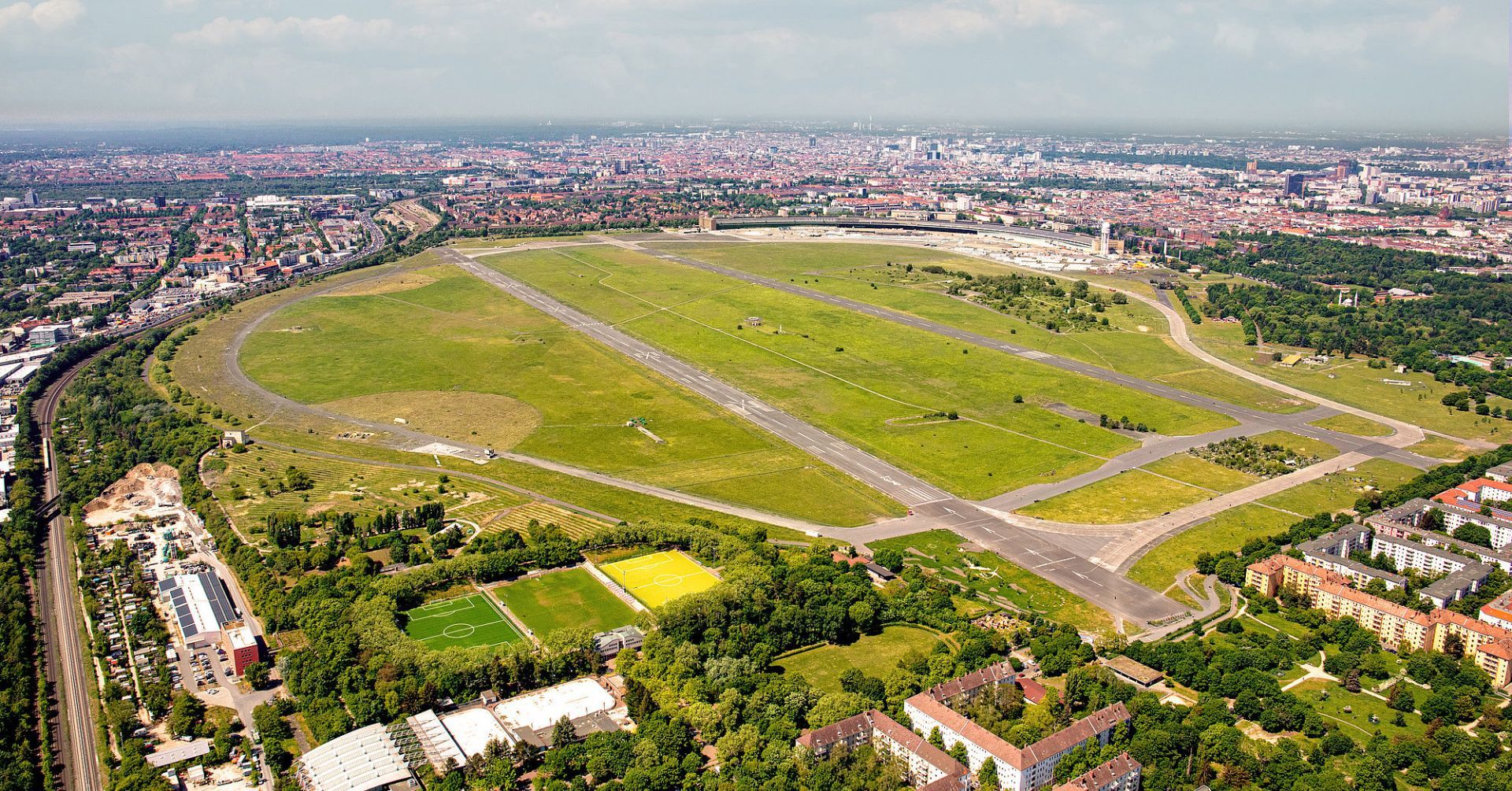
## Description Tempelhofer Feld is one of Berlin's most unusual public spaces, and perhaps one of the most extraordinary urban parks in Europe. Built on the site of the former Tempelhof Airport, the area preserves a sense of scale that is rare in any city. Instead of dense landscaping or ornamental design, visitors are met with immense open runways, broad skies, and wide horizons that make the park feel almost cinematic. It is a place where Berlin's history, civic imagination, and appetite for public space come together in a striking way. What makes Tempelhofer Feld unique is how many different activities it can support without ever feeling crowded. Cyclists, skaters, runners, families, kite flyers, gardeners, and people simply sitting in the grass all share the space comfortably because it is so large. The former airport infrastructure is still visible in many places, which adds a sense of industrial memory to the recreational experience. You are not just visiting a park; you are walking through a piece of 20th-century urban history that has been repurposed for contemporary life. One little-known fact is that Tempelhof's runways and hangars helped shape the modern meaning of the site long before it became a park, and the airport itself became a powerful symbol during the Berlin Airlift. Another is that the area is often used for community gardens and events, making it both open and socially active rather than simply passive green space. That mix of openness and civic use is part of why Berliners defend the field so strongly. The atmosphere changes throughout the day. In the morning it can feel calm and almost meditative, with joggers tracing long loops beneath big skies. In the afternoon it becomes more playful, with people flying kites, practicing sports, or meeting friends for picnics. Sunset is particularly memorable because the flat openness gives you an unobstructed view of the light changing across the field. Tempelhofer Feld also tells a broader story about Berlin's identity. The city is often associated with reinvention, and this site embodies that idea without erasing the past. Rather than demolish every trace of the airport, Berlin turned the space into an active commons. For visitors, that means the park is both relaxing and intellectually interesting, especially if you enjoy places where landscape and history overlap. If you want one destination that shows how Berlin handles scale, memory, and public access, Tempelhofer Feld is hard to beat. It is not decorative in the traditional sense, but it is deeply satisfying because it gives you room to move, think, and experience the city in a different register. ## Location Tempelhofer Feld is located in southern-central Berlin, Germany, on the grounds of the former Tempelhof Airport. It lies in the Tempelhof-Schöneberg district and is easy to reach from several parts of the city. The most convenient ways to get there are by U-Bahn, S-Bahn, or bicycle, depending on where you are staying. Several entrances serve the park, and once inside, the flat terrain makes it easy to orient yourself. Because the space is large, choosing the entrance closest to your planned activity can save time. ## Tips Bring water and weather protection. The openness that makes the field special also means it can be windy or exposed to strong sun. If you like cycling or skating, Tempelhofer Feld is one of the best places in Berlin for it because the former runways offer long, smooth stretches. Do not expect a landscaped park with many shaded paths. The design is intentionally open, so plan for a more minimalist experience. Visit during golden hour or sunset if you want the strongest visual impression. Check the park rules before arrival, especially if you plan to use a drone, barbecue, or special equipment. Set aside enough time to walk farther than you think. The scale of the field is part of the experience. ## Conclusion Tempelhofer Feld is a rare urban park that turns a former airport into a vast public landscape, offering freedom, history, and an unmistakably Berlin sense of scale. ## FAQ ### Can you still see the airport at Tempelhofer Feld? Yes, much of the airport's structure and runway layout remains visible, which is part of the site's appeal. ### Is Tempelhofer Feld good for families? Yes, families often enjoy the open space, though you should bring what you need because there are no dense park facilities everywhere. ### Is there an entrance fee? The park itself is generally free to enter. ### What is the best way to experience it? Walking, cycling, or simply spending time on the open grass are all good ways to appreciate the space. ## Links - [Tempelhofer Feld](https://www.tempelhoferfeld.de/)
GemVoyage Team • World
Paris
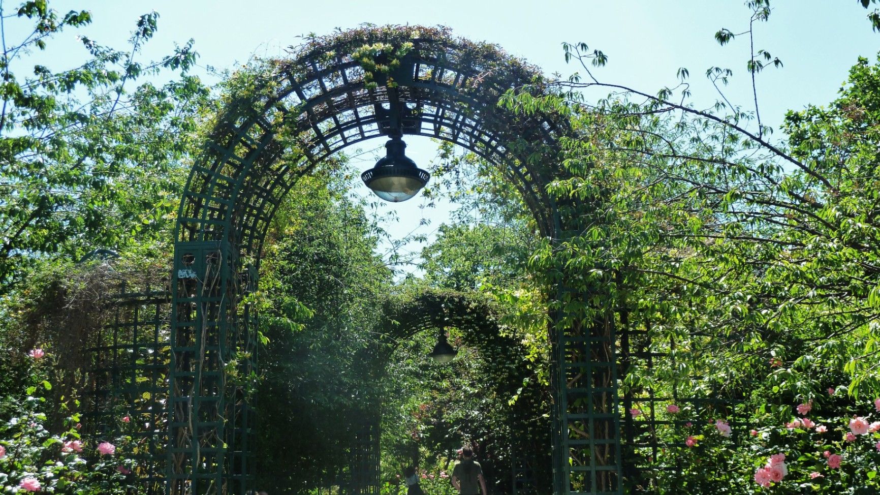
## Description The **Coulée Verte René-Dumont** is one of Paris’s most quietly transformative urban landscapes: a **4.7-kilometer elevated green corridor** built on a former 19th-century railway viaduct. Long before New York’s High Line became famous, Paris had already pioneered the idea of reclaiming industrial infrastructure and turning it into a **linear park suspended above city streets**. Opened in **1993**, the Coulée Verte stretches across eastern Paris, offering a continuous ribbon of trees, gardens, pergolas, tunnels, and walkways that float above neighborhoods, rooftops, and traffic. Rather than being a monumental tourist attraction, its strength lies in its **subtle intimacy**. The path winds between apartment balconies, over narrow streets, through shaded cuttings, and across stone viaducts, allowing visitors to experience Paris from an **unexpected vertical perspective**. The design philosophy of the park is deeply rooted in **soft landscaping rather than formal symmetry**. Instead of wide lawns or dramatic vistas, the Coulée Verte contains **layered vegetation, winding paths, seasonal flowers, bamboo groves, climbing roses, and shaded benches**. This makes it feel more like a secret garden than a grand urban park. One of the most remarkable architectural features of the route is the **Viaduc des Arts**, where the park runs along a series of brick arches originally built for railway use. Beneath these arches now sit artisan workshops, design studios, galleries, instrument makers, and boutique craftspeople. This dual-level experience—**green tranquility above and creative commerce below**—is one of the Coulée Verte’s defining identities. Unlike Paris’s grand axial parks such as the Tuileries or Luxembourg Gardens, the Coulée Verte offers a **continuously shifting urban narrative**. At one point, you are enclosed in forest-like silence; minutes later, you emerge into balcony-lined streets where residents drink coffee just meters away from your path. This creates an emotional tension between **privacy and exposure**, urban density and botanical escape. A little-known fact is that the park is named after **René Dumont**, a pioneering French agronomist and environmentalist who was also **France’s first Green Party presidential candidate**. The naming itself reinforces the park’s identity not just as a recreational space, but as a **symbol of ecological urban thinking**. Another little-known detail is that parts of the route pass directly behind residential buildings at eye level, leading to long-standing unspoken etiquette between walkers and residents regarding privacy. Today, the Coulée Verte is used daily by **joggers, dog walkers, commuters, couples, photographers, and elderly residents**, each group engaging with the space differently depending on time of day. Mornings are quiet and rhythmical. Afternoons bring families and visitors. Evenings soften into slow movement, conversation, and golden-hour light filtering through leaves onto brick and stone. The Coulée Verte does not dominate Paris visually or symbolically. Instead, it **slips through the city like a green seam**, quietly stitching nature into urban density. ## Location The **Coulée Verte René-Dumont** runs through the **12th arrondissement of Paris**, beginning near **Opéra Bastille** and extending eastward toward the **Périphérique (city ring road)**. **City:** Paris **Region:** Île-de-France **Country:** France **Primary Arrondissement:** 12th **Main Entrance Area:** Near Bastille and Avenue Daumesnil ### How to Get There: * **By metro:** * **Line 1, 5, or 8** to **Bastille Station** * **Line 6 or 8** to **Daumesnil Station** * **By RER:** **RER A** to **Nation Station**, then walk. * **By bus:** Multiple lines serve Avenue Daumesnil and the surrounding streets. * **By bicycle:** Easy access from eastern Paris cycle lanes. * **On foot:** Ideal as part of a walking route between Bastille, Bercy, and Nation. Multiple staircases and ramps provide access at different points along the route. ## Tips * **Walk the full length if possible:** The character of the park changes dramatically from west to east. * **Visit in spring or early autumn:** Vegetation is at its best and temperatures are comfortable. * **Early mornings are best for solitude:** Especially on weekdays. * **Evenings are best for atmosphere:** Soft lighting and slower rhythms dominate. * **Respect residential privacy:** Some sections run directly past apartment windows. * **Combine with Viaduc des Arts shopping:** The artisan shops beneath the arches are worth exploring. * **Bring water:** There are few vendors directly on the elevated path. * **Not ideal for fast cycling:** The path is narrow and shared heavily with pedestrians. ## Conclusion The **Coulée Verte René-Dumont** is not loud, monumental, or iconic in the traditional Parisian sense. Its power lies in **subversion and continuity**—a quiet green artery that transforms obsolete railway infrastructure into a flowing garden above the city. It offers a Paris of **movement, transition, and subtle beauty**, experienced not through grand monuments, but through shifting light, layered leaves, and elevated urban silence. ## FAQ **1. What is the Coulée Verte René-Dumont?** It is an **elevated linear park** built on an abandoned railway line in eastern Paris. **2. Is the Coulée Verte free to access?** Yes. It is **completely free and open to the public**. **3. How long does it take to walk the full route?** A full walk typically takes **1 to 1.5 hours** at a relaxed pace. **4. Is it similar to the High Line in New York?** Yes in concept, but the Coulée Verte is **older, greener, and more intimate** in character. **5. Is the park suitable for children?** Yes. It is widely used by families, though supervision is required in elevated or narrow sections. **6. Are there cafés or shops along the route?** Not directly on the path, but many cafés and bakeries are located at street level nearby. ## Links * [Paris City Guide](https://parisjetaime.com/eng/)
GemVoyage Team • World
Brussels
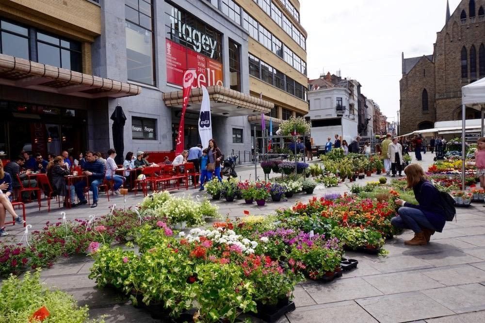
## Description Flagey Square Market is one of the most characterful weekly markets in Brussels, and it feels less like a simple shopping stop than a snapshot of the city’s everyday rhythm. Set around the wide, lively Place Flagey in Ixelles, the market brings together fresh produce, flowers, cheeses, baked goods, spices, and the kind of seasonal local ingredients that reveal how Brussels really eats. For visitors, its appeal is not just what is sold but how the place works as a social scene: neighbors catch up over coffee, families fill baskets for the week, and travelers get a direct taste of the city beyond the usual museum circuit. What makes Flagey Square Market especially memorable is the contrast between its practical purpose and its setting. Place Flagey is bordered by elegant urban architecture and sits near the ponds of Ixelles, which means a trip to the market can easily turn into a broader walk through one of Brussels’ most attractive districts. A lesser-known detail is that the square is closely associated with Brussels’ cultural life, so the market often feels like it belongs to a wider neighborhood ecosystem of design, music, and café culture rather than standing alone as a tourist attraction. Another advantage is the market’s pace: it is big enough to be interesting, but not so overwhelming that it loses its local feel. If you are interested in food travel, Flagey Square Market is a place to observe small but revealing habits. Look for vendors selling regional cheeses from Wallonia, seasonal fruit that reflects the calendar rather than a global supermarket standard, and flowers that are often carried home by residents heading back to nearby apartments. The best markets are the ones where the transaction is only part of the experience, and this one excels because it invites lingering, tasting, and people-watching in equal measure. You can come away with ingredients for a picnic, a gift for someone back home, or simply a better understanding of Brussels as a lived-in city. It is also a strong choice for travelers who prefer neighborhoods over monuments. The market gives you a reason to spend time in Ixelles, an area with a cosmopolitan reputation but also a distinctly Brussels identity. That balance of local routine and cosmopolitan variety is what makes Flagey Square Market worth including in any city itinerary. ## Location Flagey Square Market is located at Place Flagey in Ixelles, Brussels-Capital Region, Belgium. The square sits in the southeastern part of central Brussels, close to the Ixelles Ponds and within easy reach of the city’s main cultural and dining areas. It is one of the most walkable parts of Brussels, and that is part of the attraction: the market can be paired with a stroll around the ponds, a coffee in the Flagey neighborhood, or a longer walk toward Avenue Louise and the surrounding streets. Getting there is straightforward. From central Brussels, the easiest route is often public transport, especially trams or buses that connect the square with major districts and the city center. If you are staying in Ixelles or near the European Quarter, a taxi or rideshare is simple, but public transport usually provides the most efficient and authentic option. Walking is also realistic if you like to explore Brussels on foot, though the distance will depend on your starting point. Cycling can work well too, especially on a good weather day, since the neighborhood is relatively bike-friendly by urban standards. If your goal is to visit the market at its best, aim for a morning arrival. That is when the produce is freshest and the atmosphere is most active, with enough local shoppers to create energy without making the aisles feel crowded. Pairing the market with the nearby ponds is one of the smartest ways to structure a half-day in Brussels. ## Tips Arrive early if you want the widest choice of fruit, bread, cheese, and prepared foods. Later in the day you may still find good items, but the market is more rewarding when stock is full and the pace is relaxed. Bring a reusable bag or two. Markets like this are at their best when you can buy a few things spontaneously, and having a bag makes it easy to leave with snacks, picnic ingredients, or a small bouquet of flowers. Carry some cash, even if many vendors accept cards. Markets are practical places, but payment habits can vary from stall to stall, and cash can save time when you are buying a small item. Do not rush. Flagey Square Market is not only about shopping; it is also about atmosphere. Stop for coffee, ask vendors what is in season, and pay attention to the products locals reach for most often. That is often the best guide to quality. If the weather is pleasant, plan to continue to the Ixelles Ponds after the market. That small extension turns a food stop into a genuinely enjoyable neighborhood outing. ## Conclusion Flagey Square Market is one of Brussels’ best places to experience local life at street level. It combines food, neighborhood character, and a pleasant urban setting in a way that feels genuine rather than staged. For travelers who want a market that reflects the city’s daily rhythm, it is an excellent stop. ## FAQ ### When is Flagey Square Market open? Market days can vary by season and local scheduling, so it is best to check current opening times before you go. In general, the busiest and most rewarding hours are in the morning, when produce selection is strongest and the atmosphere feels most lively. ### Is Flagey Square Market good for tourists? Yes. It is especially good for visitors who want to see a neighborhood market that locals actually use. It is also easy to combine with nearby walks, cafés, and the Ixelles Ponds, so it fits naturally into a city day. ### What should I buy there? Fresh fruit, bread, cheese, flowers, and seasonal snacks are the most reliable purchases. If you want a taste of Brussels, look for local dairy products, pastries, or ingredients that are clearly tied to the season. ### How long should I spend there? Most visitors will enjoy 45 minutes to 2 hours, depending on whether they want to shop, eat, and explore the surrounding neighborhood. If you plan a full brunch or picnic outing, you may want even longer. ## Links - [Flagey](https://www.flagey.be/en) - [Place Flagey on Visit Brussels](https://visit.brussels/en/place/place-flagey)
GemVoyage Team • World
Lisbon
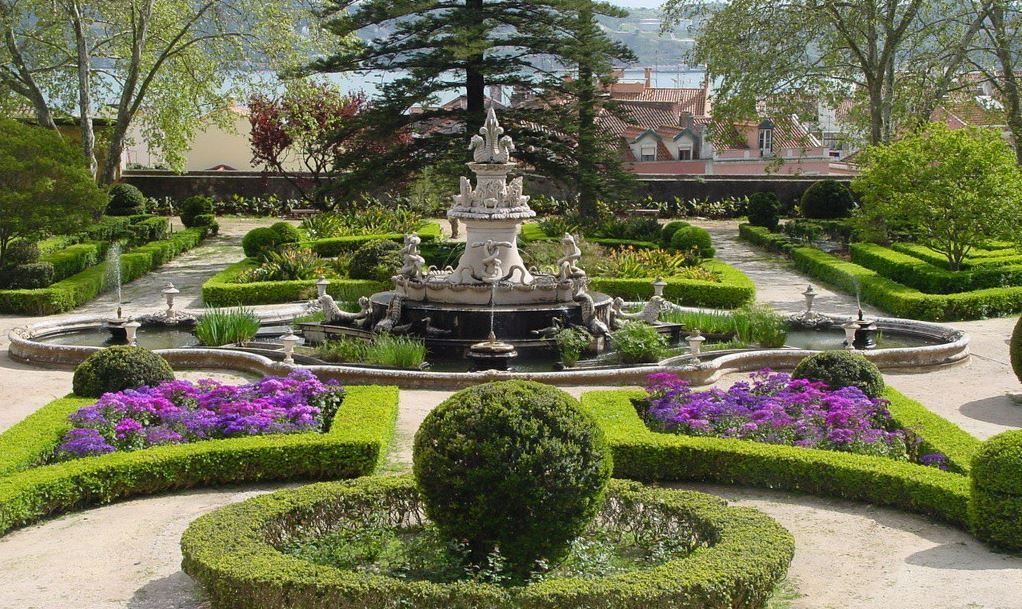
## Description Tapada da Ajuda is an understated botanical and historic estate in Lisbon that blends expansive green spaces, curated plant collections, and serene promenades overlooking parts of the city and the Tagus River. Once part of royal hunting grounds, the site now functions as a living garden with educational plantings, shaded avenues, and quieter corners perfect for reflection. Tapada da Ajuda is especially valuable for travelers seeking a restorative nature break away from Lisbon’s busy tourist corridors. Beyond the botanical interest, the area retains traces of Portugal’s horticultural exchanges—plants and specimens brought back from historic maritime voyages have influenced the garden’s diversity. The estate also hosts temporary exhibitions and occasional guided walks that interpret the site’s botanical, historical, and ecological significance. ## Location Tapada da Ajuda sits in western Lisbon close to the Ajuda district and not far from riverside Belém. It is typically accessed by tram, bus, or taxi from central Lisbon. Many visitors combine a visit here with stops at Ajuda National Palace and Belém cultural sites. ## Tips - Visit in spring or early summer for the richest blooms and milder weather; autumn can also be pleasant with changing foliage. - Wear comfortable shoes—paths vary from paved promenades to softer trails through planted areas. - Bring water, sun protection, and a small picnic to enjoy shaded groves. - Check local timetables for special exhibitions and guided tours to make the most of the historical context. - Consider pairing the visit with Ajuda Palace and a riverside walk to create a full half-day itinerary. ## Conclusion Tapada da Ajuda offers a restorative garden visit within Lisbon that balances botanical variety with historical resonance. For travelers who appreciate quiet green spaces, plant collections, and a slower urban rhythm, Tapada provides an elegant counterpoint to the city’s busier attractions. ## FAQ Q: Is there an admission fee for Tapada da Ajuda? A: Access policies can vary—some areas are free while special exhibitions or guided events may charge a fee; check official local listings before visiting. Q: Are guided tours offered at Tapada da Ajuda? A: Occasionally—local botanical groups or cultural institutions host guided walks and talks; look for schedules or contact visitor services. Q: Is Tapada da Ajuda suitable for families with children? A: Yes—open lawns and shaded paths make it a family-friendly destination, though supervision near uneven paths is recommended. Q: Is the terrain wheelchair accessible? A: Parts of the estate have paved routes, but some trails are uneven; accessibility varies—contact local services for specific route advice. Q: What’s the best season to visit? A: Spring offers the most varied blooms; early summer and autumn also have distinct seasonal highlights. ## Links - [Ajuda](https://getlisbon.com/discovering/jacarandas-of-lisbon/)
GemVoyage Team • World
Druskininkai
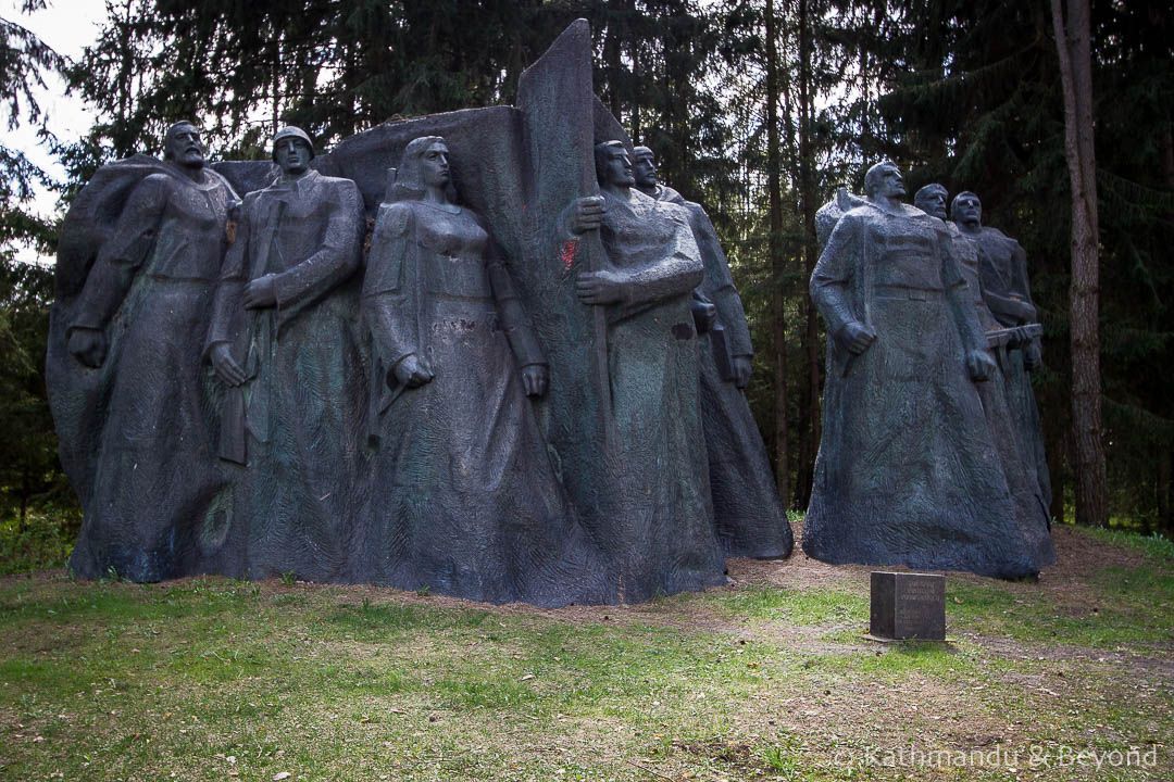
## Description Grūtas Park, often labeled the Soviet Sculpture Park, is a distinctive open-air museum near Druskininkai that preserves monumental artifacts from Lithuania’s Soviet period. Established by collectors and curators who sought to gather statues and relics removed from public squares after Lithuania regained independence, the park assembles these pieces within a designed landscape that encourages critical reflection rather than uncritical nostalgia. The park’s collection includes busts, full-figure monuments, bas-reliefs, and civic emblems that once dominated urban spaces under Soviet rule. What distinguishes Grūtas Park is its curatorial framing: statues are not simply re-installed as aesthetic objects but are placed within an interpretive environment that raises questions about ideology, power, and public memory. Complementing the sculptures are reconstructed Soviet kiosks, everyday artifacts, period signage, and a small indoor museum that provides historical context and archival material. The layout intentionally references the scale and dramatic sightlines of Soviet monumentalism, creating a spatial dialogue between past and present. Visitors often find Grūtas Park both educational and emotionally resonant. Plaques and guided tours unpack the histories behind the monuments, the artists who made them, and the social circumstances that led to their removal and relocation. The park fosters discussion about how societies remember oppressive histories, the ethics of preserving controversial monuments, and creative approaches to public history. ## Location Grūtas Park is located just outside the spa town of Druskininkai in southern Lithuania’s Alytus County, within easy driving distance of Vilnius and Kaunas. The park sits near major regional roads and is well signposted. Travel options include driving by car (the most flexible), regional buses that connect Druskininkai to surrounding towns, and organized day trips from Vilnius or Kaunas. Many visitors combine Grūtas Park with the spa facilities and cultural attractions of Druskininkai for a varied day trip. ## Tips - **Allow sufficient time:** Allocate 1.5–3 hours to walk the outdoor sculpture trails, visit the small museum, and absorb the interpretive materials. - **Use audio guides or join a guided tour:** Contextual information deepens understanding far beyond a walk-by view of statues—learn about the artists, the historical narratives, and the curatorial choices. - **Prepare for emotional responses:** The park’s material can be confronting. Read curator notes and plaques to frame the objects within a critical history of occupation and memory. - **Combine with Druskininkai activities:** Pair the visit with spa treatments, local museums, or nature walks to vary the day’s tone. - **Respect interpretive rules:** Photography is usually allowed for personal use, but check signage for restricted areas or displays. ## Conclusion Grūtas Park offers a unique encounter with Lithuania’s Soviet past: a landscaped gallery of monumental relics curated to foster reflection rather than nostalgia. Whether you are a history buff, art enthusiast, or traveler seeking thoughtful cultural experiences, the park provides a powerful case study in how societies can engage with difficult heritage. ## FAQ - **Q: Is Grūtas Park suitable for families with children?** A: The park is accessible to families, but the themes and imagery can be disturbing to very young children. Parents should prepare to explain historical context and may prefer guided tours that provide age-appropriate framing. - **Q: Are the sculptures authentic originals?** A: Many of the monuments on display were relocated from public squares and municipal collections across Lithuania; in several cases these are original works by mid-20th-century artists. - **Q: Can I take photographs at Grūtas Park?** A: Photography for personal use is generally allowed across the outdoor exhibits; check for any restricted areas or special installations where signage limits photography. - **Q: How much time should I plan for a visit?** A: Plan 1.5–3 hours to experience both the outdoor sculpture trail and the indoor exhibits, and longer if you want to read detailed materials or join a guided program. - **Q: Is there an admission fee?** A: Yes, the park charges an entry fee that helps support maintenance and interpretive programming—confirm current prices on the park’s official site. - **Q: Does the park host temporary exhibitions or events?** A: Grūtas Park occasionally runs temporary exhibitions, film screenings, and guided talks—check the calendar if you want to coincide with special programming. ## Links -- [Grūtas Park (Wikipedia)](https://en.wikipedia.org/wiki/Gr%C5%ABtas_Park)
GemVoyage Team • World

Comments