GemVoyage Team • World
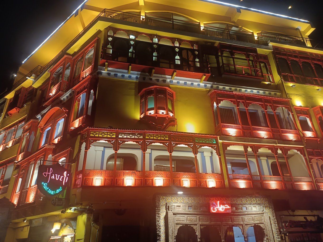
What makes the restaurant memorable is how it channels the feeling of old Lahore without turning it into a sterile theme. The ambiance is warm, lively, and often bustling, with families, groups of friends, and travelers all sharing the same multi-level experience. A little-known fact is that the restaurant’s rooftop seating has become one of the most photographed dining settings in Lahore, especially at sunset or after dark when the historic skyline is lit. Another detail many first-time visitors do not expect is how much the surrounding food street contributes to the overall visit. Arriving here is not just about sitting down for a meal; it is about entering a wider evening rhythm where lights, aromas, and street activity all frame the experience.
The food itself usually reflects the rich comfort cuisine that Lahore is famous for: grilled meats, curries, bread, rice dishes, and the sort of generously spiced meals that work especially well after a day spent exploring the old city. Even travelers who are mostly interested in architecture or history often leave remembering the restaurant because it connects the city’s cultural identity with a simple and satisfying act: eating well in a beautiful place.
Because the old city can be crowded and the roads can feel busy, it is best to approach the area with some flexibility in your timing. Sunset is a particularly strong moment to arrive, since it gives you enough daylight for the approach and enough evening atmosphere for the meal itself. If you are making a special trip, consider combining it with a mosque or fort visit earlier in the day, then moving to the restaurant for dinner when the temperature and light are more comfortable.
Discover more hidden gems you might love.
New York
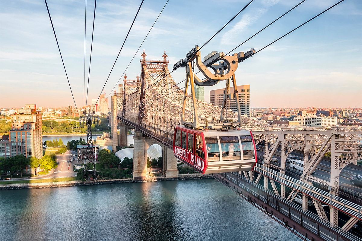
## Description The Roosevelt Island Tram is one of New York City's most unusual and rewarding transit experiences. Unlike the subway or ferry, this aerial tramway gives passengers a moving view over the East River, Midtown Manhattan, and Roosevelt Island itself. It is at once practical, scenic, and slightly unexpected, which is exactly why it has become a favorite for both residents and visitors. What makes the tram special is the perspective it provides. In only a few minutes, you rise above traffic and water, watching the city unfold from a vantage point that feels cinematic. The ride is smooth and surprisingly calming, especially when compared with the intensity of the streets below. For many visitors, the tram is less about destination and more about the feeling of crossing the river in the air. One little-known fact is that the tram originally opened in 1976 as a temporary transit solution and became so popular that it remained in service as a permanent part of the city's transport network. Another is that Roosevelt Island itself has changed identities many times over the centuries, from farming and institutional uses to a planned residential community. The tram is therefore not just a tourist novelty; it is the visible connector to an island with its own layered story. The ride is especially appealing because it works well in both directions. You can take it to reach Roosevelt Island for a stroll, then use it simply as a memorable return to Manhattan. On clear days, the views are excellent; on cloudy days, the skyline can appear dramatic and atmospheric. Either way, the experience is more than transportation. It is a brief reset within a dense urban day. Roosevelt Island itself also makes the tram more worthwhile. Once there, visitors can walk the waterfront, explore parks and memorials, and enjoy a quieter pace than in Manhattan. The tram becomes a gateway to a calmer landscape without leaving the city. That contrast is part of why it stands out in New York, a city famous for movement but not often for this kind of quiet transition. If you want one transit experience in New York that is memorable, efficient, and visually distinctive, the Roosevelt Island Tram is an easy recommendation. It is short, affordable relative to the view it offers, and unlike almost anything else in the city. ## Location The Roosevelt Island Tram operates between Manhattan and Roosevelt Island in New York City, crossing the East River from the Upper East Side area. The tram is easily reached by subway or bus from Manhattan, followed by a short walk to the station. Since it is a working part of the city's transit system, it is best treated like a transport option rather than a theme-ride attraction, even though the experience feels scenic. ## Tips Ride during daylight if you want the best views of the skyline and river. If possible, take it in one direction and return another way so you can compare the perspectives. Be aware that the tram can be busy during commute times and weekends. Bring your camera or phone ready, but do not spend the whole ride behind a screen. Plan a little time on Roosevelt Island itself so the ride is part of a fuller outing. Check service status before going, especially during weather events or maintenance periods. ## Conclusion The Roosevelt Island Tram is a short but unforgettable New York experience that combines transit, skyline views, and a unique way to cross the East River. ## FAQ ### Is the Roosevelt Island Tram worth it for tourists? Yes, it is one of the most distinctive and scenic transit rides in New York City. ### How long is the ride? It is short, usually only a few minutes, which makes the views feel concentrated and memorable. ### Does it operate like public transit? Yes, it is part of the city's transportation system rather than a private sightseeing attraction. ### Is Roosevelt Island worth visiting? Yes, especially if you want a quieter waterfront walk and a different view of Manhattan. ## Links - [Roosevelt Island Tramway](https://en.wikipedia.org/wiki/Roosevelt_Island_Tramway) - [Roosevelt Island](https://en.wikipedia.org/wiki/Roosevelt_Island)
GemVoyage Team • World

Berlin
## Description RAW-Gelände is one of Berlin’s most vivid examples of how the city has repurposed industrial space into a living cultural district. Located in Friedrichshain, the complex is known for its raw, creative atmosphere, street art, nightlife, event spaces, and independent venues. It does not feel polished in the conventional tourist sense, and that is exactly why people seek it out. The attraction is not a single building or museum hall; it is an urban environment shaped by layers of reuse, subculture, and creative experimentation. Historically, the area served railway and industrial functions, and that past still shapes the look and feel of the site. The result is a place of walls, courtyards, metal structures, graffiti, and open space where culture often feels more improvised than formal. One little-known aspect of RAW-Gelände is that it continues to function as a flexible venue ecosystem rather than a fixed monument. That means the experience can change depending on the day of the week, the season, and what events are running at the time. This fluid character is part of its appeal. Visitors often come for different reasons. Some want nightlife and live music, others come for photography, skating, street art, flea-market browsing, or simply to experience a side of Berlin that feels less curated than the central museum districts. The area reflects a very Berlin idea: the city’s strongest attractions are not always polished icons, but places where people still make, modify, and repurpose space in real time. RAW-Gelände captures that spirit extremely well. What makes it particularly interesting for travelers is the contrast between its industrial shell and its social energy. During the day, some sections feel like an open-air cultural playground. At night, certain venues transform the area into a magnet for music and late-night crowds. Because of that, RAW-Gelände is less about a single checklist moment and more about atmosphere. It is the kind of place where the details matter: the walls, the posters, the music drifting from a doorway, and the sense that the district is still being written by the people using it. ## Location RAW-Gelände is in Berlin, Germany, in the Friedrichshain district near the Warschauer Straße area. That puts it in one of the city’s liveliest neighborhoods, with easy access to public transportation, bars, clubs, and other urban attractions. The easiest way to get there is by U-Bahn, S-Bahn, tram, or taxi to the Warschauer Straße area, then continue on foot. Because the site is embedded in a busy neighborhood, walking the final stretch is usually the best way to understand where you are going and to notice the surrounding street life. If you are already exploring East Berlin, RAW-Gelände fits naturally into a larger route that includes the East Side Gallery, riverfront walking paths, and nightlife around Friedrichshain and Kreuzberg. Visitors should remember that the area is not a single enclosed attraction with one gate and one route. It is a district-like complex, so a little flexibility helps. Some parts may be busier or more active than others depending on the time of day. ## Tips Check ahead for events, especially if you want live music, markets, or club nights, because the site’s appeal changes a lot with programming. Wear practical shoes. The ground can be uneven in places, and the atmosphere is more industrial than manicured. That roughness is part of the visual character. If you are sensitive to noise or crowds, visit earlier in the day. If you want the energetic side of the area, go later and be prepared for a more intense urban environment. Take time to look beyond the obvious venues. The graffiti, passageways, posters, and improvised corners are often as interesting as the headline bars or clubs. RAW-Gelände rewards curiosity and is best approached as a walkable culture zone rather than a conventional sightseeing stop. ## Conclusion RAW-Gelände is a distinctly Berlin attraction shaped by industrial history, street culture, and constant reinvention. It is ideal for travelers who want a gritty, creative, and flexible urban experience rather than a traditional monument. ## FAQ **What is RAW-Gelände?** It is a former railway and industrial site in Berlin that now hosts cultural spaces, nightlife, art, and events. **Is it open all day?** Different parts operate on different schedules, so it is best to check individual venues and event listings. **Is it family-friendly?** Some daytime areas can be, but the overall atmosphere varies and may be more suitable for older visitors depending on the time and event. **What is it best for?** Street art, alternative nightlife, urban photography, and experiencing Berlin’s creative edge. **How much time should I plan?** At least one to two hours for a casual visit, more if you are attending an event or planning to eat and explore nearby areas. ## Links - [Official Website](https://raw-gelaende.de/) - [Berlin tourism information](https://www.visitberlin.de/en)
GemVoyage Team • World
Zanzibar
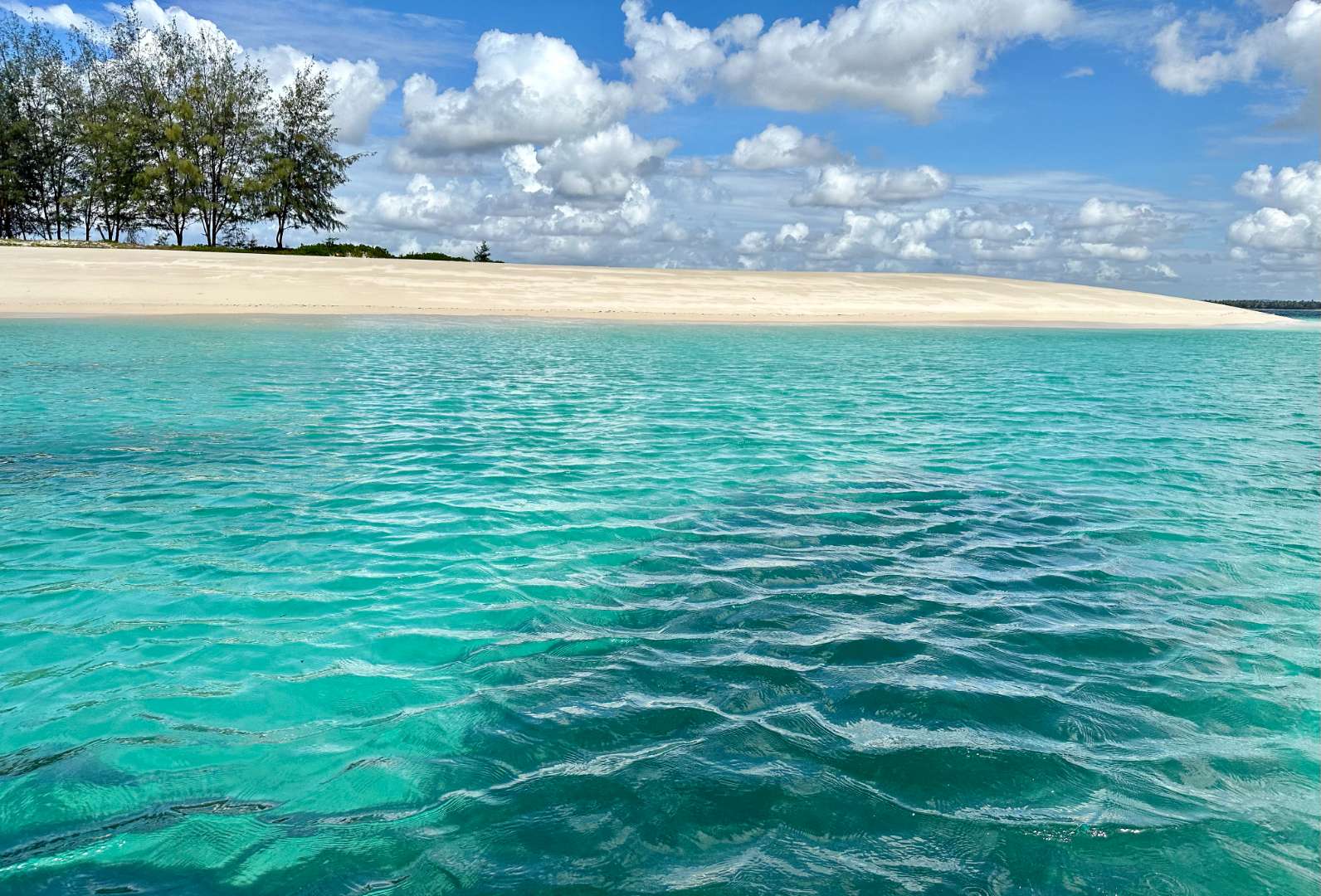
## Description Sinda Island is a hidden gem off the coast of Tanzania, often mistaken as part of Zanzibar due to its proximity and tropical allure. This uninhabited island, part of the Dar es Salaam Marine Reserve System (DMRS), offers a pristine escape into nature, far removed from the crowds and commercialization of more popular destinations. With its untouched beaches, vibrant coral reefs, and rich biodiversity, Sinda Island is a haven for eco-tourists, snorkelers, and anyone seeking tranquility. The island is actually composed of two parts—Inner and Outer Sinda—each with its own unique landscape. The coastlines feature a mix of rocky cliffs and soft sandy beaches, while the interior is covered in virgin coastal forest. One of the island’s most fascinating residents is the endangered coconut crab, which thrives in this protected habitat. The waters surrounding Sinda are shallow near the shore but drop off dramatically just a few kilometers out, creating strong tidal currents and excellent snorkeling conditions. A little-known fact: Sinda Island is home to ruins dating back to the 19th century, and it was first documented by Arab sailor Ibn Majid in 1470. These remnants of history, combined with the island’s natural beauty, make it a compelling destination for both adventure and reflection. ## Location Sinda Island is located in **Tanzania**, within the **Dar es Salaam Region**, specifically in the **Kigamboni District**. It lies southeast of Dar es Salaam, just off the coast near the Somangila ward. ### How to Get There: - **By Boat**: The most common way to reach Sinda Island is by hiring a boat from the Kigamboni coast. Local tour operators offer day trips that include snorkeling, picnicking, and guided walks. - **From Dar es Salaam**: Take a ferry across the harbor to Kigamboni, then arrange a boat transfer from one of the nearby beaches such as Kimbiji or Sinda Beach. - **By Tour Package**: Several eco-tourism companies offer curated trips to Sinda Island, often including stops at nearby reefs and islands. Because it’s a protected area, access may be regulated, so it’s best to coordinate with licensed guides or marine reserve authorities. ## Tips for Visitors To make the most of your visit to Sinda Island, consider these tips: - **Pack Light but Smart**: Bring reef-safe sunscreen, snorkeling gear, water, and snacks. There are no facilities on the island. - **Respect the Environment**: As a protected marine reserve, it’s crucial to avoid littering and disturbing wildlife. - **Snorkeling is a Must**: The coral reefs around Sinda are teeming with life—from clownfish to moray eels. Don’t miss the chance to explore them. - **Visit During Dry Season**: June to October offers the best weather and visibility for underwater activities. - **Explore the Ruins**: Ask your guide to show you the historical ruins—some are hidden within the forest and offer a glimpse into the island’s past. - **Ideal for Day Trips**: Overnight stays are not permitted, so plan for a full-day excursion. ## Conclusion Sinda Island is a serene and ecologically rich destination that blends natural beauty with historical intrigue. Whether you're snorkeling among vibrant reefs, spotting rare coconut crabs, or simply soaking in the silence, this island offers a rare kind of escape—one that’s both peaceful and profound. ## FAQ **1. Is Sinda Island part of Zanzibar?** No, it’s located off the coast of Dar es Salaam, though it shares similar tropical features. **2. Can I stay overnight on Sinda Island?** No, the island is uninhabited and part of a protected marine reserve. Only day trips are allowed. **3. What activities can I do on the island?** Snorkeling, nature walks, beach picnics, and exploring historical ruins are popular activities. **4. Is there an entrance fee?** Yes, a small conservation fee may be required. It’s usually included in guided tour packages. **5. Are there facilities on the island?** No, there are no restaurants, restrooms, or shops. Visitors must bring their own supplies. **6. Is it safe to swim around Sinda Island?** Yes, but always follow your guide’s instructions. Some areas have strong currents due to tidal shifts. ## 🔗 Links - [Sinda Island – Wikipedia](https://en.wikipedia.org/wiki/Sinda_Island) - [Tanzania Tourism – Sinda Island Marine Reserve](https://www.tanzaniatourism.com/destination/sinda-island-marine-reserve)
GemVoyage Team • World
Ontario
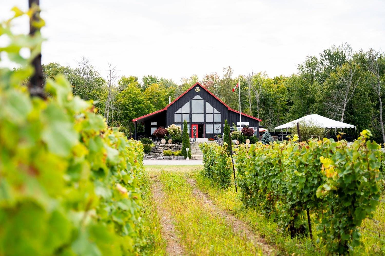
## Description Prince Edward County has become one of Ontario’s most appealing wine destinations, and its wineries are a major reason travelers now plan weekends and day trips to the region. The county combines vineyards, rural roads, lake air, farm landscapes, and a growing food culture into an experience that feels refined without losing its laid-back provincial charm. Unlike a single attraction, the wineries of Prince Edward County function as a connected landscape, where each stop contributes to a broader sense of place. What makes the area special is the relationship between wine and setting. The county’s cool-climate conditions help shape the style of wine produced here, and the region’s open fields and lakeside influence make the scenery especially enjoyable between tastings. Visitors often come for Chardonnay, Pinot Noir, sparkling wine, and other locally produced bottles, but the deeper reward is the way the entire county has developed around small producers, hospitality, and a slower pace of travel. One little-known fact is that Prince Edward County’s wine scene feels young compared with some global wine regions, yet it has gained a strong reputation because of the quality of its producers and the distinct character of the landscape. Another detail that many first-time visitors notice is how much the county encourages a full-day or weekend rhythm. The wineries are best enjoyed when you allow time for scenic driving, lunch, and perhaps an overnight stay rather than trying to compress everything into a short stop. The experience also works well for travelers who are not wine experts. You do not need technical knowledge to appreciate the hospitality, the rural atmosphere, and the chance to sample local production in a beautiful setting. Prince Edward County is one of those destinations where the landscape and the tasting room experience strengthen each other. Even travelers who visit mostly for food, photos, or a relaxing escape often come away with a deeper appreciation for Ontario wine country. ## Location The wineries are spread throughout Prince Edward County in Ontario, Canada, an island-like peninsula region on Lake Ontario northeast of Toronto. The county is most practical to visit by car, since the wineries are dispersed and the enjoyment comes from moving between them at your own pace. Public transport is limited for this type of trip, so driving is by far the most convenient option. Prince Edward County is close enough for a weekend from Toronto or other parts of southern Ontario, but the drive is long enough that many visitors prefer to stay overnight. Doing so gives you a better chance to enjoy tastings responsibly and explore the county’s food, small towns, and lakeside scenery. Once you arrive, winery visits can be paired with restaurants, farm shops, beaches, and scenic routes. ## Tips Plan transportation carefully if you intend to taste multiple wines. Designate a driver, book a tour, or arrange another safe transportation method before you begin. The county is spread out enough that responsible planning matters. Choose a few wineries instead of trying to do too many. Part of the charm here is slowing down, not racing from one tasting room to the next. A smaller number of thoughtful stops usually gives a better experience than an exhausting checklist. Book in advance when possible. Popular producers, weekend slots, and special tasting experiences can fill quickly, especially during peak travel seasons. Reservations can make the day smoother and prevent disappointment. Leave time for food and scenery. The county is as much about the wider setting as the wine itself. Adding lunch, a drive through rural roads, or a short lake-side walk can make the visit feel much more complete. ## Conclusion Prince Edward County’s wineries offer one of Ontario’s most rewarding rural travel experiences, blending quality wine, scenic landscapes, and a relaxed pace. It is a destination that works best when you give it time. ## FAQ ### Do I need to be a wine expert to visit? No. The region is welcoming to casual visitors, and many people enjoy the experience simply as a scenic tasting trip. ### Is one day enough? One day can work for a focused visit, but an overnight stay usually makes the trip much more enjoyable and less rushed. ### Are the wineries family-friendly? Many are welcoming to daytime visitors, but policies vary. It is best to check individual winery rules before bringing children. ### What kinds of wine is the region known for? Prince Edward County is especially respected for cool-climate styles, including sparkling wine and elegant white and red wines. ### Can I visit without a car? It is possible through tours and arranged transport, but a car is the most practical way to see the region’s dispersed wineries. ## Links - [Wikipedia](https://en.wikipedia.org/wiki/Prince_Edward_County,_Ontario)
GemVoyage Team • World
Jeju
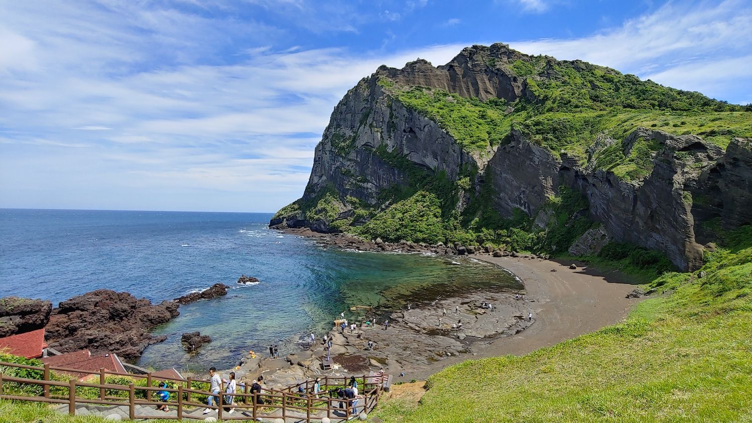
## Description Jeju Island, off South Korea’s southern coast, is a volcanic island known for Hallasan (a volcanic shield and South Korea’s highest mountain), lava tubes, basalt cliffs and distinctive stone walls. The island’s mix of beaches, rugged coastlines like Jusangjeolli, and cultural attractions (women divers known as haenyeo, folk villages and tangerine orchards) creates a varied visitor experience. Jeju’s volcanic geology also supports extensive lava tube systems (a UNESCO World Heritage feature) and scenic peaks that reward hikers and geotourists alike. Jeju’s character is both natural and cultural: haenyeo divers have shaped coastal traditions for generations, while island produce — particularly tangerines and seafood — influences local cuisine. The island’s microclimates mean you can experience contrasting conditions across short distances: misty highland mornings on Hallasan and temperate breezes on coastal beaches the same day. For outdoor enthusiasts, Jeju offers crater rims, coastal walking trails, and extensive cycling routes that reveal cliffs, hidden coves and agricultural terraces. In addition to natural features, Jeju preserves a strong vernacular culture: folk villages, stone statues (dol hareubang) and cultural festivals highlight island identity. Conservation efforts balance tourism with environmental protection, and community-based tourism initiatives allow visitors to learn about haenyeo traditions and local crafts while supporting sustainable livelihoods. ## Location Jeju Island (Jeju-do) sits about 100 km south of the Korean Peninsula and is accessible via frequent flights from Seoul, Busan and select international cities, as well as ferries from nearby ports. Jeju City and Seogwipo serve as principal hubs for exploration, with major roads connecting coastal attractions and national park trails. ## Tips - **Rent a car for flexible exploration:** Public buses cover major routes but can be slow for visiting remote sites. Renting a car gives you access to trailheads and quiet coves. - **Plan hikes on Hallasan and coastal trails in advance:** Popular trails may require permits or early starts; check trail conditions and weather before ascending. - **Try local cuisine and farm visits:** Sample Jeju black pork, fresh seafood, and citrus-based products. Farm and orchard visits offer seasonal experiences like tangerine picking. - **Respect haenyeo traditions and regulations:** Observe diving zones from designated viewpoints and book community-led experiences to learn about their craft responsibly. - **Choose quieter seasons for hiking and photography:** Spring blossom and autumn colors provide excellent conditions with fewer crowds than peak summer beach season. ## Conclusion Jeju Island blends accessible volcanic landscapes with resilient island culture, making it an ideal destination for active exploration and relaxed coastal time. Whether you favor volcanic hikes, coastal drives, cultural immersion with haenyeo communities, or sampling island cuisine, Jeju rewards travelers with variety, scenic contrasts and approachable outdoor adventures. ## FAQ - **Q: When is the best time to visit Jeju for hiking and mild weather?** A: Spring (April–June) and autumn (September–November) offer mild temperatures, clear skies and lower humidity — ideal for hiking and outdoor photography. - **Q: Are the lava tubes and Hallasan summit accessible to casual visitors?** A: Many lava tube sections are set up with visitor facilities and guided tours; Hallasan hikes range from short trails to challenging summit routes that require good fitness and early starts. - **Q: Is it easy to get around Jeju without a car?** A: Public buses cover major routes but can be slow for visiting remote sites. Renting a car is the most convenient option for flexible itineraries. - **Q: What cultural experiences should I prioritize?** A: Visit a haenyeo cultural center, explore folk villages, try local markets and attend seasonal festivals for authentic cultural encounters. - **Q: How family-friendly is Jeju?** A: Very — many sites are suitable for families, with beaches, theme attractions and short nature walks; always plan for sun protection and weather variability. ## Links - [Jeju Island — Wikipedia](https://en.wikipedia.org/wiki/Jeju_Island)
GemVoyage Team • World
Victoria
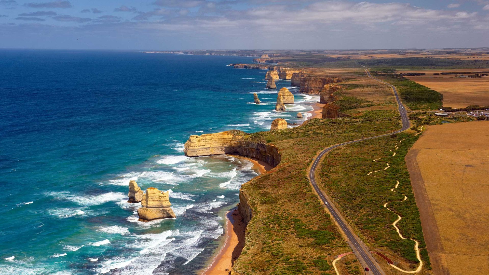
## Description The Great Ocean Road is one of the world’s most celebrated coastal drives, winding along Victoria’s southwestern shoreline past rugged cliffs, surf beaches and sculpted limestone stacks such as the Twelve Apostles. Built by returned WWI soldiers and dedicated as a war memorial, the road combines engineering, natural wonders and seaside towns with cafes, galleries and surf culture. Dramatic viewpoints, rainforest gorges (like Great Otway National Park) and wildlife sightings (koalas, kangaroos and seabirds) make the route a versatile exploration corridor. What distinguishes the route is its dramatic juxtaposition of surf, limestone geology and accessible townscapes. Photographers and road trippers prize the series of staged viewpoints where walking tracks descend to coves and panoramic platforms look out to offshore stacks. Beyond the famous stacks, the route offers fern gullies and waterfalls in the Otways, coastal walks to hidden beaches, and small towns where food and surf culture combine. Many travelers craft multi-day itineraries that combine coastal hikes, wildlife spotting and culinary stops, from coffee in Torquay to seafood in Apollo Bay and heritage-listed lookouts around Port Campbell. The road’s memorial origins also allow visitors to reflect on the engineering feat and the region’s social history while enjoying one of Australia’s most scenic drives. ## Location The Great Ocean Road runs from Torquay to Allansford near Warrnambool in Victoria, Australia, with key stops including Anglesea, Lorne, Apollo Bay and the Twelve Apostles viewpoint at Port Campbell. Melbourne is the primary gateway, roughly a 1.5–3 hour drive to the start depending on traffic. ## Tips - **Avoid peak holiday traffic and plan overnight stops:** The route is popular during Australian school holidays; split the drive into staged stops to avoid fatigue and to enjoy hikes. - **Plan time for short walks and lookout detours:** Many of the best views require small detours and short walks; factor these into your itinerary rather than only driving. - **Mind driving conditions and seasonal weather:** Wind, sea spray and rain can change conditions quickly — watch for strong crosswinds and take care on narrow coastal roads. - **Book accommodation and tours in advance during peak season:** Lorne, Apollo Bay and Port Campbell fill quickly in summer — reserve ahead if travel dates are fixed. - **Pack layers and photography gear:** Coastal light changes quickly; bring windproof layers, a tripod for sunrise/sunset shots and protective gear for salt spray. ## Conclusion The Great Ocean Road pairs dramatic coastal geology with accessible townscapes and outdoor experiences, making it an essential Australian road trip for nature lovers and photographers. Thoughtful pacing and an eye for sidetracks reveal quieter coves, rainforest secrets and local food scenes that complement the iconic seascapes. ## FAQ - **Q: How long does the full drive along the Great Ocean Road take?** A: The direct driving time without stops is around 6–7 hours, but most travelers allocate 2–3 days to properly enjoy walks, viewpoints and coastal towns. - **Q: Can I drive the Great Ocean Road in a single day from Melbourne?** A: You can, but it will be rushed; an overnight stop (or two) allows for sunrise/sunset photography, hikes, and a relaxed pace. - **Q: Are there guided tours, or is it best to self-drive?** A: Both options are common: guided day tours suit short itineraries from Melbourne, while self-driving gives freedom to explore side tracks and lesser-known beaches. - **Q: What wildlife can I expect to see?** A: Look for koalas in eucalyptus stands, kangaroos in paddocks near dusk, seabirds along the cliffs and occasional whales on migration seasons from coastal lookouts. - **Q: Is the route safe for cyclists and motorcyclists?** A: Many cyclists and motorcyclists enjoy sections of the route, but be prepared for narrow lanes, tourist traffic, and windy coastal conditions; follow local safety advice. ## Links - [Great Ocean Road — Wikipedia](https://en.wikipedia.org/wiki/Great_Ocean_Road)
GemVoyage Team • World

Comments