GemVoyage Team • World
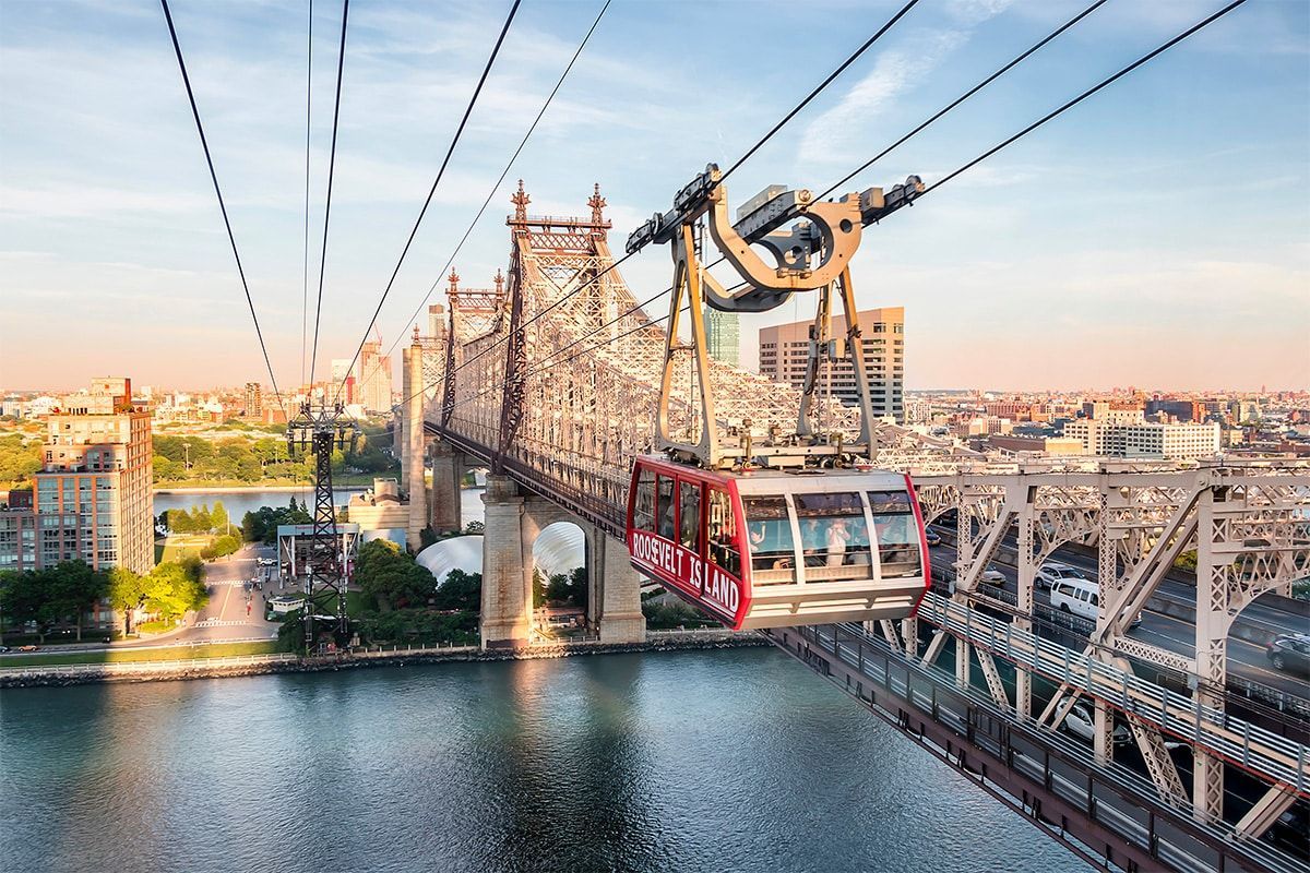
What makes the tram special is the perspective it provides. In only a few minutes, you rise above traffic and water, watching the city unfold from a vantage point that feels cinematic. The ride is smooth and surprisingly calming, especially when compared with the intensity of the streets below. For many visitors, the tram is less about destination and more about the feeling of crossing the river in the air.
One little-known fact is that the tram originally opened in 1976 as a temporary transit solution and became so popular that it remained in service as a permanent part of the city's transport network. Another is that Roosevelt Island itself has changed identities many times over the centuries, from farming and institutional uses to a planned residential community. The tram is therefore not just a tourist novelty; it is the visible connector to an island with its own layered story.
The ride is especially appealing because it works well in both directions. You can take it to reach Roosevelt Island for a stroll, then use it simply as a memorable return to Manhattan. On clear days, the views are excellent; on cloudy days, the skyline can appear dramatic and atmospheric. Either way, the experience is more than transportation. It is a brief reset within a dense urban day.
Roosevelt Island itself also makes the tram more worthwhile. Once there, visitors can walk the waterfront, explore parks and memorials, and enjoy a quieter pace than in Manhattan. The tram becomes a gateway to a calmer landscape without leaving the city. That contrast is part of why it stands out in New York, a city famous for movement but not often for this kind of quiet transition.
If you want one transit experience in New York that is memorable, efficient, and visually distinctive, the Roosevelt Island Tram is an easy recommendation. It is short, affordable relative to the view it offers, and unlike almost anything else in the city.
The tram is easily reached by subway or bus from Manhattan, followed by a short walk to the station. Since it is a working part of the city's transit system, it is best treated like a transport option rather than a theme-ride attraction, even though the experience feels scenic.
If possible, take it in one direction and return another way so you can compare the perspectives.
Be aware that the tram can be busy during commute times and weekends.
Bring your camera or phone ready, but do not spend the whole ride behind a screen.
Plan a little time on Roosevelt Island itself so the ride is part of a fuller outing.
Check service status before going, especially during weather events or maintenance periods.
Discover more hidden gems you might love.
Barcelona
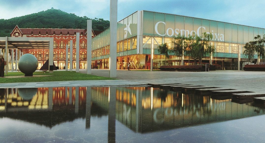
## Description The CosmoCaixa Museum of Science, officially known as Museu de la Ciència CosmoCaixa, is one of Barcelona’s most engaging and educational cultural attractions. Designed to make science accessible, interactive, and enjoyable, the museum invites visitors of all ages to explore the natural world, physics, biology, and the universe through hands-on exhibits and immersive environments. It is widely regarded as one of the best science museums in Europe. What makes CosmoCaixa unique is its emphasis on learning through experience rather than observation alone. The museum’s permanent exhibition spaces encourage visitors to touch, experiment, and question scientific principles. One of its most iconic features is the Flooded Forest, a large-scale recreation of an Amazon rainforest ecosystem complete with live plants, fish, and animals, offering an immersive look into tropical biodiversity. A lesser-known fact is that the museum building incorporates a dramatic architectural ramp system designed to guide visitors gradually through different levels of scientific exploration. Another interesting detail is that CosmoCaixa frequently updates its temporary exhibitions to reflect current scientific research and global challenges. CosmoCaixa successfully combines modern museology, cutting-edge science communication, and striking architecture, making it a standout destination in Barcelona beyond the city’s more traditional art and history museums. ## Location CosmoCaixa is located in **Spain**, in the autonomous community of **Catalonia**, within the city of **Barcelona**. It sits in the Sant Gervasi–La Bonanova district, slightly northwest of the city center, in a quieter residential area. The museum is easily reached by public transport. Visitors can take the Ferrocarrils de la Generalitat de Catalunya (FGC) train to **Avinguda Tibidabo** or **El Putxet** stations, followed by a short walk. Several bus lines also stop nearby. For those traveling by car, parking facilities are available on-site, though public transport is generally the most convenient option. ## Tips * Allow at least two to three hours to explore the museum comfortably. * Visit on weekdays or early in the morning to avoid crowds, especially during school holidays. * Don’t miss the Flooded Forest and the Planetarium, which are highlights of the museum. * Check the schedule for temporary exhibitions, workshops, and guided activities. * The museum is very family-friendly, with many exhibits designed for children and teenagers. * Take advantage of the on-site café and outdoor areas for a break during your visit. ## Conclusion CosmoCaixa Barcelona offers an engaging and thoughtful approach to science education through interactive exhibits and immersive environments. It is an ideal destination for families, students, and anyone curious about how the world works, providing a refreshing perspective on science in an accessible and enjoyable format. ## FAQ **Is CosmoCaixa suitable for children?** Yes, the museum is designed for all ages and includes many interactive exhibits for children. **How much time should I plan for a visit?** Most visitors spend between two and four hours exploring the museum. **Is there an entrance fee?** Yes, CosmoCaixa charges a modest entrance fee, with discounts for students, seniors, and families. **Are exhibits available in multiple languages?** Yes, most exhibits and information panels are available in Catalan, Spanish, and English. **Is the museum accessible for people with limited mobility?** Yes, the museum is fully accessible, with ramps, elevators, and adapted facilities. ## Links * [CosmoCaixa Official Website](https://cosmocaixa.org/es/cosmocaixa-barcelona)
GemVoyage Team • World
Tunis
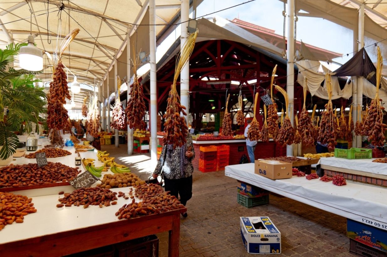
## Description The Central Market of Tunis, known locally as السوق المركزية, is one of the most vibrant and authentic places in the Tunisian capital. Serving as a hub for fresh food, spices, and everyday goods, the market offers visitors a vivid introduction to local life and culinary traditions. Bustling, colorful, and full of aromas, the market reflects the rhythms of Tunis far more intimately than many formal tourist attractions. What makes the Central Market of Tunis unique is its impressive variety and organization. Inside its historic iron-and-glass structure, visitors will find separate sections dedicated to fish, meat, fruit and vegetables, spices, flowers, and traditional products. A little-known fact is that the market building dates back to the late 19th century and was constructed during the French protectorate, incorporating European architectural elements with local commercial practices. Another lesser-known detail is that many restaurant owners and chefs from across Tunis still source their ingredients here early in the morning, ensuring the market remains central to the city’s food culture. Beyond shopping, the market is a social space where neighbors meet, bargains are exchanged, and traditions continue daily, making it an essential stop for anyone wishing to understand Tunis from the inside. ## Location The Central Market of Tunis is located in **Tunisia**, in the **Tunis Governorate**, within the city of **Tunis**. It sits just outside the old Medina, near Avenue Habib Bourguiba, one of the city’s main thoroughfares. Reaching the market is easy by public transportation. The Tunis Metro and TGM trains stop nearby, and several bus routes pass through the area. For visitors staying in central Tunis, the market is within walking distance of major hotels and landmarks. Taxis are also affordable and widely available, but walking allows you to experience the surrounding streets and shops. ## Tips * Visit early in the morning to see the market at its busiest and to enjoy the freshest products. * Be prepared for strong smells, especially in the fish and meat sections. * Ask permission before taking photos, particularly of people or individual stalls. * Bring small bills and cash, as many vendors do not accept cards. * Practice polite bargaining where appropriate, especially for non-food items. * Combine your visit with a walk through the nearby Medina for a fuller cultural experience. ## Conclusion The Central Market of Tunis offers an immersive and sensory-rich experience that captures the heart of the city. With its historic setting, diverse products, and lively atmosphere, it provides a genuine glimpse into Tunisian culture and everyday life. ## FAQ **What can I buy at the Central Market of Tunis?** You can find fresh produce, seafood, meat, spices, flowers, and various local products. **Is the Central Market tourist-friendly?** Yes, although it mainly serves locals, visitors are welcome and generally well received. **How long should I spend at the market?** Most visitors spend 45 minutes to 1.5 hours, depending on interest. **Is the market open every day?** The market is typically open daily except Sundays or major holidays, with reduced hours in the afternoon. **Is it safe to visit the Central Market of Tunis?** Yes, it is generally safe, but visitors should remain aware of their belongings in crowded areas. ## Links * [Tunisia Tourism Official Website](https://www.discovertunisia.com)
GemVoyage Team • World
Sedgefield
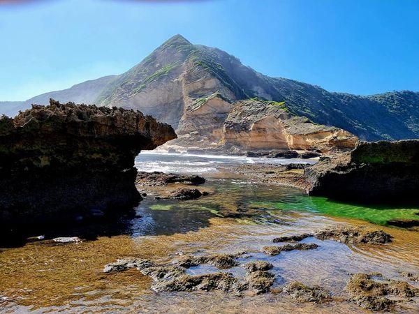
## Description **Gericke’s Point** is one of the hidden gems of South Africa’s Garden Route. Famous for its striking sandstone cliff that resembles the profile of a lion’s head, this natural landmark offers both geological beauty and incredible biodiversity. At low tide, the area transforms into a natural aquarium, revealing tidal pools brimming with colorful marine life such as starfish, sea anemones, and small fish. The rock formation itself is over 150 million years old, part of the ancient Table Mountain sandstone system. Its unusual shape and size make it one of the most photogenic spots along the coast. Beyond its geology, Gericke’s Point is also a birdwatcher’s paradise, with seabirds often seen diving for fish and dolphins occasionally passing offshore. A little-known fact is that the tidal pools here are considered some of the most diverse along the Garden Route, making it a favorite spot for marine biologists and nature enthusiasts. Another fascinating detail is that the rock face has long been a landmark for sailors navigating the coast between Sedgefield and Wilderness. ## Location Gericke’s Point is located near **Sedgefield**, a small town along the **Garden Route** in the **Western Cape Province** of **South Africa**. It lies about 25 kilometers from Knysna and around 40 kilometers from George. To reach the point, visitors typically start at Swartvlei Beach near Sedgefield. From there, a scenic beach walk of about 2–3 kilometers leads to the rock formation. The best time to go is at low tide, when the tidal pools are accessible and the walk is safe. Travelers driving the Garden Route can easily stop at Sedgefield, with parking available near the beach entrance. ## Tips * **Check the tide tables:** Low tide is the only safe and rewarding time to visit. High tide can make the walk dangerous. * **Wear sturdy shoes:** Although the walk is along the beach, exploring the tidal pools requires footwear with good grip. * **Bring a camera:** The lion-shaped rock formation and vibrant tidal pools make for excellent photography opportunities. * **Pack water and sun protection:** There are no facilities along the beach walk, so carry essentials with you. * **Respect marine life:** Avoid disturbing or removing creatures from the tidal pools—this is a fragile ecosystem. * **Stay for sunset:** The area is particularly stunning in the golden light of late afternoon, with the rock formation silhouetted against the ocean. ## Conclusion Gericke’s Point is more than just a rock formation—it is a window into South Africa’s geological past and a living showcase of coastal biodiversity. With its tidal pools, dramatic cliffs, and sweeping ocean views, it offers a perfect mix of adventure and tranquility along the Garden Route. For travelers seeking a memorable nature experience off the beaten path, Gericke’s Point is not to be missed. ## FAQ **1. How long is the walk to Gericke’s Point?** The walk from Swartvlei Beach to Gericke’s Point takes about 30–40 minutes each way, depending on pace and tide conditions. **2. Is it safe to swim near Gericke’s Point?** Swimming is possible in some tidal pools, but the open ocean can be rough. Always exercise caution and avoid strong currents. **3. Can children visit the point?** Yes, children often enjoy exploring the tidal pools, but they should be supervised closely due to slippery rocks and the incoming tide. **4. Is there an entrance fee?** No, Gericke’s Point is free to access, though parking at Swartvlei Beach may sometimes require a small fee. **5. What wildlife might I see?** In addition to tidal pool creatures, visitors may spot dolphins offshore, oystercatchers, and other seabirds. In whale season (June–November), southern right whales are sometimes visible. **6. When is the best time to visit?** The best time is at low tide and preferably in the morning or late afternoon when temperatures are milder and light conditions are ideal. ## Links * [Visit Garden Route – Sedgefield](https://www.visitgardenrouteandkleinkaroo.com) * [South African Tourism – Garden Route](https://www.southafrica.net)
GemVoyage Team • World
Vigo
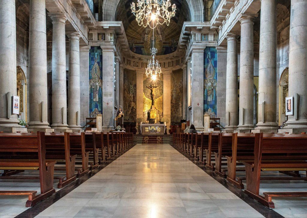
## Description The Concatedral – Basílica de Santa María de Vigo is one of the most important religious and historical monuments in the city of Vigo. Standing prominently in the old town area, this Roman Catholic basilica-concatedral serves as a key symbol of the city’s spiritual heritage and architectural evolution. While Vigo is often associated with its port and modern urban life, this church offers a quieter, more reflective window into its past. What makes the Concatedral – Basílica de Santa María unique is its layered history. The current neoclassical structure, completed in the early 19th century, was built on the remains of earlier Gothic churches destroyed during attacks in the late 16th century. Despite its relatively austere exterior, the interior reveals elegant altarpieces, religious artwork, and a serene atmosphere that contrasts with the bustling streets outside. A little-known fact is that the church holds the image of Cristo de la Victoria, Vigo’s most venerated religious figure, honored every August during one of Galicia’s largest religious processions. Another lesser-known detail is that the building holds the status of both a basilica and a co-cathedral, sharing diocesan importance with the Cathedral of Tui. The Concatedral – Basílica de Santa María is not only a place of worship but also a cornerstone of Vigo’s cultural and communal identity. ## Location The Concatedral – Basílica de Santa María is located in **Spain**, in the autonomous community of **Galicia**, within the city of **Vigo**. It stands in the historic Casco Vello (Old Town), near the waterfront and close to Plaza de la Constitución. The church is easily accessible on foot from central Vigo, especially if you are exploring the old town area. Public buses stop nearby, connecting Casco Vello with other parts of the city. Taxis are also readily available and affordable. Visitors arriving by car should be aware that parking in the old town can be limited, so public transport or walking is recommended. ## Tips * Visit during the morning or early afternoon for a quieter and more contemplative experience. * Dress modestly, especially if attending a service or visiting during religious events. * Take time to explore Casco Vello before or after your visit, as the surrounding streets are rich in history. * If visiting in August, check dates for the Cristo de la Victoria procession, one of Vigo’s most important annual events. * Photography is generally allowed, but flash may be restricted during services. * Check mass times if you wish to experience the church as an active place of worship. ## Conclusion The Concatedral – Basílica de Santa María de Vigo is a meaningful blend of faith, history, and architecture. As both a spiritual center and a historic landmark, it offers visitors a deeper understanding of Vigo beyond its modern image and coastal setting. ## FAQ **Why is it called a co-cathedral?** It shares cathedral status with the Cathedral of Tui within the same diocese, making it a co-cathedral. **Is there an entrance fee?** No, entrance is generally free, though donations are appreciated. **Can tourists visit during mass?** Yes, visitors are welcome, but should remain respectful and quiet during services. **How long does a visit take?** Most visits last between 20 and 40 minutes, depending on interest. **Is the church accessible for people with limited mobility?** Accessibility is limited due to the historic structure, but the main entrance is generally manageable. ## Links * [Diocese of Tui-Vigo Official Website](https://www.diocesetuivigo.org) * [Turismo de Vigo](https://www.turismodevigo.org)
GemVoyage Team • World
Petén
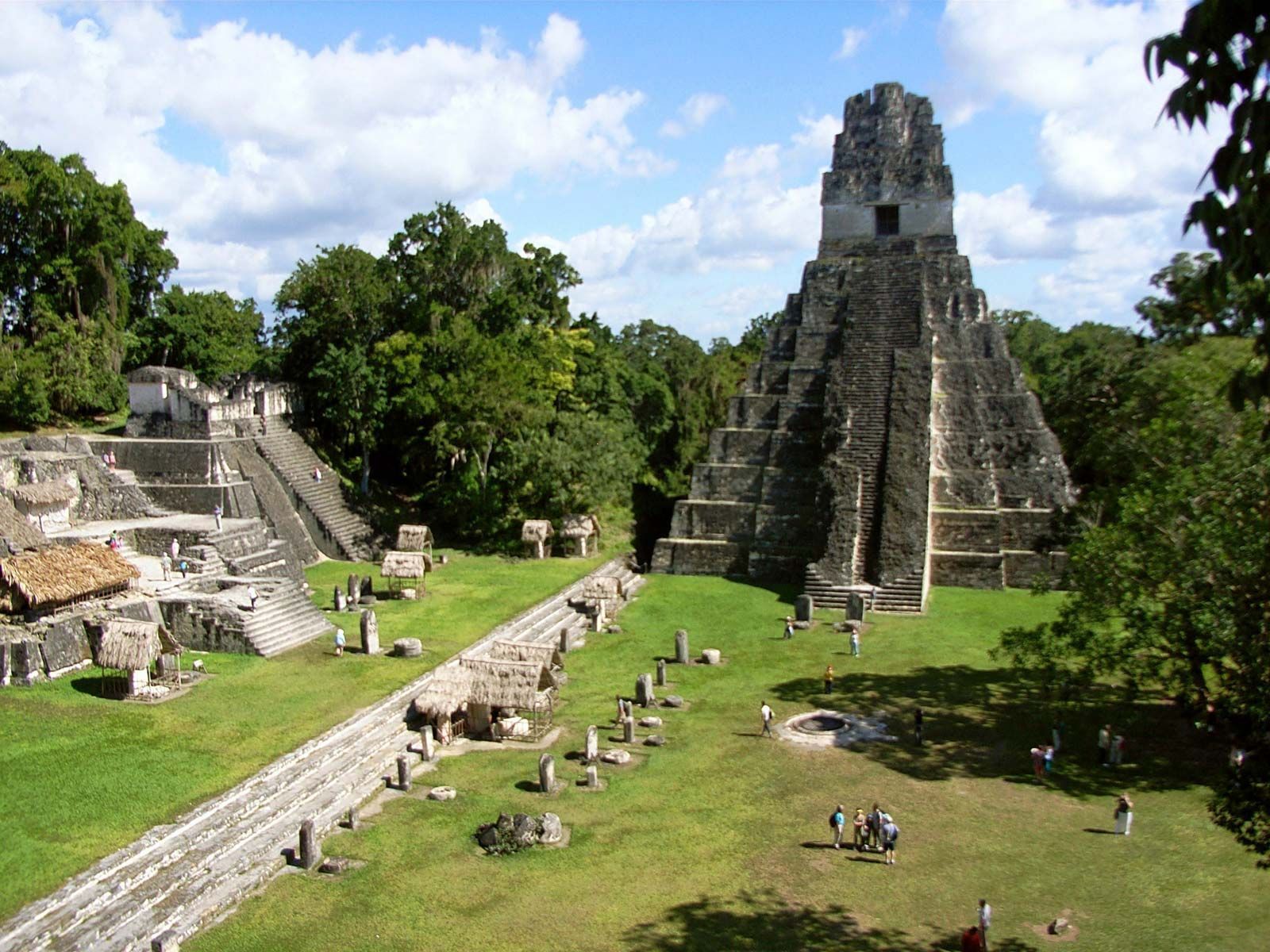
## Description Tikal is one of the most important archaeological sites of the ancient Maya civilization, located within the dense lowland rainforests of Petén, Guatemala. The city’s towering limestone pyramids and plazas emerge above the jungle canopy, offering dramatic skyline views and a palpable sense of antiquity. During its Classic period, Tikal was a major political and ceremonial center; excavated palaces, stelae and ballcourts tell stories of dynasties, calendrical knowledge and cosmology. Visitors to Tikal are rewarded by a blend of monumental architecture and biodiverse rainforest. The temples and palaces rise through the tree canopy, so that from the tops of several structures you can peer over treetops to see other pyramids peeking through the foliage. This interplay between built environment and ecology is central to Tikal’s power: the jungle both conceals and reveals the city, a dramatic reminder of centuries of abandonment and recovery. Tikal’s primary plaza, monumental ballcourts, and the iconic Temple IV and Temple II complexes preserve stelae with carved inscriptions, verifiable sequences of rulers and artistic programs that speak to the city’s political sophistication. Archaeological work also reveals complex water-management features, reservoirs and causeways that allowed the city to sustain a significant population despite a seasonal tropical climate. Walking among Tikal’s temples at sunrise — when the jungle stirs and howler monkeys call — is an evocative way to connect with a complex culture of architecture, ritual and astronomy. Early morning light transforms the stone into warm tones and dramatically silhouettes the temple profiles against the rising sun, making sunrise a photographer’s favorite. Guides can point out hieroglyphic inscriptions, sacred alignments and the role of celestial observation in Maya ritual life. ## Location Tikal National Park is in Guatemala’s northern Petén department. The site is reachable via a short flight to Flores (Mundo Maya International Airport, FLV) or by road from Flores town, which serves as the usual visitor base. Most visitors use Flores as a staging point and arrange shuttle transfers, guided tours, or independent day trips to the park. ## Tips - **Arrive at dawn for temples and wildlife:** Early mornings provide cooler light, bird activity and quieter conditions before larger tour groups arrive. Dawn visits also let you catch the moment when the jungle wakes up. - **Hire a knowledgeable guide:** Licensed local guides provide historical context, translate glyphs and explain how architecture relates to Maya cosmology — essential for getting more from the site. - **Bring insect repellent and sun protection:** The lowland rainforest environment includes biting insects and strong sunlight in exposed plazas. Lightweight long sleeves and repellent are useful. - **Plan logistics from Flores:** Book shuttle transfers or organized tours in advance during high season, and consider staying overnight near the site for sunset or sunrise experiences. - **Support responsible tourism:** Choose certified guides and operators that follow park rules and contribute to local community economies. ## Conclusion Tikal is both a monumental archaeological treasure and a living jungle experience: temples puncturing the canopy, dawn rituals and carved monuments make it an essential site for understanding Maya civilization. For travelers seeking a mix of natural soundscapes, wildlife encounters and a deep cultural history, Tikal offers an immersive and emotionally resonant experience. ## FAQ - **Q: How long should I spend at Tikal?** A: A full day is ideal to cover the main plazas, climb at least one temple for panoramic views, and explore the northern and central complexes. Two days allow for a slower pace, birding and visiting lesser-known complexes. - **Q: Can visitors climb the temples at Tikal?** A: Access to climbable areas varies — some temples allow limited ascent to designated viewpoints while others are closed to protect fragile structures. Follow current park rules and signage. - **Q: What wildlife might I see at Tikal?** A: Expect to see howler monkeys, toucans, parrots, motmots and a range of tropical birds; early morning is best for birdwatching and animal activity. - **Q: Is it safe for solo travelers and families?** A: The site is generally safe during daylight hours. Follow standard travel precautions: use licensed guides, secure belongings, carry water and avoid isolated areas after dark. - **Q: Are there accommodations near the park?**n+ A: Flores and nearby villages offer a range of lodgings from budget hostels to mid-range hotels; staying in Flores provides easy access to flights and transportation. ## Links - [Tikal — Wikipedia](https://en.wikipedia.org/wiki/Tikal)
GemVoyage Team • World
Bosnia
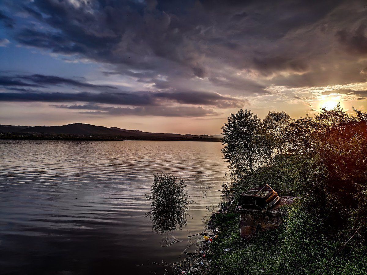
## Description **Modrac Lake (Modračko jezero)** is one of the largest artificial lakes in Bosnia and Herzegovina and a significant recreational and economic resource for the northeastern part of the country. Created in the 1960s by damming the **Spreča River**, the lake was originally built to supply water for industry and surrounding towns. Over time, it evolved into a **popular leisure destination**, especially during the summer months. What makes Modrac Lake distinctive is its **dual identity**. On one hand, it is a functional reservoir supporting industry and agriculture in the Tuzla region. On the other, it serves as a relaxed getaway for locals, offering swimming areas, weekend houses, fishing spots, and informal beaches. Unlike heavily commercialized European lakes, Modrac retains a raw, local character shaped more by everyday use than tourism planning. A lesser-known fact is that before the lake was created, several villages and agricultural lands were submerged, permanently altering the local landscape and economy. Another interesting detail is that Modrac Lake supports a **diverse fish population**, including carp, catfish, pike, and perch, making it one of the most important freshwater fishing locations in the region. The atmosphere around the lake is informal and authentic. Small cafés, seasonal food stands, and family-owned cottages line parts of the shoreline, particularly near towns and villages. This gives visitors a genuine glimpse into regional leisure culture rather than a curated tourist experience. ## Location **Country:** Bosnia and Herzegovina **Region:** Tuzla Canton **Nearest Cities:** Tuzla, Lukavac, Živinice Modrac Lake lies in **northeastern Bosnia**, about 15 kilometers southwest of Tuzla, stretching between several municipalities. ### How to Get There * **By car:** * The easiest and most flexible option. From Tuzla, the drive takes about 20–30 minutes depending on the access point. * **By taxi:** * Available from Tuzla and nearby towns, though return arrangements should be planned. * **By local transport:** * Buses connect Tuzla with nearby towns such as Lukavac and Živinice, followed by short walks to the shore. ## Tips * **Visit in summer:** July and August are the most active months, with swimming and lakeside life at its peak. * **Choose your access point carefully:** Some areas are better maintained and cleaner than others. * **Bring your own supplies:** Facilities vary greatly depending on the location. * **Fishing requires a permit:** Licenses can be obtained locally. * **Avoid swimming after heavy rain:** Water clarity can decrease due to runoff. * **Respect the environment:** As a working reservoir, preservation depends largely on visitor behavior. ## Conclusion Modrac Lake is not a polished resort, but a **functional and lived-in landscape** that plays an important role in local life. Its wide shoreline, relaxed atmosphere, and accessibility make it a meaningful destination for those interested in regional culture, outdoor relaxation, and everyday Bosnia beyond major tourist routes. ## FAQ **1. Is Modrac Lake natural or artificial?** It is an artificial lake created by damming the Spreča River. **2. Can you swim in Modrac Lake?** Yes, swimming is common in designated areas, especially during summer. **3. Is the lake clean?** Water quality varies by location and season; some areas are better maintained than others. **4. Is Modrac Lake good for fishing?** Yes. It is one of the most important fishing lakes in northeastern Bosnia. **5. Are there hotels around the lake?** Accommodation is limited; most visitors stay in Tuzla or nearby towns. **6. Is Modrac Lake suitable for tourists?** Yes, particularly for travelers seeking local experiences rather than resort-style tourism. ## Links * [Bosnia and Herzegovina tourism portal](https://www.tourismbih.com/)
GemVoyage Team • World

Comments