GemVoyage Team • World
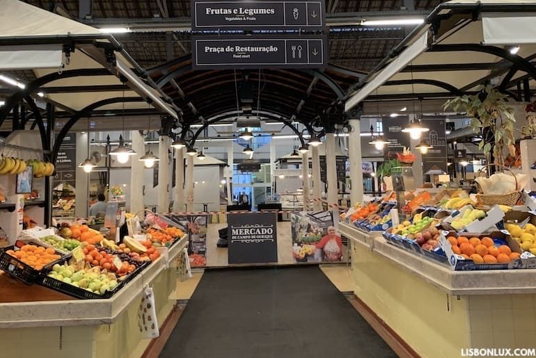
The market’s architecture is typically covered and airy, with stalls organized around central aisles. Recent renovations have injected a modern food-court vibe alongside still-active traditional vendors, making it a place where you can buy grocery staples in the morning and return later for a relaxed meal. Little-known facts: Campo de Ourique historically developed as a self-contained neighborhood with a strong shopping tradition, and the market has long been a point where multiple culinary generations intersect.
Getting there: The neighborhood is accessible by tram, bus and metro. The Rato Metro station and several bus lines serve the area; trams and short walks from nearby attractions make it easy to combine a market visit with broader neighborhood exploration. Taxis and rideshares can drop you near the market’s main entrance.
Q: Are there vegetarian options?
A: Yes. Many vendors and food stalls offer vegetarian and vegan-friendly dishes.
Q: Can I take food to go?
A: Absolutely; many stalls prepare takeaway plates and sandwiches.
Q: Is parking available nearby?
A: Street parking and small public car parks exist, but public transport is recommended.
Discover more hidden gems you might love.
Tirana
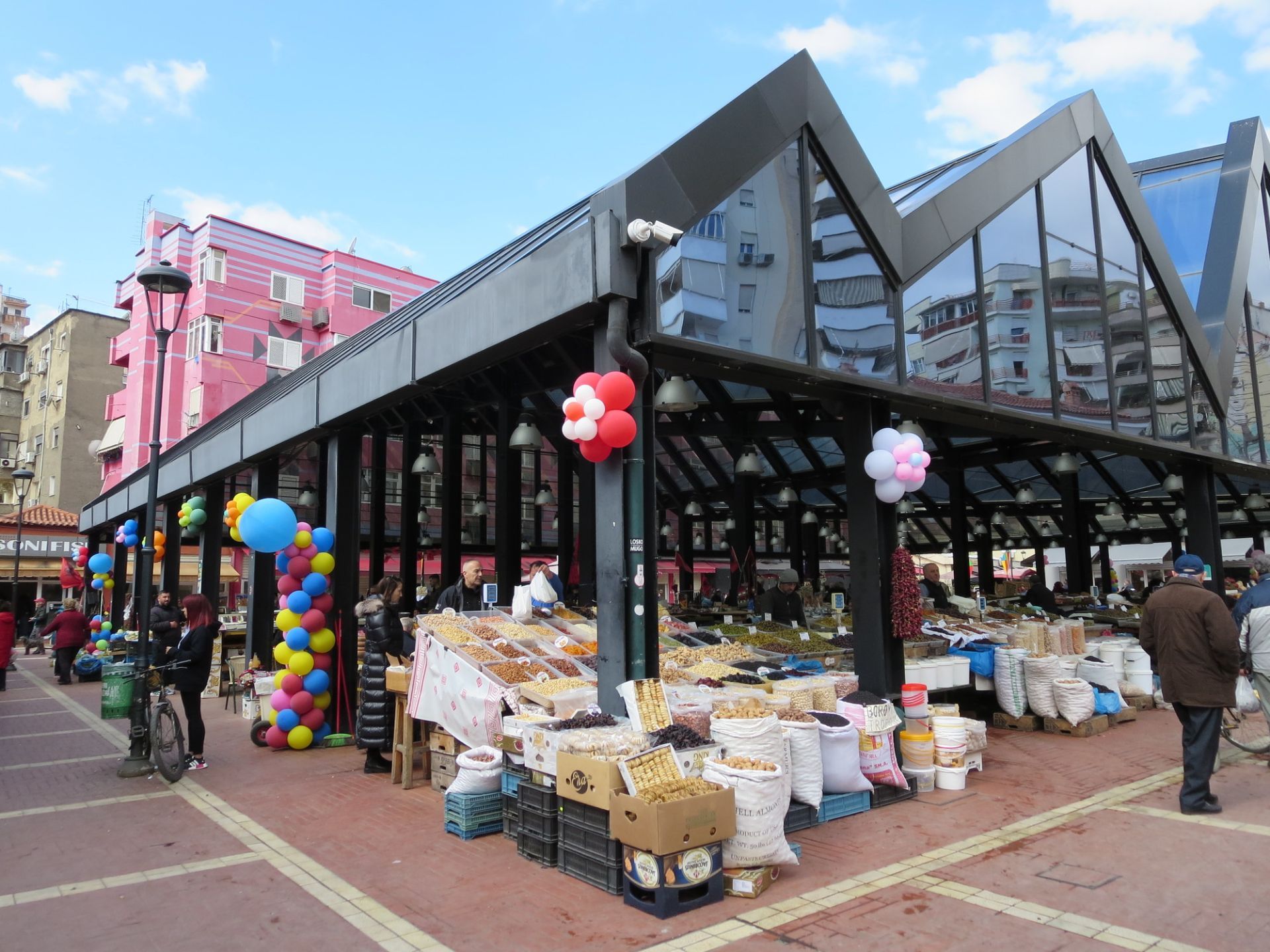
## Description Pazari i Ri, or the New Bazaar, is one of the most engaging places to experience Tirana in everyday motion. It is a market, but also much more than that. The area combines food, neighborhood life, casual shopping, and urban social energy in a way that makes it feel central to how the city now presents itself. Visitors often come expecting a simple market stop and end up spending much longer because the atmosphere is so easy to enjoy. The market’s strength is its blend of old and new. Traditional produce stalls and food sellers sit alongside cafés, contemporary public space, and a district that has been reimagined for modern city life without losing its local feel. One little-known fact is that Pazari i Ri has become a symbol of Tirana’s broader urban renewal, showing how the city can update itself while keeping a neighborhood scale. Another is that it is one of the easiest places to observe how locals shop, eat, and meet during the day, making it valuable for travelers who want more than landmark sightseeing. Food is a major reason to go. Fresh fruit, vegetables, herbs, cheeses, spices, and prepared dishes all contribute to a lively market atmosphere. The surrounding area also makes it simple to sit down for coffee or a meal after browsing. That flexibility is important because it allows the market to work as both a practical stop and a relaxed social outing. You do not have to buy anything to enjoy the visit. Watching the movement, hearing the conversations, and taking in the color and rhythm of the place is enough. For visitors, Pazari i Ri offers a nice balance between structure and spontaneity. You can go there with a shopping list if you want, but you can also simply wander and let the market lead you. Because it sits within central Tirana, it is one of the easiest places to combine with sightseeing, making it a very efficient and satisfying addition to a city day. ## Location Pazari i Ri is located in central Tirana, Albania, a short distance from the city’s main center and many of its major pedestrian and civic areas. It is easy to fit into a day that also includes Skanderbeg Square, nearby museums, or central cafés. The market is very accessible on foot from the core city center, which makes it especially convenient for visitors staying in central Tirana. Taxis and ride-hailing services are also simple options, but walking is often the most pleasant way to arrive because it lets you approach the area gradually and notice the changing urban texture around it. Since the market is central, it works well at almost any time of day, though morning and lunchtime visits tend to feel most active. If your schedule is open, try to arrive when people are shopping for daily supplies, because that is when the market feels most local and animated. ## Tips - Go hungry. The area around the market is one of the easiest places in Tirana to combine browsing with a meal or snack. - Visit in the morning if you want the freshest produce and the most active local rhythm. - Take time to look beyond the main stalls. The surrounding streets and cafés are part of the experience. - Use the market as a people-watching stop as well as a shopping stop. It is a good place to observe daily life. - Bring small notes or a card, but be flexible. Different vendors may prefer different payment methods. ## Conclusion Pazari i Ri is one of Tirana’s best examples of a market that feels both practical and social. It gives travelers an easy way to see the city’s everyday life while enjoying food, color, and a lively central setting. ## FAQ ### Is Pazari i Ri mostly for tourists? No. It is used by locals as well, especially for shopping and daily routines, which gives it a more authentic atmosphere. ### What should I buy there? Fresh produce, local foods, small snacks, and market-style goods are the most natural purchases, though the experience is just as enjoyable if you only browse. ### Is it a good place for lunch? Yes. The surrounding area has enough food and café options that it works very well as a lunch stop. ### How long should I stay? You can see the essentials in under an hour, but a slower visit with coffee or a meal often makes the experience much better. ## Links - [Tirana official tourism information](https://visit-tirana.com/) - [Tirana on Wikipedia](https://en.wikipedia.org/wiki/Tirana)
GemVoyage Team • World
Paris
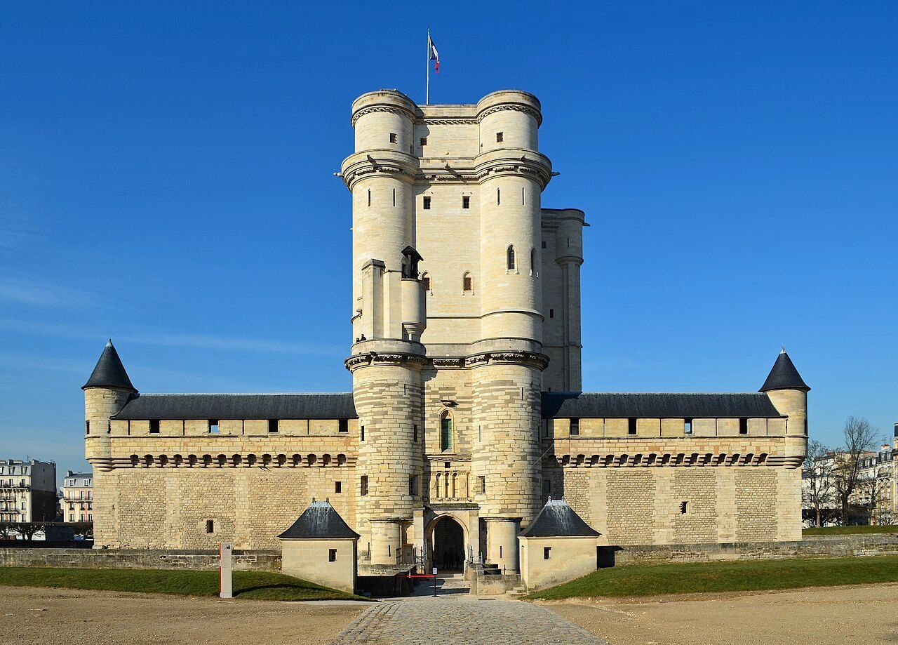
## Description The **Château de Vincennes** is one of France’s most historically significant royal fortresses and a remarkable example of **medieval military architecture** in the heart of modern Paris. Located just east of the city, this vast castle stands as a symbol of the **power, prestige, and evolution of the French monarchy** from the Middle Ages through the Renaissance. Originally built as a **hunting lodge for King Louis VII in the 12th century**, the site was transformed into a formidable **royal fortress** by **King Philip VI** and **King Charles V** during the 14th century. The result was one of Europe’s largest and most impressive medieval castles, complete with towering walls, fortified gates, and a majestic **52-meter (170-foot) keep** — the tallest medieval fortified tower in Europe. The keep, surrounded by a deep moat, served as both a **royal residence** and a **symbol of authority**. Inside, visitors can explore beautifully preserved **royal apartments**, **chapels**, and **ceremonial halls** that once housed some of France’s most powerful monarchs, including **Charles V**, **Henry IV**, and **Louis XIV**. Before Versailles rose to prominence, Vincennes was the main royal residence of the French crown. What makes the Château de Vincennes truly unique is its **dual character** — both royal and defensive. The complex includes a massive **curtain wall with nine towers**, a **drawbridge**, and a **gothic-style chapel** modeled after Sainte-Chapelle in central Paris. Over the centuries, it also served as a **royal prison**, holding famous figures such as **the Marquis de Sade**, **Denis Diderot**, and **Mirabeau**. A lesser-known fact is that the **castle was occupied by Napoleon Bonaparte’s troops**, later used as a **military arsenal**, and even served as a **command center during World War II**. Despite its turbulent past, the site remains remarkably well-preserved and offers a fascinating journey through 800 years of French history. Today, the Château de Vincennes stands as a peaceful yet awe-inspiring monument — less crowded than central Paris landmarks, making it an ideal destination for history enthusiasts seeking authenticity and atmosphere. ## Location The **Château de Vincennes** is located in the **suburb of Vincennes**, directly east of **central Paris**, within the **Val-de-Marne (Île-de-France)** region. It sits adjacent to the **Bois de Vincennes**, Paris’s largest public park. To get there: * **By metro:** Take **Line 1** to **Château de Vincennes Station**, which is just outside the main entrance. * **By RER:** The **RER A** also stops at **Vincennes Station**, about a **5-minute walk** from the castle. * **By bus:** Several Paris bus lines serve the area, including **46, 112, and 114**. * **By car:** Easily accessible via the **Périphérique** (Porte de Vincennes exit), with nearby paid parking available. * **By bike or on foot:** The surrounding **Bois de Vincennes** area offers scenic paths leading directly to the château. ## Tips * **Take the guided tour:** It offers rich historical context about the kings, prisoners, and architects who shaped the site. * **Visit the Sainte-Chapelle de Vincennes:** A stunning Gothic chapel that rivals its Parisian namesake in beauty and craftsmanship. * **Climb the keep:** The panoramic view from the top reveals both the castle’s vast grounds and the Paris skyline. * **Go early or late in the day:** To enjoy a quieter experience and capture the best light for photos. * **Combine with nearby attractions:** After your visit, explore the **Bois de Vincennes**, **Parc Floral de Paris**, or the **zoo** — all within walking distance. * **Family-friendly:** Wide courtyards and open spaces make it a great outing for families and children. * **Check for exhibitions:** The castle regularly hosts **temporary exhibitions, medieval fairs, and reenactments**. ## Conclusion The **Château de Vincennes** is a living testament to the grandeur and endurance of French royal history. With its soaring towers, Gothic chapel, and centuries of royal intrigue, it offers visitors a journey from the medieval era to modern France — all within reach of central Paris. Far less crowded than the city’s major monuments, it’s a place where you can truly feel the **power, elegance, and mystery** of France’s royal past. Whether you’re fascinated by architecture, military history, or French monarchy, the Château de Vincennes promises an experience both majestic and intimate. ## FAQ **1. When was the Château de Vincennes built?** Construction began in the **14th century** under **Philip VI** and **Charles V**, though the site dates back to a 12th-century royal hunting lodge. **2. What is the château known for?** It is renowned as **France’s largest medieval royal fortress**, featuring Europe’s tallest keep and a beautifully preserved Gothic chapel. **3. How can I get there from central Paris?** Take **Metro Line 1** directly to **Château de Vincennes Station** — it’s the last stop on the line and just a few minutes’ walk from the castle. **4. Are guided tours available?** Yes, guided tours in French and English are offered daily and provide detailed insights into the château’s rich history. **5. How long should I plan for a visit?** Allow about **2–3 hours** to explore the keep, chapel, and grounds at a comfortable pace. **6. Is it suitable for children?** Yes — children often enjoy exploring the towers and open courtyards, and there are family-friendly tours available. **7. When is the best time to visit?** Spring and early autumn offer pleasant weather and fewer crowds, though the château is open year-round. ## Links * [Wikipedia page](https://en.wikipedia.org/wiki/Ch%C3%A2teau_de_Vincennes)
GemVoyage Team • World
Berlin
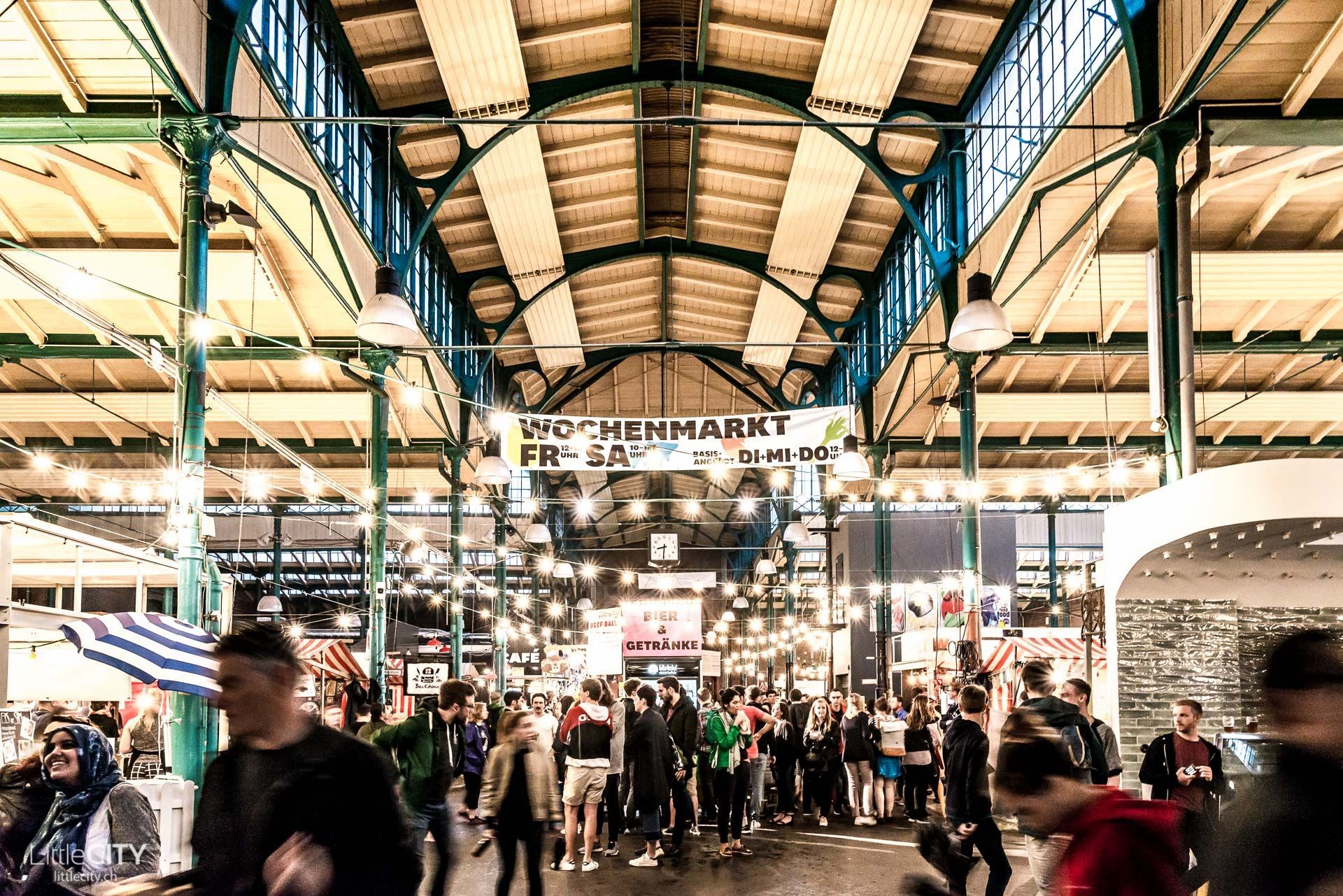
## Description Markthalle Neun is one of Berlin’s most engaging food destinations because it combines history, neighborhood identity, and culinary experimentation in a single space. Unlike a polished shopping mall or a generic indoor market, it feels deeply rooted in Kreuzberg’s local culture. The building itself carries the atmosphere of a traditional market hall, but the life inside it is contemporary and dynamic. Visitors come for food, but they stay because the market offers a sense of community and urban character that is hard to fake. One of the hall’s greatest strengths is variety. Depending on the day and the event schedule, you might encounter street food, specialty produce, artisan products, small-batch drinks, or themed market programming. That flexibility is part of why Markthalle Neun has become such an important Berlin institution. It is not frozen in one format. Instead, it adapts to local tastes and seasonal ideas while still keeping the market tradition visible. That makes it feel both authentic and current. The hall is especially known for helping local and sustainable food culture gain a stronger public profile. Many visitors think of it as a place to eat, but it is also a platform for small producers and creative cooks. A lesser-known fact is that the market has played a major role in shaping Berlin’s reputation as a city where food can be casual, ethically minded, and inventive without being stiff or overly formal. Another is that the hall’s atmosphere often feels more neighborhood-driven than tourist-driven, which gives the experience a welcome sense of local rhythm. The best visits are usually those where you arrive with time to sample, browse, and absorb the setting. The hall can feel energetic but not overwhelming, and that balance makes it pleasant for visitors who enjoy urban food culture. It is a place where lunch can turn into an afternoon, especially if there is a special market theme or event happening. Because of that, Markthalle Neun is more than a place to eat. It is a place to understand one of Berlin’s most appealing everyday social spaces. ## Location Markthalle Neun is in Berlin, Germany, in the Kreuzberg district. The location places it in one of the city’s most culturally active neighborhoods, with cafés, bars, shops, and street life all around it. Public transport is the easiest way to get there. From other central Berlin neighborhoods, you can reach Kreuzberg quickly and then continue on foot. That works especially well if you want to combine the market with a broader walk through the district. Because Kreuzberg is lively and dense, walking the neighborhood after the market can be just as rewarding as the market itself. If you are planning around a particular event or market day, check the schedule in advance. The hall’s activity changes significantly depending on what is happening there, and timing can shape the entire experience. ## Tips Arrive hungry, but do not fill up too fast. It is better to sample a few things and leave room for whatever looks best once you are inside. Check which day or theme is running before you go, because the market’s identity changes with programming. Some days are much stronger for specific types of food than others. Bring a little flexibility. The hall is most rewarding when you let yourself wander and compare options rather than trying to decide everything immediately. If you care about atmosphere as much as food, pair the visit with a Kreuzberg walk. The market becomes even more meaningful when seen as part of the neighborhood around it. The hall is also useful for travelers who want to understand Berlin through everyday culture rather than only through monuments and museums. Kreuzberg’s identity has long been shaped by migration, experimentation, and community-based creativity, and Markthalle Neun reflects that very clearly. Even if you only stop in for a snack, the space gives you a stronger sense of how Berlin’s food scene is tied to local life, not just to polished hospitality. ## Conclusion Markthalle Neun is one of Berlin’s best food-focused attractions because it combines historic market architecture with a modern, community-oriented food culture. It is a standout stop for travelers who want a taste of local life. ## FAQ **What is Markthalle Neun known for?** It is known for its food culture, market events, and strong local identity in Kreuzberg. **Is it only for lunch?** No. The market can be worth visiting at different times depending on programming and special events. **How long should I stay?** One to two hours is a good baseline, longer if you want to eat, shop, and explore the area. **Is it touristy?** It attracts visitors, but it still feels strongly tied to local Berlin food culture. **Should I check the schedule first?** Yes. The market’s offerings can change significantly depending on the day. ## Links - [Official website](https://markthalleneun.de/en/)
GemVoyage Team • World
Alexandria
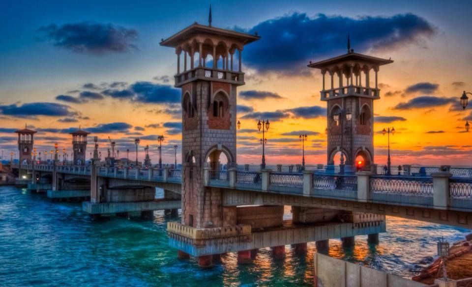
## Description The Stanley Bridge Corniche Walk is one of the most enjoyable ways to experience Alexandria’s seaside character because it brings together a famous city landmark and the broader rhythm of the Mediterranean waterfront. Stanley Bridge itself is a recognizable symbol of modern Alexandria, but what makes the area memorable is not only the bridge as an object. It is the surrounding promenade, the sea air, the movement of people, the views toward the coastline, and the way the corniche helps connect the city’s urban life with its maritime setting. For visitors, this is the kind of place that turns a simple walk into an experience of atmosphere. The bridge and the walkway around it are especially appealing because they capture Alexandria’s layered identity. The city has ancient roots, but much of its contemporary charm comes from places where residents and visitors mix along the water. A lesser-known fact is that the Stanley area is relatively modern compared with Alexandria’s ancient core, yet it has become one of the city’s most photographed and recognizable places because of its coastal setting and architectural profile. Another detail worth noticing is how the area changes across the day: morning brings a softer, more reflective mood, while evening often becomes livelier as people come out for a breezy promenade. For travelers, the walk is rewarding because it offers a sense of place without requiring a formal agenda. You can simply move along the corniche, stop for photos, watch traffic and waves, and enjoy the city unfolding in layers. The bridge frames the sea and the shoreline in a way that feels distinctly Alexandrian, and the surrounding area is often a pleasant place to pause, drink something cold, or continue toward nearby stretches of the waterfront. That flexibility is exactly why this walk belongs in an Alexandria itinerary. The best part may be how accessible it feels. You do not need special preparation to appreciate it. The waterfront itself does the work, offering changing light, open views, and a strong sense of local daily life. ## Location Stanley Bridge Corniche Walk is located in Alexandria, Egypt, along the city’s Mediterranean waterfront in the Stanley district. The walk sits on the Corniche, Alexandria’s main coastal boulevard, which makes it easy to locate and simple to fold into a broader day in the city. Because it is part of the public waterfront, the area is easy to approach and does not require special ticketing or entrance procedures. Getting there is usually easiest by taxi, rideshare, or local transport depending on where you are staying in Alexandria. Walking is ideal if you are already nearby, since the whole point of the experience is to enjoy the seafront at a human pace. If you are planning a longer sightseeing route, Stanley works well as a connecting point between central Alexandria and other coastal areas. The best way to enjoy it is to arrive with enough time to linger. A short pass-through is fine, but the waterfront rewards slowing down. Sunset is especially attractive for light and atmosphere, though morning can be calmer and better for a more relaxed walk. ## Tips Choose comfortable shoes, even though the route is simple. A pleasant walk often turns into a longer one than expected. Visit near sunset if you want the most dramatic light and the most social atmosphere. Do not focus only on the bridge itself. The surrounding corniche is what gives the experience its full value. Be aware of traffic and keep an eye on crossings. Like many urban waterfronts, the area is lively and active. Combine the walk with a café stop or a meal nearby so the outing feels complete rather than rushed. ## Conclusion The Stanley Bridge Corniche Walk is one of Alexandria’s most enjoyable low-effort experiences, blending sea views, city life, and a strong sense of place. It is ideal for travelers who want to feel the Mediterranean character of the city without needing a formal attraction schedule. ## FAQ ### Is the Stanley Bridge area good for tourists? Yes. It is one of Alexandria’s most scenic and accessible waterfront spots, with strong appeal for casual visitors and photographers. ### How long should I spend there? Anywhere from 30 minutes to 2 hours, depending on whether you are simply passing through or lingering for a walk and a meal. ### Is it better in the day or evening? Both work well. Daylight is good for seeing the sea clearly, while evening often feels more atmospheric and social. ### Do I need a ticket? No. The corniche is a public waterfront area, so the experience is generally open and walkable. ## Links - [Alexandria on Wikipedia](https://en.wikipedia.org/wiki/Alexandria)
GemVoyage Team • World
Seoul
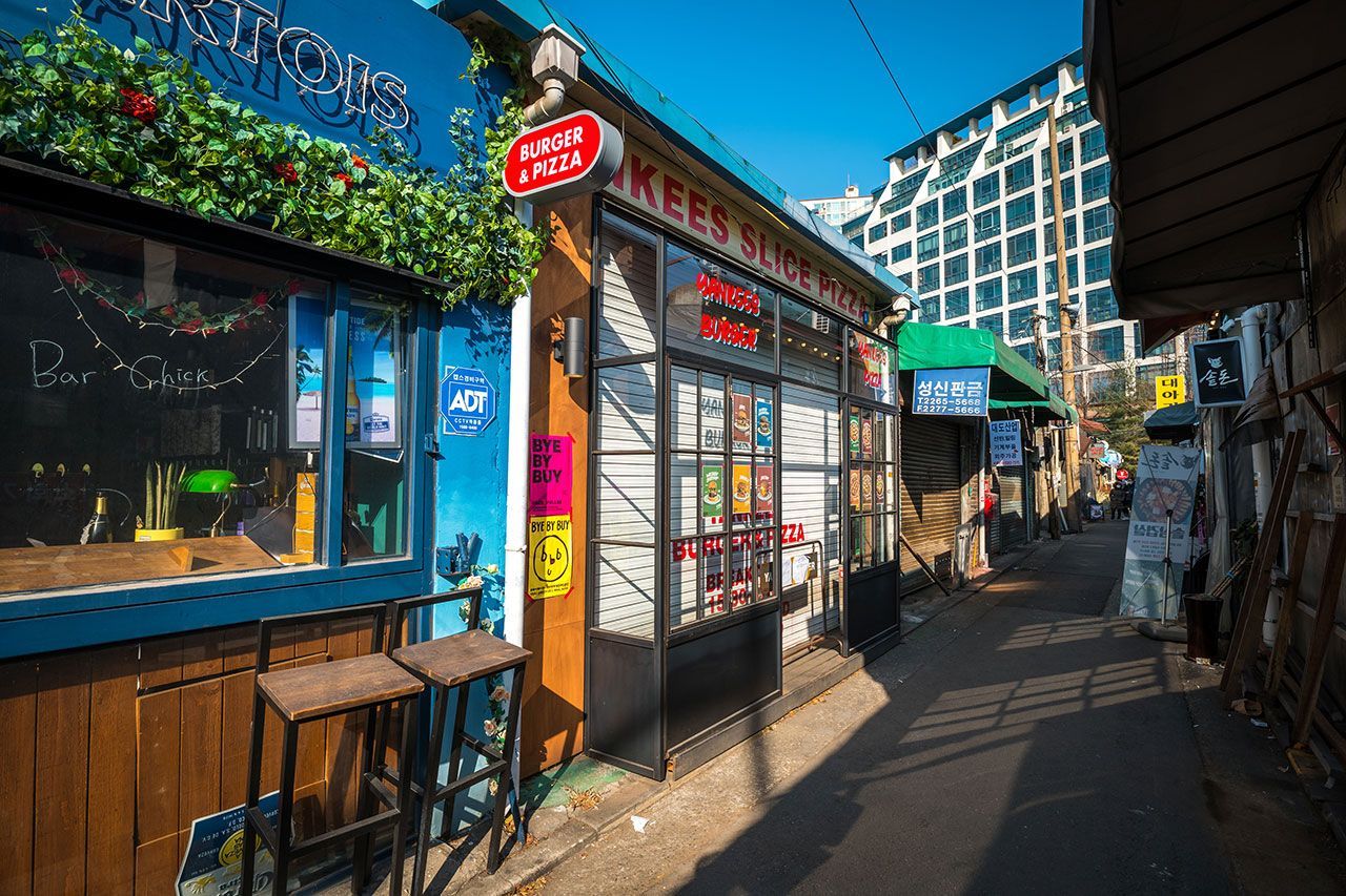
## Description Mullae Art Village in Seoul is a compelling example of an industrial district transformed into an active creative ecosystem. Once home primarily to metalworks and small foundries, the neighborhood now hosts a mix of artist studios, mural-covered facades, experimental cafes, and workshops that continue to hum with production. This coexistence of working industry and emerging creative culture lends Mullae a gritty authenticity—visitors can witness the surprising juxtaposition of active metal fabrication alongside open studio events and gallery nights. The village has become a draw for photographers, designers, and travelers looking for non-touristy creative scenes. Monthly studio openings, collaborative exhibitions, and pop-up markets animate the neighborhood, while small bars and eateries offer late-night conversation and informal artist gatherings. Mullae’s charm is not polished; it’s lived-in, evolving, and full of small discoveries. ## Location Mullae sits in Yeongdeungpo-gu, Seoul, and is accessible from Mullae Station on Line 2, with short walks into the heart of the creative cluster. The area is best explored on foot, following alleyways and industrial lanes where murals, sculptures, and studios appear around unexpected corners. ## Tips - Time visits for open-studio events or weekends when more artists and galleries welcome visitors. - Be mindful of working studios—respect cordoned areas and do not enter without permission. - Bring a camera and a sense of exploration—industrial textures, murals, and found-object sculptures make for strong photography subjects. - Support local businesses: many cafes and shops are run by artists and makers, and purchases help sustain the community. - Safety note: some areas near active workshops may have operational hazards—obey signage and keep a safe distance from machinery. ## Conclusion Mullae Art Village is a vivid, working example of how industrial neighborhoods can become creative hubs without losing their gritty character. It’s ideal for curious travelers who value authenticity, emerging art scenes, and the energetic overlap of craft and creativity. ## FAQ Q: Are studios in Mullae open to the public? A: Many studios open during scheduled studio days or events; otherwise contact artists or galleries directly for visits. Q: Is it safe to take photos in Mullae? A: Yes, in public areas, but avoid photographing inside private workshops without permission and respect workers’ safety zones. Q: Are there cafes and shops in Mullae? A: Yes—small cafes, bars, and maker-driven shops are common and offer unique handmade goods and refreshments. Q: When is the best time to visit Mullae? A: Weekends and scheduled open-studio events offer the richest experience, though weekday afternoons can be quieter for wandering. Q: How can I support the local creative community? A: Buy directly from artists, attend open-studio events, and patronize local cafes and pop-up markets. ## Links - [Mullae Art Village](https://english.seoul.go.kr/seoul-art-space-mullae-mullae-creative-village/)
GemVoyage Team • World
Siberia
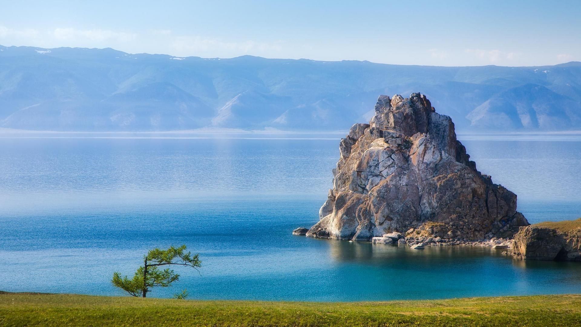
## Description Lake Baikal in southern Siberia is a global natural wonder: the world’s deepest and one of its oldest freshwater lakes, it holds roughly 20% of the planet’s unfrozen surface freshwater by volume. Stretching over 600 kilometers north-to-south and reaching depths of more than 1,600 meters, Baikal’s sheer scale is awe-inspiring. The lake’s crystalline waters, dramatic rifts, and seasonal extremes produce striking phenomena — from the unbelievable clarity of summer waters to the otherworldly expanses of transparent winter ice that allow you to walk, drive, or even ice-sail across a dazzling frozen surface. Baikal is also a hotspot of biodiversity and scientific interest. Its shoreline, submerged terraces, and deep basins host numerous endemic species found nowhere else on Earth, including the Baikal seal (nerpa) — the only seal species that has adapted to a fully freshwater environment — and dozens of endemic fish and invertebrates. The lake’s unique ecology is the result of millions of years of relative isolation, stable cold temperatures at depth, and complex nutrient cycling. Scientists study Baikal to better understand limnological processes, long-term climate records trapped in sediment layers, and the evolution of isolated ecosystems. For travelers, Baikal delivers a rare combination of dramatic landscapes and varied activities across seasons. In summer, the shoreline blooms with wildflowers, and mountain hikes and multi-day treks through taiga and steppe reveal panoramic views over the water. Kayaking, boat excursions, and shoreline camping let you sample the lake’s nearshore biodiversity and peaceful beaches. In winter, when the lake freezes, the surface becomes a vast frozen highway: locals and guides lead safe ice-walking excursions, cross-lake snowmobile trips, ice-fishing experiences, and festivals that celebrate the season. Photographers prize Baikal for its vivid ice formations, clear reflections, and light at dawn and dusk. Beyond natural spectacle, Baikal is threaded with human stories: small lakeside towns such as Listvyanka, the ferry-served Olkhon Island with its shamanic sites, and the city of Irkutsk — a historical gateway with Siberian wooden architecture and museums — are rich portals into local culture. Sustainable and low-impact travel is increasingly available via small-scale guesthouses, ecotour operators, and community-led tours that prioritize the lake’s protection. ## Location Lake Baikal spans the regions of Irkutsk Oblast and the Republic of Buryatia in Russia, with the lake forming a striking spine across southeastern Siberia. The city of Irkutsk is the primary gateway for international and domestic visitors, linked by the Trans-Siberian Railway and regional flights; it offers accommodations, museums, and transport connections. From Irkutsk, paved roads and seasonal bus services reach lakeside settlements like Listvyanka, Port Baikal, and the ferry terminals for Olkhon Island — the lake’s largest island and a cultural heartland with cliffs, shamanic sites, and small villages. Other access points include Ulan-Ude to the east and smaller regional airfields that connect via charter or seasonal flights. Travel times can be long, so many visitors plan multi-day itineraries that combine transit into the lake area with on-site exploration. ## Tips - **Respect seasonal access and local rules:** Ice travel and remote trails require local knowledge; always consult local guides and authorities before venturing onto the ice or into isolated areas. Safety equipment and up-to-date conditions are essential. - **Plan time for Olkhon Island:** Olkhon is a cultural and scenic highlight, with dramatic cliffs, shamanic sites, and small settlements. Allow several days to explore its coves, beaches, and sacred capes. - **Pack for extremes:** Even in summer, weather can shift quickly; bring layered clothing, waterproof shells, sturdy boots, sun protection, and insect repellent. In winter, prioritize thermal layers, insulated boots, and a reliable outer layer. - **Travel with experienced local guides:** Guides provide safety on ice crossings, access to lesser-known shorelines, wildlife-spotting skills, and cultural context about Buryat and Siberian heritage. Choose operators that practice sustainable tourism. - **Respect conservation rules:** Stick to marked paths, avoid disturbing nesting birds or haul-out sites, and follow Leave No Trace principles. Support local conservation initiatives when possible. - **Time your visit for activities:** Summer is best for hiking and kayaking; late spring and early autumn deliver fewer crowds and pleasant light; winter offers unique ice experiences but requires more planning. ## Conclusion Lake Baikal is both a living laboratory and a vast natural wonder: its depth, clarity, and ancient lineage make it one of Earth’s most singular freshwater realms. Whether you come for scientific curiosity, wilderness hiking, cultural exchange with lakeside communities, or simply to witness impossibly clear water and glass-like ice, Baikal rewards patient travel and respectful exploration. Plan carefully, choose sustainable operators, and allow enough time to move slowly around its bays and islands — the lake’s scale is best absorbed at human pace. ## FAQ - **Q: Can you swim in Lake Baikal?** A: Swimming is possible in summer at sheltered beaches and near lakeside villages, but the water remains cold even in peak months; stay near lifeguarded or popular swimming areas, enter gradually to avoid shock, and follow local safety guidance. - **Q: What is the best time to visit Lake Baikal?** A: Late June through September gives the warmest weather, flowering meadows, and easier trekking. Late winter (February–March) is ideal for ice-scenery photography and safe ice excursions when the ice is thickest and the light is crisp. Shoulder seasons offer quieter conditions. - **Q: How do I reach Olkhon Island, and do I need a vehicle?** A: Olkhon is reached via a seasonal ferry or ice road depending on the time of year. Many visitors rent 4x4 vehicles or join guided tours; public buses operate from nearby towns but capacity is limited. Plan logistics in advance, especially in peak season. - **Q: Are there wildlife viewing opportunities?** A: Yes—local guides can help you spot endemic fish species, waterbirds, and in protected offshore areas you may observe Baikal seals. Respect distance guidelines and avoid disturbing habitats. - **Q: Do I need special permits or visas to visit?** A: International visitors need a valid Russian visa. Some protected areas require entry fees or permits for camping and research; check with regional park authorities for up-to-date rules. - **Q: Is Internet and phone coverage available?** A: Coverage varies—cities like Irkutsk and larger settlements have decent mobile data; more remote shorelines and parts of Olkhon have limited connectivity. Prepare for periods offline and download maps or emergency contacts beforehand. ## Links -- [Lake Baikal — Wikipedia](https://en.wikipedia.org/wiki/Lake_Baikal)
GemVoyage Team • World

Comments