GemVoyage Team • World
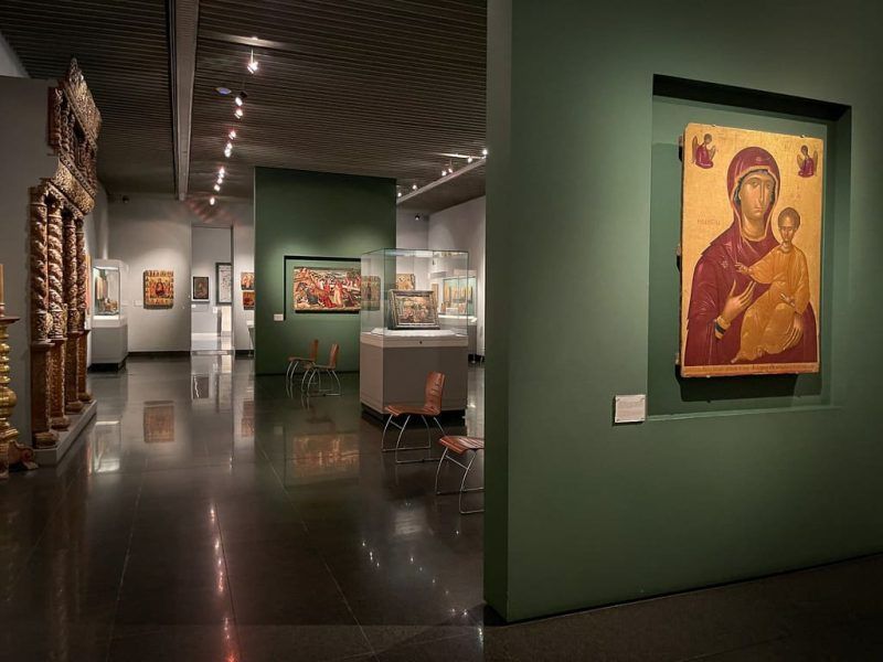
What makes the museum especially compelling is the way it links antiquity, Byzantium, Ottoman-era influence, and modern Greek identity without treating them as separate islands. The collection helps you understand that Greece’s cultural history is not only classical. It is long, evolving, and regionally diverse. That broader perspective is one of the museum’s great strengths. It is also why the Benaki is so useful to travelers who want to go beyond postcard versions of Athens.
One lesser-known fact is that the museum began as a private collection before growing into one of the country’s key public cultural institutions. Another is that its displays often reward viewers who pay attention to craftsmanship and everyday materials, not just monumental masterpieces. The result is a museum that feels intellectually rich but still accessible. You do not have to be an expert to enjoy it, though you will likely get more from it if you are interested in how objects carry cultural memory.
The Benaki is also appealing because it offers a calmer, more curated counterpoint to the dramatic scale of Athens’ ancient ruins. After time at the Acropolis or major archaeological sites, the museum gives context to the broader human story behind those stones. It helps connect art, religion, politics, and daily life. For many visitors, that synthesis is exactly what makes the visit worthwhile.
The easiest way to get there is by public transport, taxi, or on foot depending on where you are staying. Since central Athens is compact enough for many visitors to explore by walking, the museum can often be part of a broader route through nearby neighborhoods and monuments. If you are visiting multiple museums, check the specific branch or main building you plan to see, as the Benaki institution includes multiple sites and collections.
It is a good idea to pair the museum with a café stop or another nearby cultural site, especially if you want to keep the day balanced and avoid museum fatigue.
If possible, read the museum’s room structure or collection focus before entering so you can prioritize areas that match your interests.
Do not focus only on the “headline” objects. Some of the most rewarding pieces are the smaller items that reveal everyday life and social change.
If you are interested in Greek history across periods, this museum is one of the most useful stops in Athens because it connects those periods in one place.
How long should I spend there? Two hours or more is ideal if you want to see the museum properly.
Is it good for first-time visitors to Athens? Yes, especially if you want historical context beyond ancient ruins.
Does it focus only on ancient Greece? No. It covers a much broader cultural timeline.
Is it easy to reach? Yes, it is centrally located and straightforward to access.
Discover more hidden gems you might love.
Laos
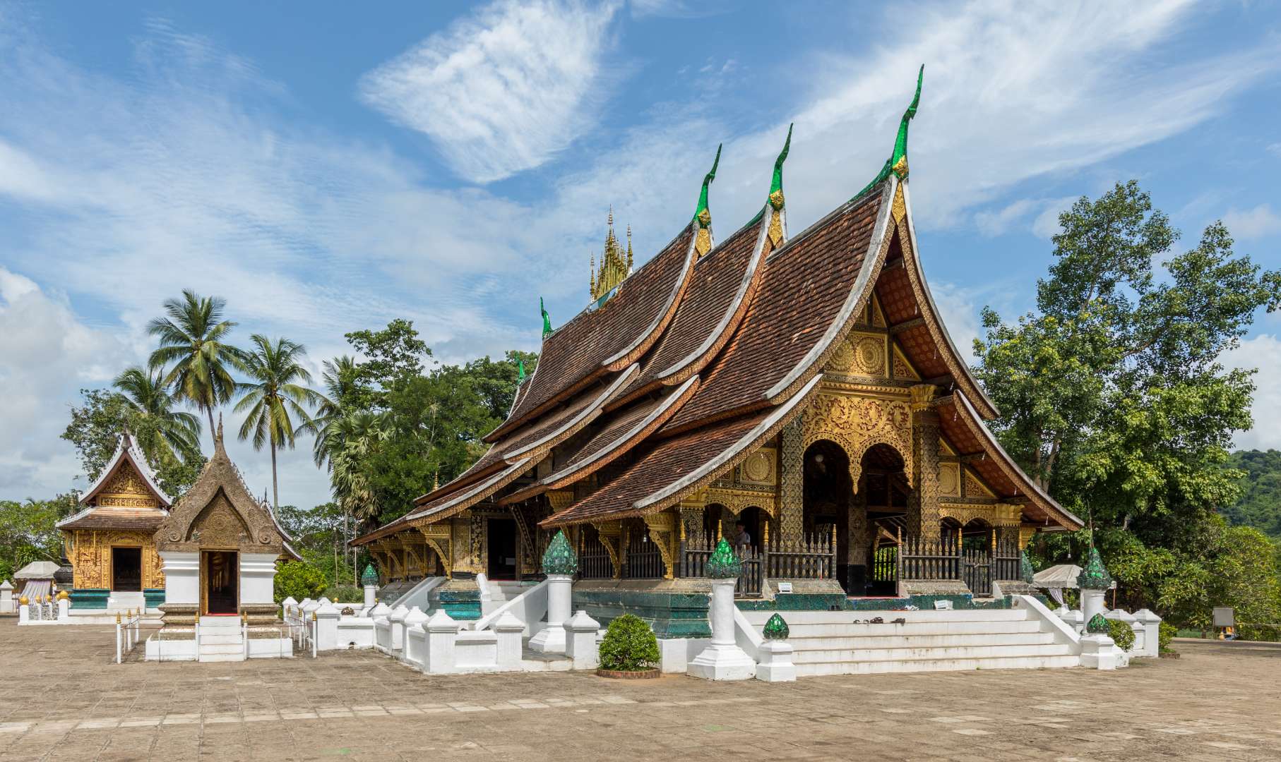
## Description Wat Xieng Thong, often referred to as the “Temple of the Golden City,” is one of the most revered and architecturally significant Buddhist temples in Laos. Located in the UNESCO World Heritage city of Luang Prabang, this 16th-century temple is a masterpiece of traditional Lao art and religious devotion. Built in 1560 by King Setthathirath, Wat Xieng Thong served as a royal temple and played a central role in religious ceremonies, coronations, and cultural festivals. The temple complex features over twenty structures, including shrines, pavilions, and monks’ quarters. Its centerpiece is the sim (main sanctuary), known for its sweeping multi-tiered roof that nearly touches the ground—a hallmark of classic Luang Prabang style. The rear façade of the sim is adorned with a stunning mosaic of the “Tree of Life,” a symbolic depiction of spiritual growth and harmony. Inside, gold stenciling on black lacquered walls illustrates scenes from Buddhist cosmology and the legendary life of King Chanthaphanith. A little-known fact: Wat Xieng Thong was spared during the sacking of Luang Prabang in 1887 by the Black Flag Haw. The invading leader, Deo Van Tri, had studied at the temple as a monk and chose to use it as his headquarters rather than destroy it. Another unique feature is the temple’s funerary carriage house, which contains an elaborate royal funeral chariot and urns used in cremation ceremonies for members of the royal family. ## Location Wat Xieng Thong is located in **Laos**, in the **Luang Prabang Province**, within the city of **Luang Prabang**. It sits at the northern tip of the peninsula formed by the Mekong and Nam Khan rivers, offering scenic views and a peaceful atmosphere. ### How to Get There - **By Foot**: If you're staying in central Luang Prabang, the temple is easily accessible by walking along the riverfront or through the old town. - **By Bicycle**: Renting a bike is a popular way to explore the city and reach Wat Xieng Thong. - **By Tuk-Tuk**: Local tuk-tuks can take you directly to the temple entrance from anywhere in town. - **By Boat**: Some river tours include a stop at the temple, offering a unique approach from the Mekong. Its location near other major attractions makes it an ideal starting point for a day of cultural exploration. ## Tips - **Visit Early or Late**: Morning and late afternoon offer softer light for photography and fewer crowds. - **Dress Modestly**: As with all religious sites in Laos, shoulders and knees should be covered. Scarves or sarongs are often available at the entrance. - **Take Your Time**: The temple complex is rich in detail. Allocate at least an hour to explore the sim, chapels, and surrounding gardens. - **Hire a Guide**: A local guide can provide deeper insights into the temple’s history, symbolism, and architecture. - **Respect the Space**: Be quiet and respectful, especially when monks are present or prayers are taking place. - **Check for Festivals**: Wat Xieng Thong hosts several annual religious events, including Pi Mai (Lao New Year), which features traditional rituals and processions. ## Conclusion Wat Xieng Thong is a cultural and spiritual gem in Luang Prabang, showcasing the elegance of Lao architecture and the depth of its Buddhist traditions. With its rich history, artistic beauty, and tranquil setting, it offers a profound and memorable experience for visitors. ## FAQ **1. What are the opening hours of Wat Xieng Thong?** The temple is open daily from 8:00 AM to 5:00 PM. **2. Is there an entrance fee?** Yes, the entrance fee is typically around 20,000 Kip per person. **3. Can non-Buddhists visit the temple?** Yes, Wat Xieng Thong is open to all visitors, regardless of religious background. **4. Is photography allowed inside the temple?** Photography is allowed in most areas, but flash and tripods are discouraged. Always be respectful. **5. Are there guided tours available?** Yes, local guides can be hired in Luang Prabang or at the temple entrance. **6. Is the temple wheelchair accessible?** Some areas may be difficult to access due to steps and uneven ground, but the main courtyard is relatively flat. ## Links - [Wat Xieng Thong – Wikipedia Overview](https://en.wikipedia.org/wiki/Wat_Xieng_Thong)
GemVoyage Team • World
Amsterdam
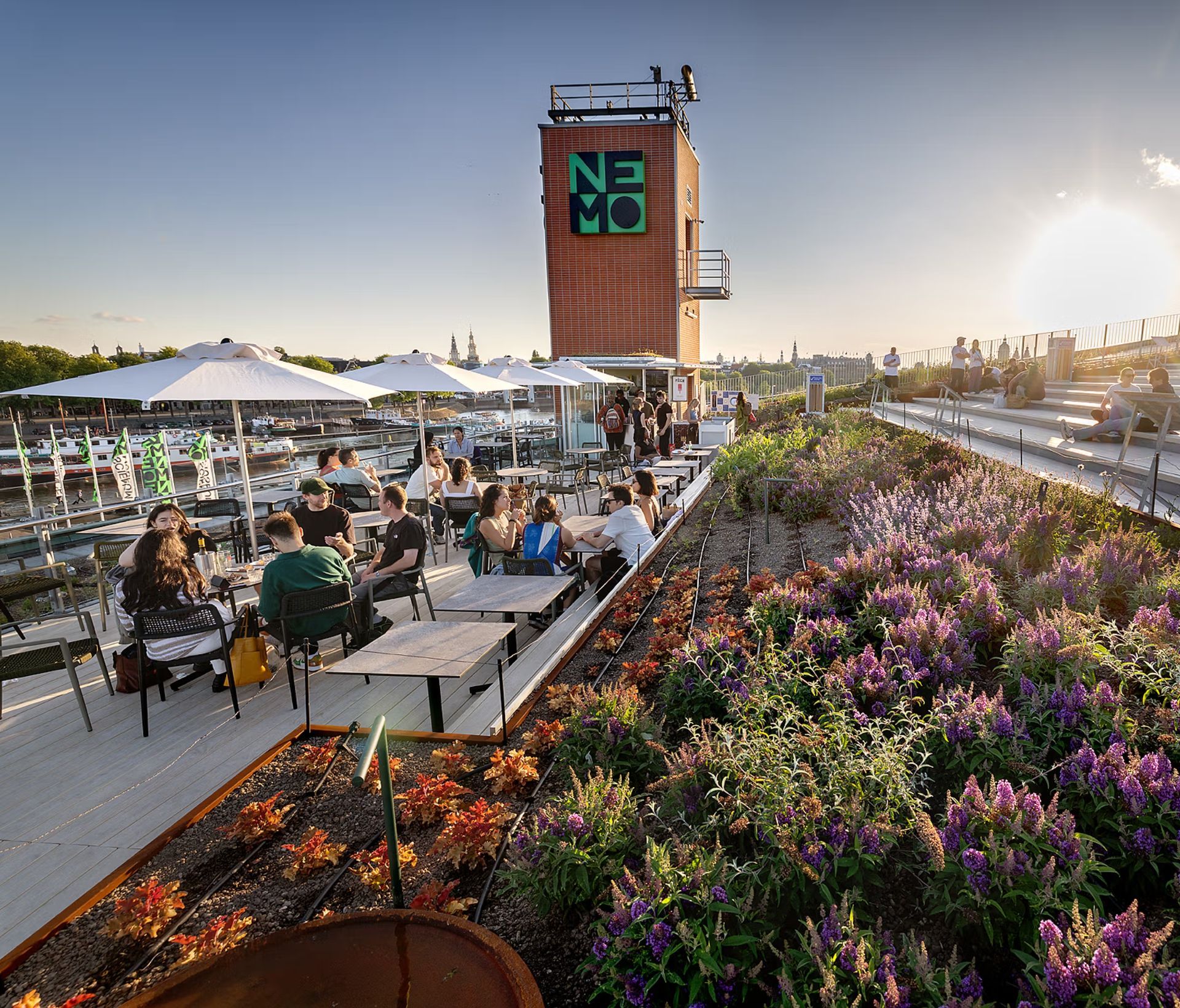
## Description Amsterdam is a city of canals, bicycles, and centuries of history layered into every brick and bridge. Among its many attractions, one of the most underrated and genuinely delightful experiences is the rooftop terrace of NEMO Science Museum. Sitting on top of one of the city's most architecturally distinctive buildings, the rooftop offers a panoramic view over the historic city center that is difficult to match from any other vantage point. What makes it particularly remarkable is that access to the rooftop is entirely free, even for visitors who do not have a ticket to the museum itself. NEMO is housed in a building designed by the renowned Italian architect Renzo Piano, who is also responsible for landmarks such as the Centre Pompidou in Paris and The Shard in London. The building, which opened in 1997, is shaped to resemble the bow of a large ship emerging from the water of the Oosterdok harbor. This is no coincidence: the building was designed in the shape it has because it sits directly above the entrance to the IJ tunnel, one of the major road tunnels running beneath Amsterdam's waterways. The rooftop continues this nautical theme, with its sloping green surface and tiered terraces that feel like the decks of a great vessel. One fact that many visitors do not know is that in summer the rooftop transforms into a seasonal outdoor swimming spot. A small temporary pool is set up on the roof, offering an extraordinary place to swim with views over one of Europe's most beautiful city skylines. This is one of the more unusual and memorable experiences available in Amsterdam and yet it remains relatively unknown outside the city. Another interesting detail is that the rooftop is accessible via an outdoor staircase on the side of the building, meaning you do not need to pass through the museum entrance at all, making it a truly accessible and free outdoor space. The view from the top takes in the historic canal houses of the city center, the Centraal Station, the open harbor, the Scheepvaartmuseum, and on clear days extends far into the distance across the flat Dutch landscape. Sunset from the rooftop is particularly spectacular, with the low northern light casting long golden shadows across the water and rooftops below. ## Location NEMO Science Museum is located in the Oosterdok area of central Amsterdam, in the Netherlands. The full address is Oosterdok 2, 1011 VX Amsterdam. It sits on a man-made peninsula that juts into the Oosterdok harbor, directly adjacent to the historic city center. Getting there is straightforward. From Amsterdam Centraal Station, the museum is a short walk of approximately 10 to 15 minutes. Head east along the waterfront, passing the Scheepvaartmuseum and following the signs for NEMO. The building is unmistakable from a distance given its distinctive ship-like form rising above the harbor. Tram and bus routes also stop near the museum, and the area is easily navigated by bicycle, which is of course the most Amsterdam way to travel. There is limited parking for cars in the area, so public transport or cycling is recommended. ## Tips - **Access the rooftop for free.** The outdoor staircase on the side of the building leads directly to the rooftop without requiring a museum ticket. This makes it an excellent option for travelers on a budget or those who simply want the view. - **Arrive around sunset.** The rooftop faces west and southwest, making it an ideal spot to watch the sun go down over the city. The light during golden hour is extraordinary and the view becomes particularly photogenic. - **Visit during summer for the rooftop pool.** If you are visiting Amsterdam between late June and August, the temporary rooftop swimming pool is a unique experience. Check NEMO's website for the exact dates each year as they vary. - **Combine the visit with the museum.** If you have children or are interested in science and technology, the NEMO museum itself is excellent and well worth a visit. The interactive exhibits are engaging for adults as well as children. - **Go on a clear day.** The view is best when the weather is clear. Amsterdam's weather can be unpredictable, so check the forecast and pick a clear afternoon for the best experience. - **The rooftop has seating and a cafe in season.** During the summer months, a cafe operates on the rooftop serving drinks and light food. Arriving with time to sit and take in the view is well worthwhile. ## Conclusion The rooftop of NEMO Science Museum is one of those rare places that manages to be both completely free and genuinely extraordinary. In a city as beautiful and well-visited as Amsterdam, finding a spot that offers such a commanding view without crowds or admission fees is a genuine discovery. Whether you are visiting for the view, the architecture, the seasonal swimming pool, or simply a quiet place to sit above the city, the NEMO rooftop delivers an experience that will stay with you long after you have left Amsterdam. ## FAQ **Is the NEMO rooftop really free to access?** Yes. The rooftop terrace is accessible via an outdoor staircase that does not require a museum ticket. You can visit the rooftop completely free of charge at any time during the museum's opening hours. Note that during special evening events the rooftop may have a separate admission. **What are the opening hours of the rooftop?** The rooftop is generally accessible during the same hours as the museum, which is typically open Tuesday through Sunday from 10:00 AM to 5:30 PM. It is closed on most Mondays except during school holidays. Always verify the current hours on the official NEMO website before visiting. **When does the rooftop swimming pool open?** The swimming pool on the NEMO rooftop is a seasonal installation that operates during the summer months, typically from late June to late August. Exact dates vary each year and should be checked on the official NEMO website. **Who designed the NEMO building?** The NEMO building was designed by Italian architect Renzo Piano. It opened in 1997 and has since become one of Amsterdam's most recognizable modern landmarks. The building's ship-like shape is a reference to its location above the IJ tunnel and the surrounding harbor. **Is NEMO suitable for adults without children?** Absolutely. While NEMO is particularly popular with families and school groups, the museum's exhibits are engaging for adults as well. Even visitors who have no interest in the museum interior will find the rooftop rewarding. **Is the rooftop accessible by wheelchair?** The outdoor staircase that provides free access to the rooftop is not wheelchair accessible. However, wheelchair users can access the rooftop via the elevator inside the museum, which does require a museum ticket. NEMO is generally well equipped for visitors with mobility requirements. ## Links - [NEMO Science Museum Official Website](https://www.nemosciencemuseum.nl/en) - [NEMO Science Museum on Wikipedia](https://en.wikipedia.org/wiki/NEMO_(museum)) - [Amsterdam Tourism Official Website](https://www.iamsterdam.com)
GemVoyage Team • World

Rome
## Description Janiculum Hill (Gianicolo) stands as one of Rome’s most rewarding scenic vantage points, offering sweeping panoramas of the city’s rooftops, domes and spires, with St. Peter’s Basilica prominently on the skyline. Unlike the classical seven hills of ancient Rome, Janiculum sits to the west of the Tiber and has a distinct character: it combines leafy public gardens, impressive monuments to Italy’s 19th-century unification heroes, and pockets of quiet away from the densest tourist routes. Visitors come to linger on terraces and balustrades, photograph the city at golden hour, and stroll the shaded promenades lined with cypress and plane trees. What makes Janiculum special is its layered atmosphere — it’s part memorial, part urban park and part living neighborhood. Statues and memorials, including the commanding equestrian statue of Giuseppe Garibaldi, recall Italy’s Risorgimento period and add historic depth to the views. The hill is studded with small chapels, fountains such as the striking Fontana dell'Acqua Paola (also called Il Fontanone), and hidden viewpoints that look across the Tiber to the heart of ancient Rome. Little-known facts: Janiculum is home to several international monuments (including busts and memorials to foreign volunteers who fought for Italy) and there’s a long-standing local tradition of a noon cannon shot — a historical custom that punctuates the day and ties the hill into Rome’s lived rituals. ## Location Janiculum Hill is located in Rome, Lazio region, Italy, on the west bank of the Tiber River opposite the historic Trastevere and the ancient core of the city. The main terraces and the most frequented viewpoints cluster along the Via Garibaldi and the Passeggiata del Gianicolo, a ridge that runs north-south. The nearest neighborhoods are Trastevere (below the hill) and the residential Monteverde and Gianicolense districts. To get there: from central Rome, one of the most pleasant routes is to walk up from Piazza Trilussa in Trastevere and ascend via the Viale del Gianicolo or the stairways that connect Trastevere’s lanes to the hill’s terraces. Public transport options include buses that serve nearby stops (check local routes such as lines that head to Trastevere and Monteverde) or taking tram/bus to the Trastevere rail station and walking up. Taxis or ride-hailing services can drop you near the top terraces for a short walk. For visitors who prefer a guided introduction, many walking tours of Trastevere and the Janiculum combine history and views. ## Tips - Timing: For the most stunning light, aim for the hour before sunset (golden hour) for warm, cinematic views and photographs. Early morning offers quieter conditions and softer light. The hill can be breezy in late afternoon. - Crowds: The terraces are popular but not overcrowded like central squares. Weekdays and early mornings are best to avoid local visitors during weekends. - Security & comfort: Pickpocketing is less common here than in dense tourist hubs, but keep usual precautions. Wear comfortable shoes for cobbled paths and steps. - Amenities: There are a few cafés and kiosks nearby, but consider bringing water, especially in summer. Public restrooms are limited; plan accordingly. - Seasons: Spring and autumn are ideal for pleasant temperatures; summer can be hot and busier. Winter offers crisp air and clearer long-distance visibility on good days. - Photography: Bring a zoom lens for close-ups of city details and a wide angle for sweeping skyline shots. Some viewpoints are fenced; respect barriers and private property. ## Conclusion Janiculum Hill is a peaceful, evocative corner of Rome where panoramic views meet commemorative monuments and shady walks. It rewards visitors who step just a little off the busiest tourist routes with moments of true perspective—on the city’s urban spread, its historical layers, and its daily life. Whether you come for sunset, a reflective stroll among monuments, or to trace lesser-known aspects of modern Italian history, Janiculum offers an intimate, memorable encounter with Rome. ## FAQ Q: Is Janiculum Hill within walking distance from the historic center? A: Yes. From Trastevere and several central points it is a manageable walk; stairways and slopes connect it to the historic center. Q: Is there an entrance fee? A: No. Janiculum’s public terraces and gardens are free to visit. Q: Are there guided tours available? A: Yes. Many walking tours of Trastevere and specialized history tours include Janiculum; private guides can provide deeper context on the monuments. Q: Is the area safe at night? A: Generally yes, but standard urban precautions apply—stick to well-lit areas and main promenades. Q: Can I drive up? A: Driving is possible to some upper roads and viewpoints, but parking is limited. A drop-off is convenient. ## Links [Wikipedia: Gianicolo (Janiculum)](https://en.wikipedia.org/wiki/Janiculum) [Roma Turismo / Visit Rome (official tourism guides)](https://www.turismoroma.it)
GemVoyage Team • World
Seoul
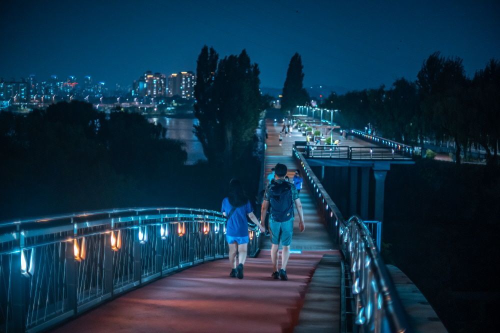
## Description Seonyudo Park is a standout example of urban ecological design: a former water treatment plant reborn as a thoughtfully landscaped public park on an island in the Han River. The designers preserved key elements of the plant—filter basins, machinery platforms, and concrete shells—and repurposed them as botanical displays, reflective ponds and educational spaces. The result is a layered experience where industrial memory and living ecology intersect: walking routes weave through restored filtration beds, shaded groves, themed gardens and interpretive exhibits that explain water purification and habitat restoration. Visitors appreciate Seonyudo for its inviting balance of engineered structure and natural regeneration. The greenhouse and wetland areas host seasonal plantings and migratory birds, while the decks and viewpoints offer long riverside panoramas that are particularly striking at sunset. Beyond the visual appeal, the park operates as a civic classroom: plaques and small exhibits outline the former plant operations and current sustainability initiatives, helping visitors of all ages understand ecological cycles and urban water systems. Seonyudo’s design also makes it a pleasant social space: picnic spots, quiet courtyards and accessible pathways encourage lingering, and occasional cultural events—workshops, guided ecological walks and small performances—lend the park a local community feel. For urban planners, photographers and families alike, Seonyudo Park is a model of how industrial remnants can be transformed into resilient public amenities. ## Location Seonyudo Park sits on Seonyudo Island in the Han River within Mapo-gu, central Seoul. The island is easy to reach by the pedestrian footbridge connecting to the northern riverbank near Dangsan, and public transit options include Seonyudo Station (Line 9) and nearby bus stops. Cyclists frequently access the island via the riverside cycling paths that thread along the Han. Because Seonyudo is integrated into the riverfront network, you can combine a visit with a longer riverside ride or walk that links to adjacent parks and cultural districts. The park’s central location makes it an accessible stop during a day exploring Mapo and the west bank of the Han. ## Tips - Go in late afternoon or early evening for the best light and cooler temperatures, especially in summer. - Rent or bring a bicycle to follow the riverside paths; Seonyudo is well connected to Seoul’s cycling routes. - Take the short interpretive walk through the former filter beds to learn about the site’s history and water treatment processes—signage and occasional guided tours add context. - Pack a picnic or a light snack; while there are small kiosks at times, facilities are limited compared with larger parks. - Watch for seasonal plantings and bird migrations—spring and autumn are especially rewarding for flora and fauna observation. ## Conclusion Seonyudo Park exemplifies how thoughtful design can convert industrial infrastructure into productive green space. It rewards visitors who are curious about urban sustainability, landscape architecture and the layered histories of cities. Whether you are a photographer seeking unique compositions of water and concrete, a family looking for a quiet riverside escape, or a planner studying adaptive reuse, Seonyudo offers a memorable, instructive and restful visit. ## FAQ Q: Is there an entrance fee? A: No. Seonyudo Park is a public park and free to enter, though some seasonal programs or guided workshops may have small fees. Q: Are dogs allowed in the park? A: Dogs are generally allowed but must be kept on a leash and under control; check posted rules for specific zone restrictions. Q: Are there restroom facilities and drinking water? A: Public restrooms and water fountains are available near principal access points, but facilities can be limited—carry water for long summer visits. Q: Can I cycle across the park? A: Cycling routes approach and circle the island; on-site cycling may be restricted in certain pedestrian or ecological zones—dismount where indicated. Q: Is there parking nearby? A: Limited parking is available along nearby roads, but public transit and cycling routes are the preferred ways to reach the island. ## Links - [Seonyudo Park (Wikipedia)](https://en.wikipedia.org/wiki/Seonyudo_Park)
GemVoyage Team • World
Zagreb
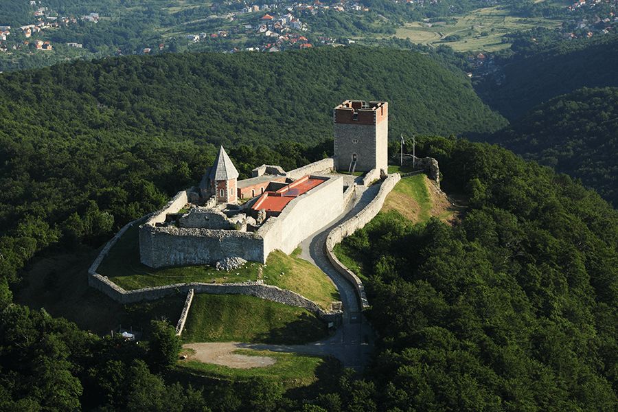
## Description Medvedgrad is a medieval fortress perched high on the southern slopes of Mount Medvednica, overlooking the city of Zagreb. Built in the 13th century following the Mongol invasion of the region, the fortress was designed as a defensive stronghold and later developed into a noble residence. Today, Medvedgrad stands as a powerful symbol of Croatian history, resilience, and national identity, offering visitors both historical insight and sweeping views of the surrounding landscape. What makes Medvedgrad unique is its dramatic setting and layered past. The fortress features preserved walls, towers, courtyards, and chapels that reveal how medieval life and defense were organized. A little-known fact is that Medvedgrad was abandoned relatively early, partly due to repeated earthquakes and difficulties accessing water on the hilltop. Another lesser-known detail is the presence of the “Altar of the Homeland,” a modern memorial within the fortress complex dedicated to Croatian independence, blending medieval heritage with contemporary national symbolism. Walking through Medvedgrad allows visitors to step back in time while also enjoying panoramic views over Zagreb and, on clear days, far beyond. ## Location Medvedgrad is located in **Croatia**, in the **City of Zagreb**, on **Mount Medvednica**, just north of the city center. The fortress sits above the neighborhood of Šestine, surrounded by forested hills and hiking trails. Visitors can reach Medvedgrad by car, taxi, or on foot via marked hiking paths from nearby neighborhoods or Medvednica Nature Park. Driving is the most convenient option, with parking available near the site, followed by a short walk. For those who enjoy outdoor activities, hiking up to Medvedgrad is a popular choice and offers scenic views along the way. ## Tips * Wear comfortable shoes, especially if you plan to hike or explore uneven stone surfaces. * Visit on a clear day to fully enjoy the panoramic views of Zagreb and the surrounding countryside. * Allow time to explore the interior exhibition spaces, which provide historical context. * Bring water and sun protection, particularly during warmer months. * Combine your visit with a walk or picnic in Medvednica Nature Park. * Check opening hours in advance, as they may vary by season. ## Conclusion Medvedgrad is a striking blend of medieval history, natural beauty, and national symbolism. Its hilltop location, well-preserved ruins, and scenic views make it one of Zagreb’s most rewarding attractions for history enthusiasts and nature lovers alike. ## FAQ **When was Medvedgrad built?** The fortress was constructed in the mid-13th century after the Mongol invasion of the region. **How long does a visit take?** Most visitors spend one to two hours exploring the fortress and enjoying the views. **Is Medvedgrad suitable for children?** Yes, though children should be supervised due to uneven terrain and high walls. **Is there an entrance fee?** Yes, a modest entrance fee is usually required to access the site. **Can I hike to Medvedgrad?** Yes, several marked hiking trails lead to the fortress from nearby areas. ## Links * [Medvedgrad Official Information](https://www.medvedgrad.hr) * [Zagreb Tourist Board](https://www.infozagreb.hr/hr)
GemVoyage Team • World
Denmark
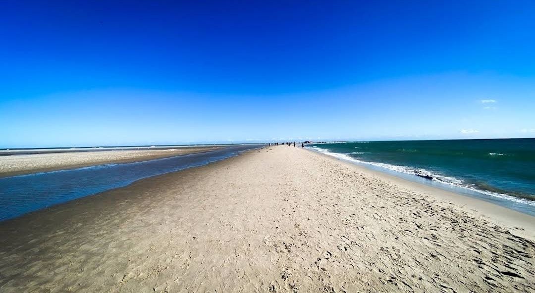
## Description **Grenen** is one of Denmark’s most extraordinary natural landmarks, where two seas—the **Skagerrak** and the **Kattegat**—dramatically meet. At the northernmost tip of Jutland, visitors can witness the unique sight of waves colliding from different directions, creating a visible line in the water. This natural phenomenon makes Grenen one of Denmark’s most visited and photographed attractions. The area is not just about the sea—it’s a place of raw beauty. The sandbar stretches far out into the water, and as you walk along the beach, you’ll be surrounded by endless skies, shifting sands, and fresh sea air. Many visitors find it both a peaceful and powerful experience. **Little-known facts**: * Grenen has been gradually moving northeast for centuries due to sand and tidal currents. The spit extends a few meters every year, reshaping the coastline bit by bit. * The area is also a paradise for birdwatchers. Because of its geographical location, Grenen is one of the best places in Denmark to spot migratory birds, especially in spring and autumn. --- ## Location Grenen is located just outside **Skagen**, a charming coastal town at the very top of **North Jutland**, in **Denmark**. Skagen itself is known for its distinctive yellow houses with red-tiled roofs and its long artistic tradition, but Grenen is the crown jewel of the area. ### How to get there: * From **Skagen town center**, Grenen is about 3 kilometers away. Visitors can walk, cycle, or take the famous **Sandormen tractor bus**, which transports people directly to the tip of the spit. * If you’re coming from other parts of Denmark, you can reach Skagen by train or bus via Frederikshavn, or by car along the scenic coastal roads. Once in Skagen, Grenen is well signposted and easy to access. --- ## Tips * **Wear suitable shoes**: The sandy terrain can be uneven, and the walk to the very tip can take around 20–30 minutes. Comfortable shoes or sandals are recommended. * **Don’t swim**: Although it may be tempting, swimming at Grenen is strictly discouraged. The currents where the two seas meet are extremely strong and unpredictable. * **Try the Sandormen ride**: The tractor-pulled bus called *Sandormen* has been operating since 1947 and is a fun, practical way to reach the very end of the spit. * **Bring a camera**: The meeting of the seas is a stunning photo opportunity, especially at sunset when the sky lights up in beautiful colors. * **Visit Skagen’s attractions too**: After Grenen, explore Skagen’s art museums, lighthouses, and the nearby Råbjerg Mile, Denmark’s largest migrating sand dune. --- ## Conclusion Grenen is more than just Denmark’s northern tip—it’s a rare natural spectacle where two seas clash, shaping the land and leaving visitors in awe. Its ever-changing landscape, combined with rich wildlife and historical charm, makes it a must-see for anyone traveling to North Jutland. Whether you walk barefoot in the sand, take the Sandormen, or simply sit and admire the horizon, a visit to Grenen promises memories of Denmark’s wild and beautiful coastline. --- ## FAQ **1. What makes Grenen special?** Grenen is where the Skagerrak and Kattegat seas meet, creating a visible collision of waves. It’s also one of Denmark’s most scenic natural areas. **2. Can you swim at Grenen?** No, swimming is not allowed due to extremely strong and dangerous currents at the meeting point of the seas. **3. How do you get to the very tip of Grenen?** You can walk along the beach from Skagen or take the Sandormen tractor bus, which drives visitors directly to the point. **4. Is Grenen suitable for children and families?** Yes, Grenen is family-friendly. Kids usually enjoy the tractor ride and spotting seals or birds along the coast, but parents should keep them away from the water’s edge. **5. Are there animals to see at Grenen?** Yes, Grenen is known for bird migration, and you may also see seals resting on the sandbanks. **6. When is the best time to visit Grenen?** Grenen is open year-round, but the best times are spring and summer for pleasant weather, or autumn for dramatic skies and bird migration. --- ## Links * [Visit Denmark – Grenen](https://www.visitdenmark.com/denmark/plan-your-trip/grenen-skagen-gdk640520) * [Sandormen Tractor Bus – Official Info](https://www.sandormen.dk/)
GemVoyage Team • World

Comments