GemVoyage Team • World
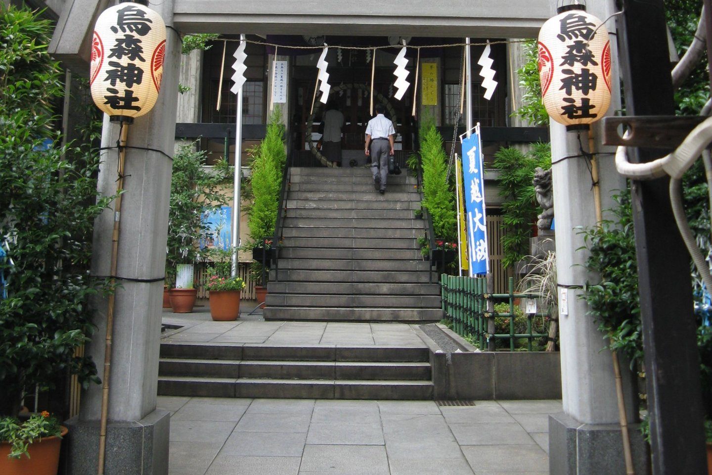
Karasumori Shrine (烏森神社) is a small yet deeply symbolic Shinto shrine tucked into one of Tokyo’s most modern and fast-paced districts. Unlike large, monumental shrines surrounded by forests or expansive grounds, Karasumori stands out precisely because of its contrast with its surroundings. Encircled by office towers, restaurants, and neon-lit streets near Shimbashi, the shrine feels like a quiet spiritual pocket preserved inside the machinery of the modern city.
The shrine is dedicated primarily to Ame-no-Uzume-no-Mikoto, a Shinto deity associated with joy, performance, and the arts, as well as protection from misfortune. Because of this, Karasumori Shrine has long been popular with actors, entertainers, businesspeople, and office workers, all of whom come to pray for success, smooth communication, and good fortune in their professional lives.
What truly makes Karasumori Shrine unique is its distinctive omamori (protective charms). These charms are unusually colorful, often featuring bright red, yellow, blue, and green threads rather than the subdued tones found at most shrines. According to shrine tradition, these colors represent protection from misfortune arriving from any direction. This detail is relatively unknown outside Japan and has helped the shrine develop a quiet but loyal following among locals.
Another lesser-known fact is that Karasumori Shrine was originally located closer to Edo Castle but was moved to its current position during urban development. Despite its relocation, it retained strong ties to merchants and workers, which explains its enduring relevance in a business district rather than a residential or historical one. The shrine has also survived fires, earthquakes, and wartime destruction, making it a subtle symbol of resilience amid Tokyo’s constant transformation.
Karasumori Shrine is not a place for grand ceremonies or long visits. Its value lies in intimacy, symbolism, and continuity, offering a moment of pause rather than spectacle.
Country: Japan
Region: Kantō
City: Tokyo
Ward: Minato
Area: Shimbashi
Karasumori Shrine is located just a short distance from Shimbashi Station, one of Tokyo’s major transportation hubs and a center for office culture and nightlife.
* JR Yamanote Line, Keihin-Tohoku Line, or Tokyo Metro Ginza Line to Shimbashi Station. From the Karasumori Exit, the shrine is a 2–3 minute walk.
* Toei Asakusa Line to Shimbashi Station, also within walking distance.
* Easily accessible if you are exploring central Tokyo districts such as Ginza or Shiodome.
* A convenient option due to the shrine’s central location, though unnecessary given public transport access.
Karasumori Shrine offers a rare glimpse into Tokyo’s spiritual life as it exists today, not as a preserved relic but as a living part of the urban routine. Small, understated, and symbolic, it rewards visitors who value authenticity and subtlety over grandeur.
1. Is Karasumori Shrine famous?
It is well-known among locals but relatively unknown to international tourists.
2. Is there an entrance fee?
No, entry is free.
3. How long should I spend there?
Around 15 to 30 minutes is sufficient.
4. What is the shrine best known for?
Its colorful protective charms and prayers for career success and good fortune.
5. Is it suitable for first-time visitors to a Shinto shrine?
Yes, its small size makes it approachable and easy to understand.
6. Can I combine it with other attractions?
Yes, it pairs well with visits to Ginza, Shiodome, or nearby dining areas.
Discover more hidden gems you might love.
Beijing
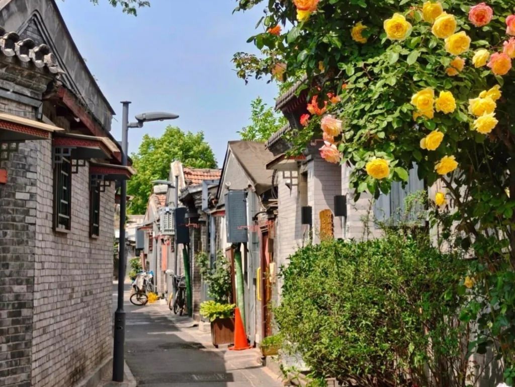
## Description Qinhuangdao Alley Hutongs, as a travel idea, points to one of Beijing’s most rewarding urban experiences: moving through the city’s traditional hutong lanes and seeing how historic residential fabric still shapes everyday life. Hutongs are not grand monuments in the usual sense. They are narrow lanes, courtyard-house networks, and neighborhood corridors that preserve a more intimate view of Beijing than the city’s large avenues and famous landmarks. That is exactly why they remain so compelling. They let visitors step into the scale of older Beijing, where community, domestic life, and street activity sit in close proximity. The appeal of the hutong experience lies in its texture. Instead of one single iconic object, you get layered details: gray brick walls, courtyard entrances, hand-painted signs, hidden cafés, neighborhood shops, bicycles, small temples, and the daily rhythm of residents going about ordinary routines. A lesser-known fact is that hutongs are not just tourist curiosities; they are living urban forms that have survived because they still support local life, even as some areas have changed dramatically. Another overlooked detail is that many of the most interesting hutong walks reveal small architectural differences from lane to lane, including gate styles, courtyard layouts, and adaptations made over time to fit modern use. If you are traveling in Beijing for the first time, hutongs can be one of the most useful experiences you choose because they explain the city in a human-scale way. They show how neighborhoods are organized, how people move, and how history remains present without always announcing itself loudly. Unlike large museums, the hutong district does not ask you to stand still. It invites you to wander, notice, and compare. That makes it especially rewarding for slow travelers, photographers, architecture lovers, and anyone who prefers atmosphere over checklist sightseeing. The name “Qinhuangdao Alley Hutongs” may be used locally or descriptively, but the broader experience belongs firmly to Beijing’s historic center. Rather than approaching it as a single fenced attraction, think of it as a neighborhood exploration. That mindset will help you appreciate it much more fully. ## Location The hutong experience is centered in Beijing Municipality, China, especially in the older districts of Dongcheng and Xicheng where historic lanes remain most visible. Depending on the exact lane or alley you plan to visit, you may be close to landmarks such as Shichahai, Nanluoguxiang, the Bell and Drum Towers, or other traditional neighborhoods. Because hutongs are embedded in the city’s fabric, their location is best understood as a district-level experience rather than a single destination pin. Getting there is usually easiest by subway, followed by a short walk. Beijing’s public transit network is efficient for reaching the historic core, and once you exit the station, the pleasure comes from entering the smaller lanes on foot. Taxis and rideshares are also practical, but traffic can make them slower than the metro during busy hours. If you prefer a more immersive approach, combine subway access with a walking route that allows for detours into side streets. Because the exact lanes can be harder to define than a single monument, it helps to visit with an open itinerary. Choose a starting point in a known hutong district and then let the side alleys guide your exploration. That approach usually produces the most interesting results. ## Tips Walk slowly. Hutongs reward attention to detail, and many of their best moments are found between the obvious sights. Respect private space. These are living neighborhoods, not theme park sets, so it is important to be considerate when taking photos or peering into courtyards. Visit at a comfortable time of day. Morning and late afternoon often feel more pleasant for walking, with softer light and a calmer pace. Combine the walk with food. Small noodle shops, tea spots, and casual eateries can turn a simple stroll into a much richer cultural experience. Do not try to “finish” the hutongs. The value is in wandering a manageable section well, not in covering everything. ## Conclusion The hutongs of Beijing offer one of the most atmospheric ways to understand the city. They are historic, living, and quietly beautiful, with enough variation to reward curiosity at every turn. For travelers who want Beijing beyond its headline monuments, this is an essential experience. ## FAQ ### What is a hutong? A hutong is a traditional Beijing alley or lane, usually linked to courtyard-house neighborhoods. The form reflects older patterns of urban life and remains an important part of the city’s identity. ### Are hutongs still inhabited? Yes. Many hutong areas are still lived in, even though some have been renovated, adapted, or repurposed for commerce and tourism. ### Is this more of a walking experience than a fixed attraction? Exactly. Hutongs are best understood as a walkable neighborhood environment rather than a single enclosed site. ### How long should I spend there? A focused walk might take 1 to 2 hours, but a more rewarding visit can easily stretch longer if you stop for food, tea, or photography. ## Links - [Hutong on Wikipedia](https://en.wikipedia.org/wiki/Hutong) - [Beijing official tourism](https://english.beijing.gov.cn/)
GemVoyage Team • World
Barcelona
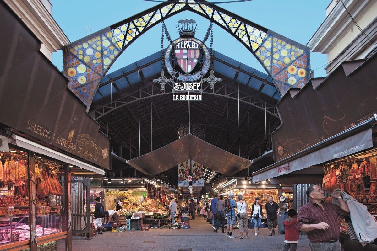
## Description **Mercat de la Boqueria**, officially known as **Mercat de Sant Josep de la Boqueria**, is Barcelona’s most famous food market and one of the most iconic culinary landmarks in Europe. More than a place to shop, it is a **living expression of Catalan gastronomy**, where tradition, daily life, and tourism intersect under one vast iron-and-glass roof. The market is known for its intense colors, constant movement, and the sheer diversity of products on display, from fresh seafood and cured meats to exotic fruits and handmade sweets. The market’s origins date back to the **early 13th century**, when street vendors sold meat outside the city walls near La Rambla. Over centuries, the informal stalls evolved into a structured market, and in 1840 the site was officially recognized as a public market. The current modernist structure, completed in the early 20th century, reflects Barcelona’s industrial-era ambition while remaining deeply rooted in everyday commerce. What makes Mercat de la Boqueria unique is its **dual identity**. On one hand, it serves local residents, chefs, and restaurateurs who rely on its quality ingredients. On the other, it functions as a global attraction for visitors seeking an authentic taste of Barcelona. Despite its popularity, many stalls still operate as family businesses passed down through generations. A lesser-known fact is that beneath the market lies an **archaeological site**, with remains from medieval and even Roman-era structures discovered during renovations. Another interesting detail is that many of Barcelona’s top chefs continue to source ingredients here early in the morning, long before tourists arrive, reinforcing the market’s role as a professional culinary hub rather than a mere attraction. ## Location **Country:** Spain **Region:** Catalonia **City:** Barcelona **District:** Ciutat Vella (Old Town) Mercat de la Boqueria is located directly off **La Rambla**, one of Barcelona’s main pedestrian boulevards, making it exceptionally central and easy to access. ### How to Get There * **By metro:** * Take Line L3 (Green Line) to **Liceu** station. The market entrance is immediately outside the station. * **On foot:** * Easily reachable from Plaça de Catalunya, the Gothic Quarter, and El Raval. * **By bus:** * Multiple city bus lines stop along La Rambla. * **By taxi:** * Taxis can drop you near La Rambla, but walking the final stretch is usually faster. ## Tips * **Go early in the morning:** Between 8:00 and 10:00 a.m. is best for fewer crowds and fresher displays. * **Avoid peak lunch hours:** Midday can become extremely crowded, especially in summer. * **Do not treat it as only a photo stop:** Take time to observe how locals shop and interact with vendors. * **Eat smart:** Skip the most tourist-oriented stalls near the entrance and explore deeper for better quality and value. * **Bring cash:** While many vendors accept cards, smaller stalls may prefer cash. * **Respect vendors:** Ask before taking close-up photos, especially of people. ## Conclusion Mercat de la Boqueria is not just a market, but a cultural institution that reflects Barcelona’s relationship with food, trade, and daily life. Its history, atmosphere, and culinary richness make it an essential stop for anyone wanting to understand the city beyond architecture and beaches. ## FAQ **1. Is Mercat de la Boqueria touristy?** Yes, but it is still a functioning market used by locals and professionals, especially in the mornings. **2. Is there an entrance fee?** No. Entry is free. **3. Can I eat inside the market?** Yes. There are bars and counters serving tapas, seafood, and prepared dishes. **4. How long should I plan for a visit?** About **1 to 2 hours**, depending on whether you eat or just explore. **5. Is it suitable for vegetarians?** Yes. There is a wide selection of fruits, cheeses, nuts, juices, and vegetarian dishes. **6. Is the market open every day?** Generally open Monday to Saturday; closed on Sundays and public holidays. ## Links * [Official Barcelona markets site](https://ajuntament.barcelona.cat/mercats)
GemVoyage Team • World
Oslo
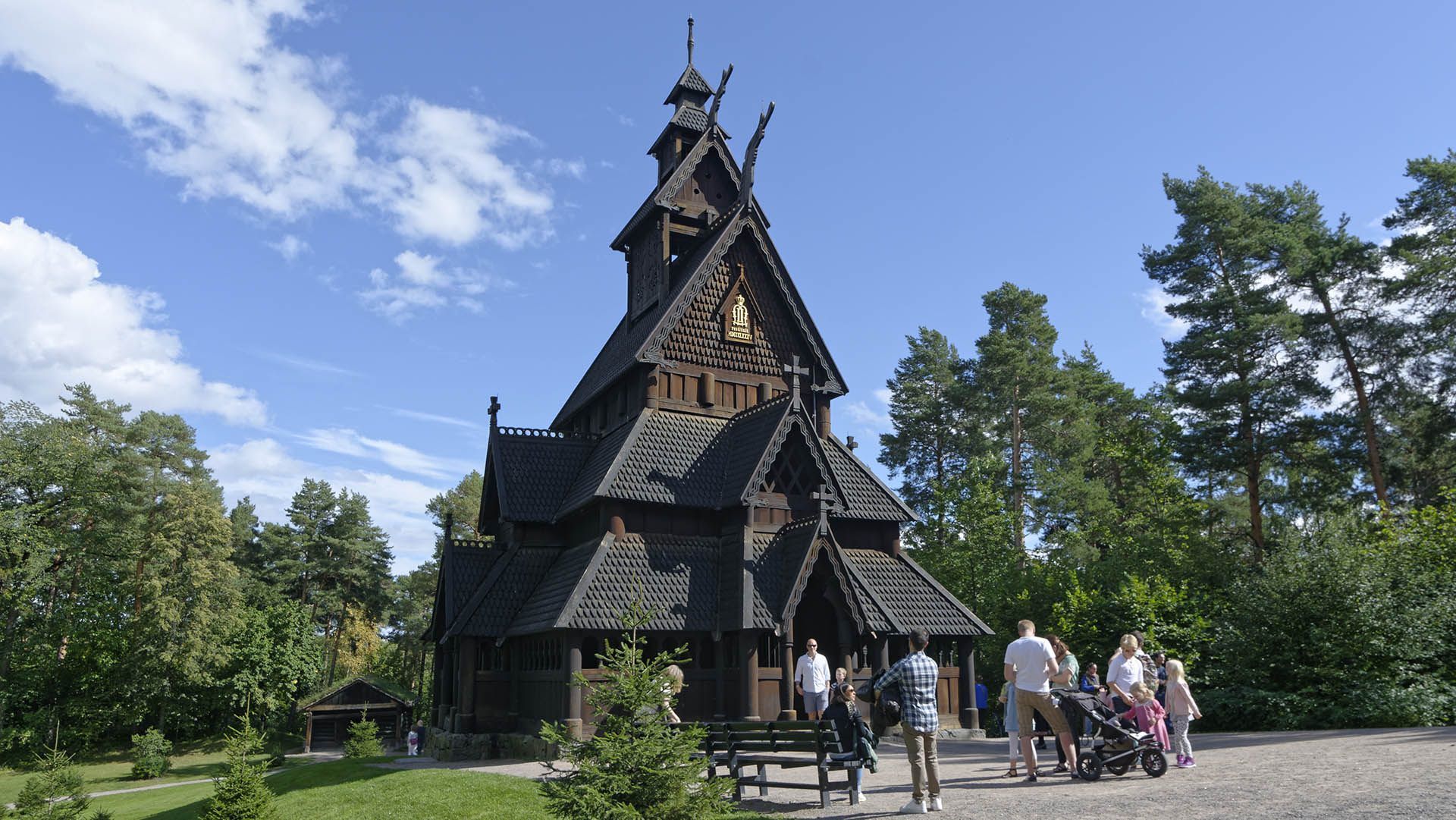
## Description **Gol Stave Church (Gol stavkirke)** is one of Norway’s most significant surviving examples of medieval wooden church architecture and a powerful symbol of the country’s cultural heritage. Originally built around the **late 12th century** in the town of Gol, the church represents the stave church tradition, a uniquely Scandinavian architectural form constructed almost entirely of timber using vertical load-bearing posts, or “staves.” What makes Gol Stave Church particularly remarkable is not only its age, but its **story of survival**. By the 19th century, many stave churches were being demolished due to changing religious practices and maintenance costs. Gol Stave Church was dismantled in the 1880s and narrowly avoided destruction thanks to the intervention of King Oscar II, who recognized its historical value. The church was carefully relocated and reconstructed on the Bygdøy peninsula in Oslo, where it stands today as a centerpiece of Norway’s architectural memory. Architecturally, the church combines Christian symbolism with **Viking-era decorative traditions**. Carved dragon heads, interlacing wood patterns, and animal motifs reflect pre-Christian Norse art, subtly integrated into a Christian sacred structure. This blending of belief systems is one of the most fascinating aspects of stave churches and offers insight into Norway’s transition from paganism to Christianity. A lesser-known fact is that much of what visitors see today is based on **meticulous historical reconstruction**, informed by archaeological studies, surviving stave churches, and medieval building techniques. Another interesting detail is that Gol Stave Church was never intended to function as an active parish church in Oslo; its role is primarily educational and cultural, serving as a reference model for lost stave churches across Norway. Gol Stave Church is not large, but its craftsmanship, symbolism, and historical weight give it a presence that far exceeds its physical scale. ## Location **Country:** Norway **Region:** Eastern Norway **City:** Oslo **Area:** Bygdøy Peninsula Gol Stave Church is located within the grounds of the **Norwegian Museum of Cultural History (Norsk Folkemuseum)**, an open-air museum dedicated to Norway’s cultural and architectural history. ### How to Get There * **By bus:** * Bus lines from central Oslo (such as from Nationaltheatret or Jernbanetorget) run directly to Bygdøy. * **By ferry (seasonal):** * Ferries operate from the Oslo harbor to Bygdøy, offering a scenic approach during warmer months. * **By bicycle:** * A pleasant option in good weather, with dedicated cycling routes leading to the peninsula. * **By taxi:** * Easily accessible by taxi from central Oslo. ## Tips * **Combine with the open-air museum:** Gol Stave Church is part of a much larger cultural complex; allow enough time to explore. * **Visit during daylight hours:** Natural light enhances the carved details and wood textures. * **Read the interpretive panels:** They explain stave church construction and symbolism clearly. * **Expect authenticity, not luxury:** Interiors are simple and atmospheric rather than ornate. * **Dress for the weather:** Much of the surrounding museum is outdoors. * **Photography rules apply:** Interior photography may be restricted. ## Conclusion Gol Stave Church is a rare and powerful reminder of medieval Norway’s craftsmanship, belief systems, and architectural ingenuity. Its careful preservation and relocation allow visitors to experience a building type that once defined Norwegian religious life but has nearly vanished. ## FAQ **1. Is Gol Stave Church still an active church?** No, it functions as a historical exhibit rather than a place of worship. **2. How old is the church?** It dates back to approximately the late 1100s. **3. Is it an original building or a replica?** It is a reconstructed original, assembled using historic materials and techniques. **4. How much time should I plan for the visit?** Plan **1.5 to 3 hours** if combining it with the surrounding museum. **5. Is it suitable for children?** Yes, especially for children interested in history and Viking culture. **6. Can you see other stave churches nearby?** There are no other original stave churches in Oslo, but several exist elsewhere in Norway. ## Links * [Visit Oslo official tourism site](https://www.visitoslo.com) * [Official Website](https://www.stavechurch.com/gol-stave-church/?lang=en)
GemVoyage Team • World
Siena
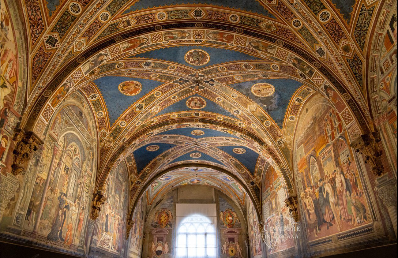
## Description Santa Maria della Scala is one of Siena's most remarkable heritage sites because it combines religious history, civic charity, underground architecture, and museum culture in a single monumental complex. Positioned directly across from Siena Cathedral, it once served as one of Europe's oldest hospitals and later evolved into a major cultural institution. Visiting it today gives travelers a powerful sense of how medieval cities cared for pilgrims, the sick, and vulnerable populations while also expressing civic pride through architecture and art. The complex is striking because it feels like a city within a city. Rooms, corridors, chapels, cloisters, stairways, and subterranean spaces reveal different layers of use over the centuries. You do not just look at one building; you move through an entire institution that grew and adapted over time. Artworks, fresco cycles, archaeological remains, and preserved spaces make the experience intellectually rich and visually engaging. Unlike many museums that isolate objects from their context, Santa Maria della Scala helps you understand how architecture, service, devotion, and public life interacted in medieval Siena. One little-known fact is that pilgrims arriving on the Via Francigena often found shelter here, making the site an important stop on one of Europe's great medieval routes. Another detail many visitors overlook is the sheer scale of the underground spaces, which reflect practical needs for storage, movement, and service as much as ceremonial or artistic ambition. Those lower levels are among the most memorable parts of the visit because they show the functional side of a structure that many people initially expect to be purely decorative or religious. The site is also important because it illustrates Siena's identity as a city that valued public welfare, religious patronage, and artistic expression simultaneously. That combination is part of what makes the complex worth a serious visit. If you want to understand Siena beyond its famous piazza and cathedral, Santa Maria della Scala gives you a fuller picture of the city's medieval social world and its later cultural memory. ## Location Santa Maria della Scala is in Siena, in the Tuscany region of Italy, directly opposite Siena Cathedral near the city's historic center. The location is ideal for sightseeing because it sits within one of Siena's most visited pedestrian areas, making it easy to combine with the Duomo, Piazza del Campo, and nearby museums and churches. Because the city center has limited vehicle access, walking is by far the best way to reach the complex once you are already in Siena. If you are arriving from outside the city, buses and taxis can bring you close to the historic core, but you should expect to continue on foot through narrow streets and sloping lanes. That is part of the Siena experience. The approach to Santa Maria della Scala is rewarding because the surrounding streets reveal the city's medieval layout and its strong relationship between public squares, religious institutions, and commercial life. For most visitors, the best recommendation is to explore the site as part of a broader walking circuit through Siena's center. Allow enough time to move through the exhibit spaces at a relaxed pace rather than trying to fit it into a rushed cathedral-only itinerary. ## Tips Give yourself time. Santa Maria della Scala is not a quick stop, and its value increases when you spend time understanding the different floors, rooms, and thematic displays. If you only skim the site, you miss its most compelling features. Combine your visit with the cathedral area. The relationship between Santa Maria della Scala and Siena Cathedral is one of the most interesting aspects of the site, both visually and historically. Seeing them together helps explain how prestige, religion, and charity coexisted in the city. Pay attention to the underground areas and temporary exhibitions. These spaces often hold some of the most atmospheric material and can be less crowded than the main public rooms. They also show how the institution evolved over centuries instead of freezing it in one period. If you like medieval history, read a little before arriving. The more you know about pilgrimages, hospitals, and civic patronage in Tuscany, the more rewarding the visit becomes. Santa Maria della Scala is rich enough to reward curiosity, and small historical details can transform the experience. ## Conclusion Santa Maria della Scala is one of Siena's most important monuments, offering an unusually complete view of medieval care, devotion, and civic life inside a beautifully layered historic complex. ## FAQ ### What was Santa Maria della Scala used for? It served as a hospital, shelter for pilgrims, charity institution, and later as a cultural and museum complex. ### Why is Santa Maria della Scala important? It is important because it is one of Europe's oldest hospital complexes and because it preserves a rare combination of architecture, art, and social history. ### How much time should I spend there? Most visitors should allow at least one to two hours, and longer if they want to explore the exhibits in depth. ### Is it close to Siena Cathedral? Yes. It is located directly across from the cathedral, making it easy to visit both on the same trip. ## Links - [Official website](https://www.santamariadellascala.com/) - [Wikipedia article](https://en.wikipedia.org/wiki/Santa_Maria_della_Scala)
GemVoyage Team • World
Nordland County
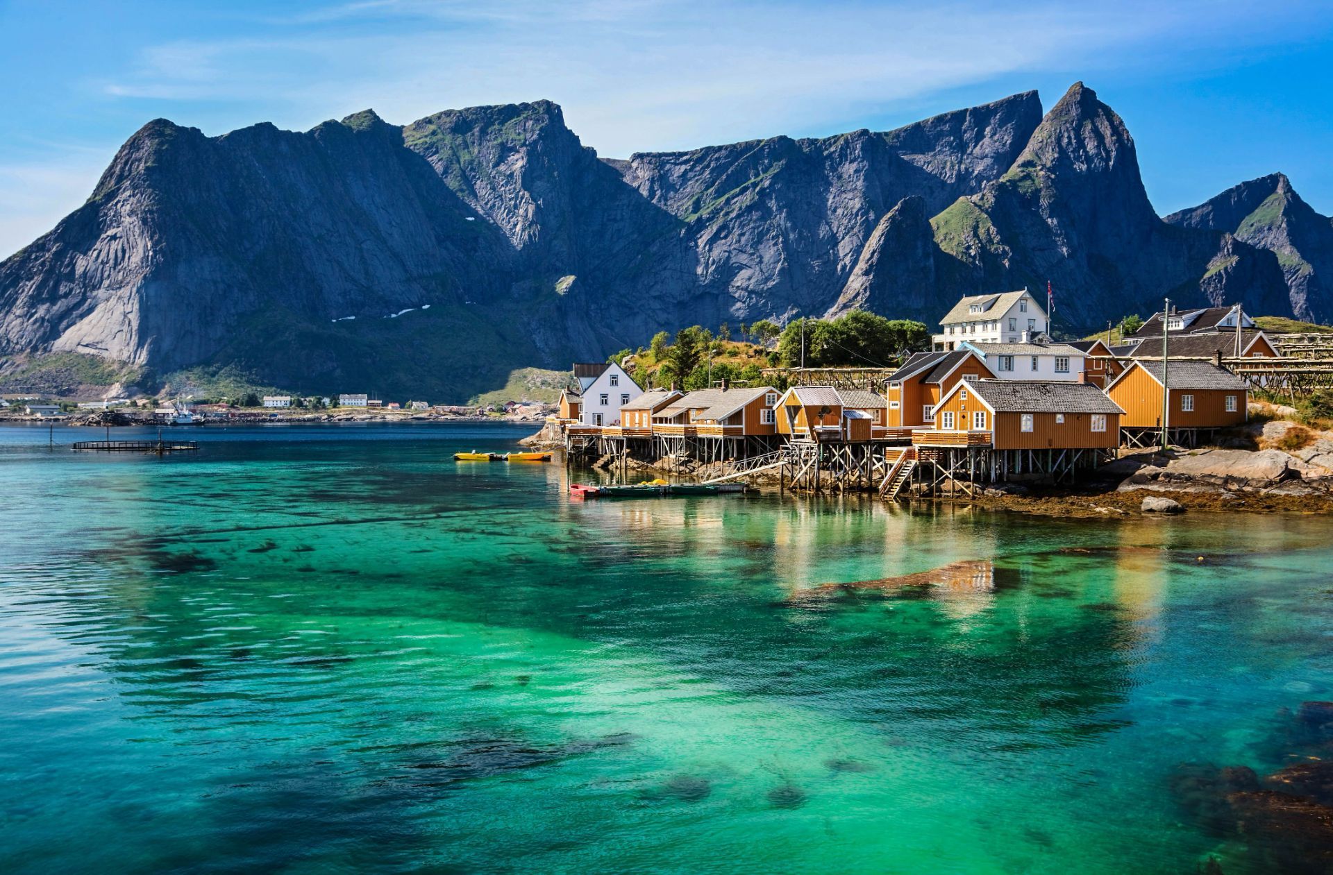
## Description The Lofoten archipelago in northern Norway is known for dramatic mountains rising directly from the sea, sheltered bays dotted with red rorbuer (fishermen’s cabins), and a culture shaped by the cod-fishing season. The islands’ jagged peaks, sheltered fjords and clear northern light create a playground for photographers, hikers and sailors. In summer the midnight sun bathes the landscape in continuous soft light; in winter the aurora borealis weaves curtains above snow-dusted fjords. Lofoten’s distinctiveness lies in the proximity of ocean and mountain: trails often ascend steep ridges that drop into crystal-clear water, and small fishing villages serve as intimate bases for outdoor activities. A lesser-known feature: the islands host significant seabird colonies and seasonal fisheries that have influenced local cuisine and traditions for centuries. Lofoten is not only a visual spectacle but also a destination that rewards slow travel and careful planning. The archipelago's human scale — low-lying villages, narrow winding roads and tiny harbors — means that experiences are tactile and immediate: you can start your day with fresh cod straight from a quay, follow a narrow trail to a windswept summit by afternoon, and end it watching the sea change color as the light shifts. For photographers and naturalists the islands offer a year-round curriculum: in spring and early summer, migrant birds and seals become active along the coastline; in high summer the midnight sun extends golden-hour conditions for long landscape sessions; in autumn the first snows highlight ridgelines and create vivid contrasts; and in winter the long nights are ideal for aurora hunting, provided the skies are clear and weather windows allow. Trail conditions vary widely: some classic hikes like Reinebringen and Kvalvika require stout footwear and a head for exposure, while many coastal walks are family-friendly and can be combined with ferry hops and short drives. Sea-based activities are equally compelling — kayaking through sheltered fjords, joining local fishing trips, or chartering a boat for wildlife watching. Local cultural experiences add texture: museums documenting the seasonal cod fisheries, small artisan shops selling wool and salt-dried fish, and community-run cafés where fishermen swap stories. Food culture in Lofoten remains rooted in the sea; besides stockfish and cod, you’ll encounter local sheep cheeses, cloudberry desserts and a surprisingly well-developed craft-beer scene in a few towns. Practicalities matter in Lofoten. Roads are scenic but narrow, and in winter they can be affected by snow and wind; a flexible itinerary is wise. While many visitors cluster in Reine and Svolvær, quieter pockets such as Henningsvær, Nusfjord and Vinstad reward those who linger. Conservation-minded travel is important: stay on marked trails, respect nesting birds (especially during spring), and support locally owned businesses. Small details like packing waterproof layers, carrying a reliable map or GPS, and learning a few Norwegian phrases will enhance safety and interpersonal encounters. Taken together, these elements make Lofoten an unforgettable destination where dramatic geology, maritime culture and luminous Arctic light combine into a deeply memorable travel experience. ## Location Lofoten lies within Nordland county, above the Arctic Circle, accessible by ferry, road and regional flights from Bodø and Harstad/Narvik airports. The main islands (Austvågøya, Vestvågøya, Flakstadøya and Moskenesøya) are linked by scenic roads and tunnels. The islands are most commonly reached via the E10 highway, which threads the archipelago and connects ferries and causeways. Travelers flying in usually connect through Bodø, which provides ferry and road links, or land at Evenes (near Harstad/Narvik) then drive west. Several regional ferries link the mainland with islands and provide excellent photo opportunities; during summer months additional tourist ferry routes and charter options operate between hotspots like Reine and Svolvær. Car rental is widely available in nearby towns and airports, but public transport is a viable option for those who prefer not to drive, with buses and select ferries serving the larger settlements. ## Tips - **Respect weather windows:** Mountain weather changes rapidly; check local forecasts and prepare with layers and navigation tools. - **Book rorbuer early in summer:** Traditional cabins are popular in high season; reserve in advance. - **Try cod-based cuisine:** Experience local dishes tied to the seasonal stockfish tradition. - **Plan photographic routes:** Sunrise, sunset, and aurora times are key for planning shots; local guides help find hidden vantage points. - **Pack for microclimates:** Conditions can vary from wind-blasted summits to calm fjord inlets in short distances; waterproof outer layers and thermal mid-layers are essential. - **Mind daylight hours:** In summer you can shoot at midnight; in winter plan activities around shorter daylight but prime aurora hours. - **Respect wildlife and nesting areas:** Keep distance from seabird colonies and seal haul-outs to avoid disturbance. - **Rent responsibly or use local guides:** Boat, kayak and fishing charters offer deeper access; choose operators with good safety and sustainability records. - **Bring cash for small purchases:** While cards are widely accepted, some small cafés and stalls may prefer cash in remote villages. ## Conclusion Lofoten combines raw Arctic scenery with a resilient maritime culture, offering dramatic outdoor adventures and timeless coastal charm. Whether you come for the light, the mountains, or the cultural textures of fishing villages, Lofoten rewards curiosity and careful pacing. The islands invite both active exploration and quiet observation — a place to test your kit on rugged trails or simply watch tides and light shift over a year of weathered harbor wood. For travelers prioritizing sustainable, small-scale tourism, Lofoten offers a rich palette of experiences that connect landscape, livelihood and seasonal rhythms. ## FAQ - **Q: When is the best time to visit?** - A: Summer for midnight sun and hiking; winter for northern lights and dramatic snow landscapes. - **Q: Are there guided activities?** - A: Yes — kayaking, hiking, fishing tours and wildlife excursions are widely available. - **Q: Do I need a car to enjoy Lofoten?** - A: A car gives flexibility for reaching remote viewpoints and dispersed villages; however, during summer a combination of buses, ferries and guided tours can cover many highlights without driving. - **Q: How do I plan for aurora viewing?** - A: Check local aurora forecasts and cloud cover, pick dark sites away from town lights, and be patient — clear sky windows are unpredictable. Local guides can increase success rates and handle safety in cold conditions. - **Q: Are trails family-friendly?** - A: Many shoreline walks and lowland trails are suitable for families; some iconic ridgeline hikes are steep and exposed and require good footwear and experience. - **Q: How should I handle food and provisioning?** - A: Larger towns have supermarkets and restaurants; in smaller villages, stockfish shops, local bakeries and seasonal markets offer regional specialties — plan ahead for long drives between services in peak season. ## Links - [Lofoten — Wikipedia](https://en.wikipedia.org/wiki/Lofoten)
GemVoyage Team • World
Karachi
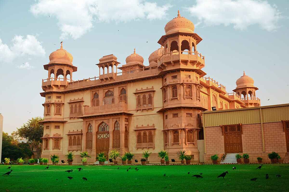
## Description Mohatta Palace is one of Karachi’s most iconic architectural gems, blending history, culture, and artistry into a single breathtaking experience. Built in 1927 by Shivratan Chandraratan Mohatta, a wealthy Hindu Marwari businessman, the palace was originally intended as a summer retreat. Designed by architect Agha Ahmed Hussain, it showcases the Indo-Saracenic style, combining elements of Mughal and Rajasthani architecture. The structure is made of pink Jodhpur stone and local yellow Gizri stone, giving it a warm, regal glow that stands out in the heart of Clifton. The palace spans over 18,500 square feet and features nine domes, intricately carved windows, floral motifs, and a grand central dome that crowns the building. Inside, visitors find polished teak wood staircases, long corridors, and stately rooms that once hosted lavish gatherings. Today, Mohatta Palace functions as a museum, hosting exhibitions that celebrate Pakistan’s rich artistic and cultural heritage—from miniature paintings and textiles to contemporary art installations. A little-known fact: the palace once housed a private temple dedicated to Lord Shiva on its rooftop terrace, a quiet reminder of its original owner's spiritual life. Another intriguing detail is the presence of secret underground tunnels, rumored to have been used for discreet movement during political unrest—though these remain closed to the public. ## Location Mohatta Palace is located in **Karachi**, the largest city in **Pakistan**, within the **Sindh** province. Specifically, it sits in the upscale neighborhood of **Old Clifton**, at 7 Hatim Alvi Road, Block 5. ### How to Get There: - **By Car**: Easily accessible via Shahrah-e-Faisal or the Clifton Bridge. Parking is available nearby. - **By Public Transport**: Local buses and ride-hailing services like Careem and Uber can drop you off directly at the entrance. - **From Jinnah International Airport**: The palace is about a 45-minute drive depending on traffic. For tourists, hiring a local guide or joining a heritage tour can enhance the experience with historical context and insider stories. ## Tips for Visitors To make the most of your visit to Mohatta Palace, keep these tips in mind: - **Check Exhibition Schedules**: The museum hosts rotating exhibitions, so check ahead to catch something that aligns with your interests. - **Photography**: While photography is allowed in the gardens, it’s restricted inside the museum. Ask staff for permission if you're documenting your visit. - **Dress Comfortably**: The palace grounds are expansive, and Karachi’s climate can be warm—light clothing and comfortable shoes are recommended. - **Visit Early**: Arriving early helps avoid crowds and gives you time to explore the gardens and nearby attractions. - **Guided Tours**: Opt for a guided tour to uncover stories and architectural details you might otherwise miss. - **Cultural Etiquette**: Respect the museum’s quiet ambiance and avoid loud conversations or disruptive behavior. ## Conclusion Mohatta Palace is more than a historical building—it’s a living museum that bridges the past and present of Pakistan’s cultural identity. With its stunning architecture, rich history, and vibrant exhibitions, it offers a unique and enriching experience for anyone visiting Karachi. ## FAQ **1. What are the opening hours of Mohatta Palace?** Typically, the museum is open from 11:00 AM to 6:00 PM, Tuesday to Sunday. It’s closed on Mondays and public holidays. **2. Is there an entry fee?** Yes, a nominal fee is charged for entry. Discounts may be available for students and groups. **3. Can I take photos inside the palace?** Photography is allowed in the gardens but restricted inside the museum. Always check with staff before taking pictures. **4. Are guided tours available?** Yes, guided tours are available and highly recommended for a deeper understanding of the palace’s history and exhibitions. **5. Is Mohatta Palace wheelchair accessible?** Accessibility is limited due to the historic nature of the building. It’s best to contact the museum in advance for specific accommodations. **6. What kind of exhibitions are held at Mohatta Palace?** Exhibitions range from traditional arts and crafts to contemporary visual art, often highlighting themes of heritage, identity, and social change. ## Links - [Mohatta Palace Official Website](https://mohattapalacemuseum.org/) - [Wikipedia – Mohatta Palace](https://en.wikipedia.org/wiki/Mohatta_Palace)
GemVoyage Team • World

Comments